
Product details
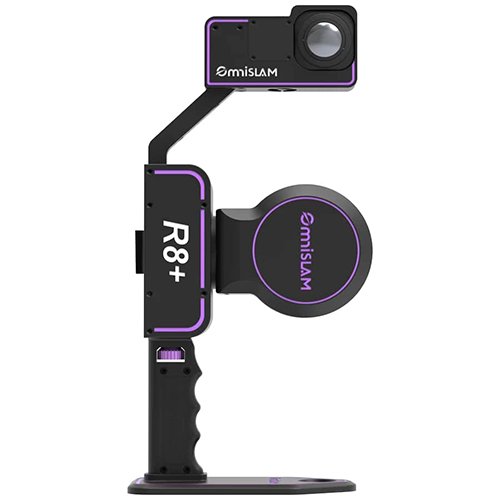
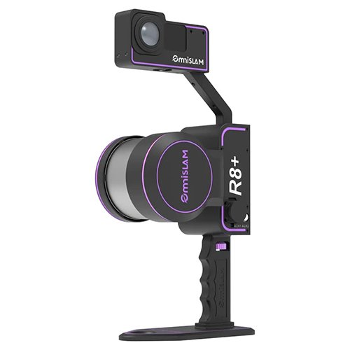
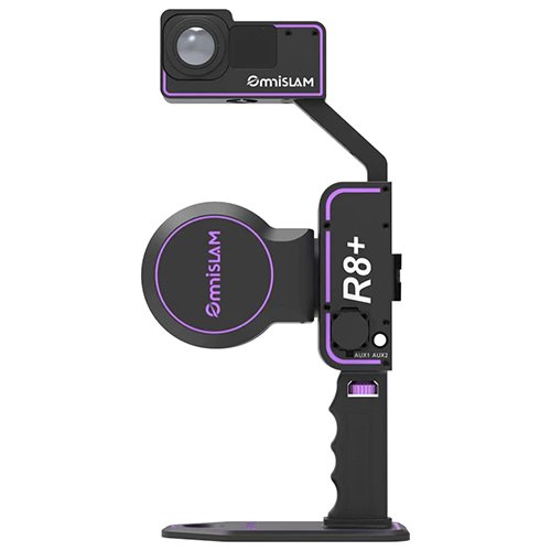
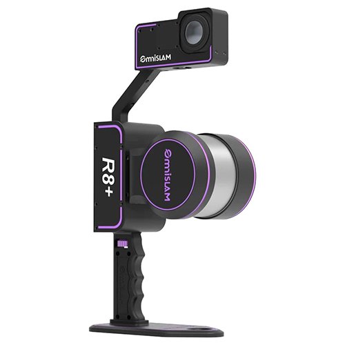
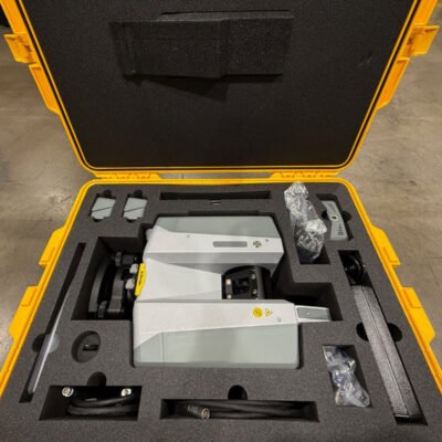
OmniSLAM R8+ 3D LiDAR System
The OmniSLAM R8+ 3D LiDAR System is an advanced mobile reality capture solution designed for professional surveying, geospatial mapping, digital twin generation, BIM documentation, infrastructure inspection, and industrial scanning applications. Combining high-speed LiDAR technology, intelligent SLAM algorithms, IMU sensor fusion, and real-time point cloud processing, the OmniSLAM R8+ delivers accurate and efficient 3D spatial data collection in complex indoor and outdoor environments.
Engineered for portability and operational flexibility, the OmniSLAM R8+ supports handheld, backpack, vehicle-mounted, and mobile platform deployment workflows. The system is optimized for GNSS-denied environments such as tunnels, industrial facilities, underground mines, warehouses, transportation corridors, and urban infrastructure projects.
What is the OmniSLAM R8+ 3D LiDAR System?
Advanced Mobile LiDAR Mapping Solution
The OmniSLAM R8+ is a SLAM-based mobile mapping system that continuously captures and processes 3D environmental data while the operator moves through the scanning area.
Core Technologies
- LiDAR laser scanning
- SLAM positioning engine
- IMU sensor integration
- Real-time trajectory estimation
- Point cloud processing
- RGB imaging support
- Digital twin generation
Main Features
High-Speed LiDAR Scanning
The system utilizes advanced LiDAR technology to capture millions of measurement points for dense and highly accurate 3D spatial datasets.
Benefits
- Fast reality capture
- High point cloud density
- Detailed environmental reconstruction
- Accurate object geometry
- Efficient large-area mapping
Advanced SLAM Positioning Technology
Intelligent Mapping Engine
The integrated SLAM (Simultaneous Localization and Mapping) engine continuously calculates the scanner’s trajectory and environmental positioning without relying entirely on GNSS signals.
SLAM Advantages
- Reliable indoor mapping
- Stable trajectory correction
- Reduced drift errors
- Smooth indoor-outdoor transitions
- High operational flexibility
Real-Time Point Cloud Visualization
The OmniSLAM R8+ allows operators to visualize mapping progress in real time during scanning operations.
Real-Time Workflow Benefits
- Immediate scan quality verification
- Coverage monitoring
- Reduced rescanning
- Faster field decisions
- Improved project efficiency
Integrated Imaging System
RGB Imaging and Colorized Point Clouds
The system supports synchronized image capture for realistic colorized point cloud generation.
Imaging Benefits
- Improved visual interpretation
- Enhanced digital twin visualization
- Better inspection workflows
- Realistic environmental documentation
Applications
Land Surveying and Geospatial Mapping
Surveying Applications
- Topographic surveys
- Utility mapping
- GIS data collection
- Transportation corridor mapping
- Urban planning
- Terrain documentation
Construction and BIM
BIM and Construction Workflows
- As-built documentation
- BIM verification
- Construction progress tracking
- Structural analysis
- Clash detection
- Digital construction workflows
Mining and Underground Mapping
Mining Applications
- Underground tunnel mapping
- Shaft documentation
- Geological surveys
- Mine infrastructure scanning
- Stockpile analysis
Industrial Facility Documentation
Industrial Scanning Tasks
- Factory digitization
- Plant documentation
- Refinery mapping
- Equipment positioning
- Asset management
- Maintenance planning
Infrastructure Inspection
Infrastructure Applications
- Railway scanning
- Highway documentation
- Bridge inspection
- Tunnel mapping
- Utility infrastructure surveys
Specifications
LiDAR Specifications
| Specification | Value |
|---|---|
| Scanning Technology | Mobile LiDAR SLAM |
| Laser Sensor Type | Multi-line LiDAR |
| Point Cloud Generation | Real-time |
| Scan Coverage | 360° Horizontal |
| Vertical Field of View | Wide-angle |
| Mapping Capability | Indoor and outdoor |
| Mobile Operation | Supported |
Accuracy Specifications
| Specification | Value |
|---|---|
| Relative Accuracy | Centimeter-level |
| Absolute Accuracy | Control-dependent |
| Drift Optimization | SLAM correction |
| Repeatability | High precision |
Accuracy Enhancement Features
- IMU-assisted positioning
- Loop closure correction
- Sensor fusion algorithms
- Trajectory optimization
- Ground control point integration
SLAM and Navigation Specifications
| Specification | Value |
|---|---|
| SLAM Technology | Integrated |
| IMU Integration | Yes |
| GNSS Support | Supported |
| Hybrid Positioning | Available |
| Indoor Navigation | Supported |
| Outdoor Navigation | Supported |
Imaging Specifications
| Specification | Value |
|---|---|
| RGB Camera | Supported |
| Panoramic Imaging | Available |
| Colorized Point Clouds | Supported |
| Image Synchronization | Real-time |
| Texture Mapping | Supported |
Data Processing Specifications
| Specification | Value |
|---|---|
| Real-Time Processing | Yes |
| Point Cloud Export | Supported |
| Storage Capacity | High-capacity |
| Data Formats | LAS, LAZ, PLY, XYZ, E57 |
| BIM Compatibility | Supported |
Physical Specifications
| Specification | Value |
|---|---|
| System Design | Portable mobile scanner |
| Mounting Options | Handheld, backpack, vehicle |
| Construction | Rugged industrial housing |
| Mobility | Lightweight field operation |
Environmental Specifications
| Specification | Value |
|---|---|
| Indoor Operation | Yes |
| Outdoor Operation | Yes |
| Industrial Durability | Yes |
| Rugged Design | Field-ready |
There are no reviews yet.