
Categories: 3D Laser Scanner
Leica BLK2FLY Drone LiDAR Scanner
Rated 0 out of 5
0 Reviews
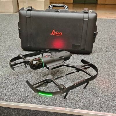
The Leica BLK2FLY Drone LiDAR Scanner, developed by Leica Geosystems, is a fully autonomous flying laser scanning solution designed for rapid and accurate 3D reality capture. Equipped with advanced LiDAR sensors, intelligent obstacle avoidance, and automated flight control, it enables seamless data acquisition for construction, surveying, infrastructure inspection, and digital twin creation. Its ability to operate in complex indoor and outdoor environments makes it a powerful tool for modern geospatial workflows.
The Leica BLK2FLY Drone LiDAR Scanner, developed by Leica Geosystems, is a fully autonomous flying laser scanning solution designed for rapid and accurate 3D reality capture. Equipped with advanced LiDAR sensors, intelligent obstacle avoidance, and automated flight control, it enables seamless data acquisition for construction, surveying, infrastructure inspection, and digital twin creation. Its ability to operate in complex indoor and outdoor environments makes it a powerful tool for modern geospatial workflows.