
Product details
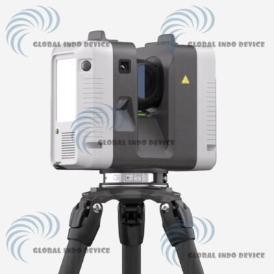
Leica BLK360 3D Scanner
Compact Reality Capture Solution for Fast and Accurate 3D Scanning
Introduction to Leica BLK360
The Leica BLK360 3D Scanner is a compact and intelligent laser scanning solution designed to simplify reality capture workflows. By combining high-speed LiDAR scanning with integrated imaging, the BLK360 enables professionals to capture accurate spatial data efficiently in both indoor and outdoor environments.
What Is the Leica BLK360
Leica BLK360 is a lightweight terrestrial laser scanner that captures dense point cloud data and high-resolution imagery from a single scanning position. Its streamlined operation makes it suitable for professionals who require fast and reliable 3D documentation without complex setup procedures.
Integrated LiDAR Technology
The scanner uses advanced LiDAR sensors to measure millions of points, delivering detailed 3D representations of real-world environments.
Built-In Imaging System
High-quality cameras capture spherical imagery that adds visual context and colorization to point cloud data.
Key Features of Leica BLK360
Fast and Efficient Scanning
High-speed data acquisition reduces time spent on site while maintaining accurate results.
Compact and Portable Design
The lightweight form factor allows easy transport and quick deployment across multiple locations.
Seamless Data Capture
Integrated sensors work together to deliver consistent geometric and visual information.
Applications and Use Cases
Architecture and BIM
Supports accurate as-built documentation and design verification for architectural projects.
Construction and Engineering
Enables site documentation, progress tracking, and coordination across construction phases.
Facility Management
Provides reliable spatial data for asset management, space planning, and maintenance workflows.
Workflow and Ease of Use
Simple Setup and Operation
The scanner is designed for fast setup, minimizing training time and operational complexity.
Efficient Data Transfer
Captured data can be transferred quickly for processing and visualization in compatible software platforms.
Why Choose Leica BLK360
Trusted Leica Geosystems Precision
Leica Geosystems is globally recognized for delivering reliable and accurate measurement technologies.
Professional-Grade Results
The BLK360 delivers dense point clouds suitable for detailed modeling and analysis.
Optimized for Modern Workflows
Designed to integrate smoothly into reality capture and digital documentation processes.
Ideal Users of Leica BLK360
Surveying and Reality Capture Professionals
Suitable for professionals who require dependable 3D scanning in diverse environments.
AEC and Facility Teams
Supports efficient collaboration and documentation across architecture, engineering, and construction projects.
Specifications – Leica BLK360 3D Scanner
System Overview
Product Name: Leica BLK360 3D Imaging Laser Scanner
Manufacturer: Leica Geosystems
Device Type: Compact 3D LiDAR imaging laser scanner
Primary Use: Reality capture, building documentation, construction, AEC workflows
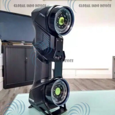
Physical & Design Specifications
Housing: Black anodized aluminium construction
Dimensions: Height approx. 165 mm; diameter approx. 100 mm
Weight: ~1 kg total, including battery
Transport Cover: Hood with integrated floor stand
Mounting Mechanism: Quick-release button mount
Core Scanning Technology
Distance Measurement System: High-speed time-of-flight enhanced by Waveform Digitizing (WFD) technology
Laser Class: Class 1 (IEC 60825-1 compliant)
Wavelength: 830 nm
Field of View: 360° horizontal / 300° vertical
Range: From ~0.6 m up to ~60 m (reflectivity dependent)
Point Measurement Rate: Up to ~360,000 points per second
Accuracy & Performance
Ranging Accuracy: ~4 mm @ 10 m; ~7 mm @ 20 m
3D Point Accuracy: ~6 mm @ 10 m; ~8 mm @ 20 m
Scan Time: Less than 3 minutes for full dome scan with spherical HDR and thermal imagery capture
Measurement Modes: Multiple resolution settings available for tailored density capture
Imaging System
Camera System: Integrated 3-camera HDR imaging system (~15 MP total) capturing full dome spherical imagery (360° × 300°) with LED flash
Thermal Sensor: FLIR-based longwave infrared panoramic camera (~360° × 70°)
Image Modes: Auto-exposed LDR and multi-bracket HDR modes
Operation & Control
Standalone Operation: One-button capture control
Mobile Control: Compatible with BLK Live and Cyclone FIELD 360 apps for iOS and Android devices
Remote Connectivity: Integrated wireless LAN (802.11 b/g/n)
Internal Memory: Storage capacity for over 100 scan setups
Orientation: Upright and upside-down operational flexibility
Power & Battery
Battery Type: Rechargeable internal Li-Ion battery (e.g., Leica GEB212)
Battery Capacity: Typically supports 40+ setups per full charge
Data & Connectivity
Data Transfer: Wireless upload and USB-C high-speed transfer
Live Data Streaming: Supported via mobile app for field feedback and verification
File Export Formats: Compatible with E57, LGS, RCP, and BIM workflows through Leica Cyclone REGISTER apps
Environmental & Durability
Operating Temperature: ~0° C to +40° C suitable for various sites
Ingress Protection: IP54 dust and water resistance for field durability
Use Cases: Suitable for indoor and outdoor reality capture applications
Software & Workflow
Mobile Apps: BLK Live, Cyclone FIELD 360 for scan control, preview, and pre-registration
Desktop Software: Leica Cyclone REGISTER 360 and Reality Cloud Studio support detailed post-processing and visualization
Typical Use Cases
Architecture and BIM documentation
Construction site capture and verification
Facility management and renovation planning
Spatial analysis and digital twin data capture
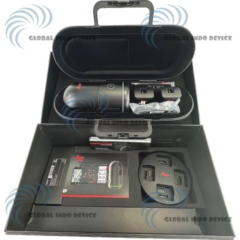
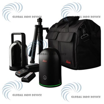
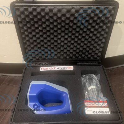
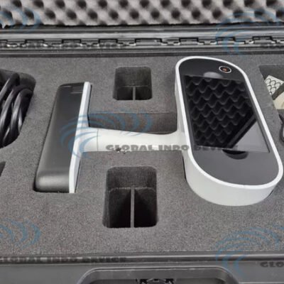
Package Components (Typical)
Leica BLK360 scanner
Rechargeable battery and charger
Protective transport cover and floor stand
USB-C data cable
Quick start guides and documentation
There are no reviews yet.