
Product details
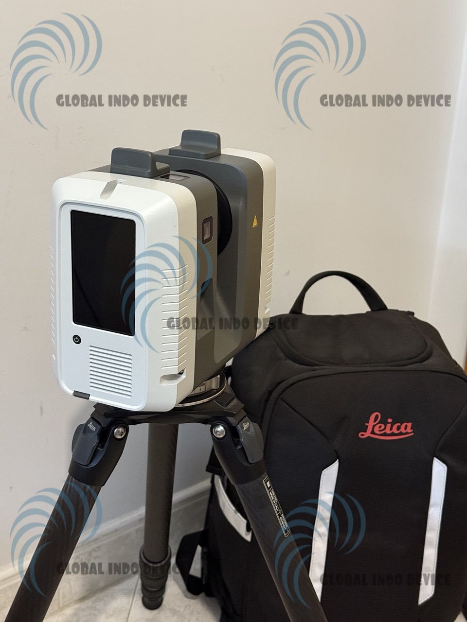
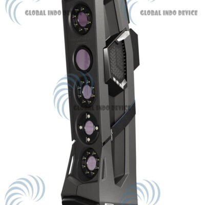
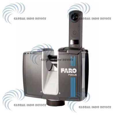
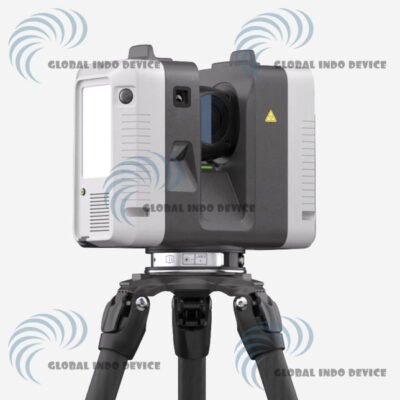
Leica RTC360 3D Scanner
High-Speed Reality Capture for Accurate 3D Documentation
Introduction to Leica RTC360
The Leica RTC360 3D Scanner is a high-performance terrestrial laser scanner designed to capture accurate 3D data at exceptional speed. Built for modern reality capture workflows, the RTC360 combines advanced LiDAR technology, intelligent sensors, and automated data registration to streamline on-site scanning and post-processing.
Overview of Leica RTC360 Technology
Leica RTC360 is engineered to simplify complex 3D scanning tasks by delivering fast data acquisition and reliable results. Its intelligent design allows professionals to capture dense point clouds with minimal manual intervention.
High-Speed LiDAR Scanning
The scanner captures millions of points per second, enabling detailed spatial data collection in a short amount of time.
Integrated Visual Inertial System
A built-in visual inertial system automatically tracks scanner movement between setups, improving workflow efficiency and reducing registration time.
Key Features of Leica RTC360
Ultra-Fast Scanning Performance
The RTC360 significantly reduces time on site while maintaining high accuracy and data consistency.
Automated Registration Workflow
Captured scans are automatically aligned during the scanning process, minimizing manual post-processing efforts.
Compact and Mobile Design
Despite its advanced capabilities, the scanner features a lightweight and portable design for easy transportation.
Applications of Leica RTC360
Architecture and BIM Documentation
Supports detailed as-built models and design verification for architectural and BIM workflows.
Construction and Engineering Projects
Ideal for progress monitoring, quality control, and coordination throughout construction phases.
Surveying and Reality Capture
Provides reliable 3D data for professional surveying, mapping, and spatial analysis tasks.
Workflow Efficiency and Usability
Fast Setup and Operation
Designed for quick deployment, allowing users to begin scanning with minimal setup time.
Seamless Data Transfer
Captured data can be transferred efficiently to compatible software platforms for processing and visualization.
Benefits of Using Leica RTC360
Increased Productivity
High-speed scanning and automated registration reduce project turnaround times.
Trusted Leica Geosystems Precision
Developed by Leica Geosystems, a globally recognized leader in measurement technology.
Scalable for Professional Use
Suitable for small projects and large-scale reality capture applications alike.
Ideal Users of Leica RTC360
AEC Professionals
Architects, engineers, and construction teams benefit from accurate and fast 3D documentation.
Surveyors and Reality Capture Specialists
Designed to meet the demands of professional surveying and digital mapping workflows.
Specifications – Leica RTC360 3D Scanner
System Overview
Product Name: Leica RTC360 3D Laser Scanner
Manufacturer: Leica Geosystems
Device Type: High-speed terrestrial 3D laser scanner with integrated imaging and automated registration
Primary Application: Reality capture for architecture, construction, surveying, and engineering workflows
Scanning & Laser Technology
Laser Class: Class 1 (IEC 60825-1:2014), 1550 nm invisible laser
Distance Measurement: Time-of-flight enhanced by Waveform Digitizing (WFD) technology
Scan Speed: Up to 2,000,000 points per second
Range: 0.5 m to 130 m (reflectivity dependent)
Field of View: 360° horizontal / 300° vertical
Resolution Settings: 3 selectable levels (3 mm / 6 mm / 12 mm @ 10 m)
Scan Time: Under 2 minutes for full dome scan with HDR imaging
Double Scan: Optional mode for automatic removal of moving objects
Accuracy & Performance
Angular Accuracy: 18″
Range Accuracy: 1.0 mm + 10 ppm
3D Point Accuracy:
-
~1.9 mm @ 10 m
-
~2.9 mm @ 20 m
-
~5.3 mm @ 40 m
Range Noise: ~0.4 mm @ 10 m, ~0.5 mm @ 20 m
Real-Time Registration: Automated pre-register point clouds using Visual Inertial System (VIS), tracking movement between setups
Imaging & Integrated Sensors
Camera System: Integrated 3-camera HDR system (~36 MP) capturing calibrated spherical imagery (360° × 300°)
HDR Imaging: 5-bracket automatic HDR capture for optimal lighting conditions
Visual Inertial System (VIS): Video-enhanced inertial navigation for scan alignment
Additional Sensors: IMU tilt sensor, altimeter, compass, GNSS support
Control & Connectivity
On-Scanner Interface: Touchscreen control with full-colour graphic display
Mobile Control: Compatible with Leica Cyclone FIELD 360 app (iOS/Android) for remote control, 2D/3D viewing, and automatic scan alignment
Wireless Connectivity: Integrated WLAN (802.11 b/g/n)
Data Storage: 256 GB Leica MS256 exchangeable USB 3.0 flash drive
Power & Battery
Internal Battery: Two Leica GEB361 rechargeable Li-Ion batteries
Battery Duration: Typically up to ~4 hours per battery
External Power: Leica GEV282 AC adapter supported
Physical & Environmental
Dimensions: 120 mm × 240 mm × 230 mm (nominal)
Weight: ~5.35 kg (without batteries)
Housing: Aluminium frame and protective side covers
Mounting: Quick mount on 5/8″ stub on tripod with optional tribrach adapters
Operating Temperature: ~–5 °C to +40 °C
Storage Temperature: ~–40 °C to +70 °C
Ingress Protection: IP54 dust and moisture resistance
Software Compatibility & Workflow
Field Software: Leica Cyclone FIELD 360 for on-site registration and preliminary workflows
Office Software: Leica Cyclone REGISTER 360 PLUS for detailed post-processing and model integration
Output Formats: Standard point cloud formats for BIM, CAD, and mapping applications
Typical Use Cases
Architecture & Building Information Modelling (BIM)
Construction progress and quality documentation
Surveying and mapping
Facility management and renovation planning
Included Components (Typical Package)
Leica RTC360 3D Laser Scanner
Rechargeable GEB361 batteries (2x)
Battery charger and external power adapter
256 GB USB 3.0 flash drive
Quick start guide and documentation
GENERAL
– 3D laser scanner: High-speed 3D laser scanner with integrated HDR spherical imaging system and Visual Inertial System (VIS) for real time registration
SCANNING
– Laser class: 1 (in accordance with IEC 60825-1:2014), 1550 nm (invisible)
– Field of view: 360° (horizontal) / 300° (vertical)
– Range: Min. 0.5 – up to 130 m
– Speed: Up to 2,000,000 pts / sec
– Resolution: 3 user selectable settings (3/6/12 mm @ 10 m)
– Accuracy:
* Angular accuracy 18”
* Range accuracy 1.0 mm + 10 ppm
* 3D point accuracy
* 1.9 mm @ 10 m
* 2.9 mm @ 20 m
* 5.3 mm @ 40 m
– Range noise: 0.4 mm @ 10 m, 0.5 mm @ 20 m
NAVIGATION SENSORS
– Visual Inertial System: Video enhanced inertial measuring system to track movement of the scanner position relative to the previous setup in real time
– Tilt: IMU based, Accuracy: 18“ (for upright and upside down setups with +/- 10° inclination)
– Additional sensors: Altimeter, Compass, GNSS
POWER
– Internal battery: 2 x Leica GEB364 internal, rechargeable Li-Ion batteries.
Duration: Typically up to 4 hours
Weight: 340 g per battery
– External: Leica GEV282 AC adapter
ENVIRONMENTAL
– Operating temperature: -5° to +40°C
– Storage temperature: -40° to +70°C
– Operating low temperatures: -10° to +40°C
– Dust/Humidity: Solid particle/liquid ingress protection IP54 (IEC 60529)
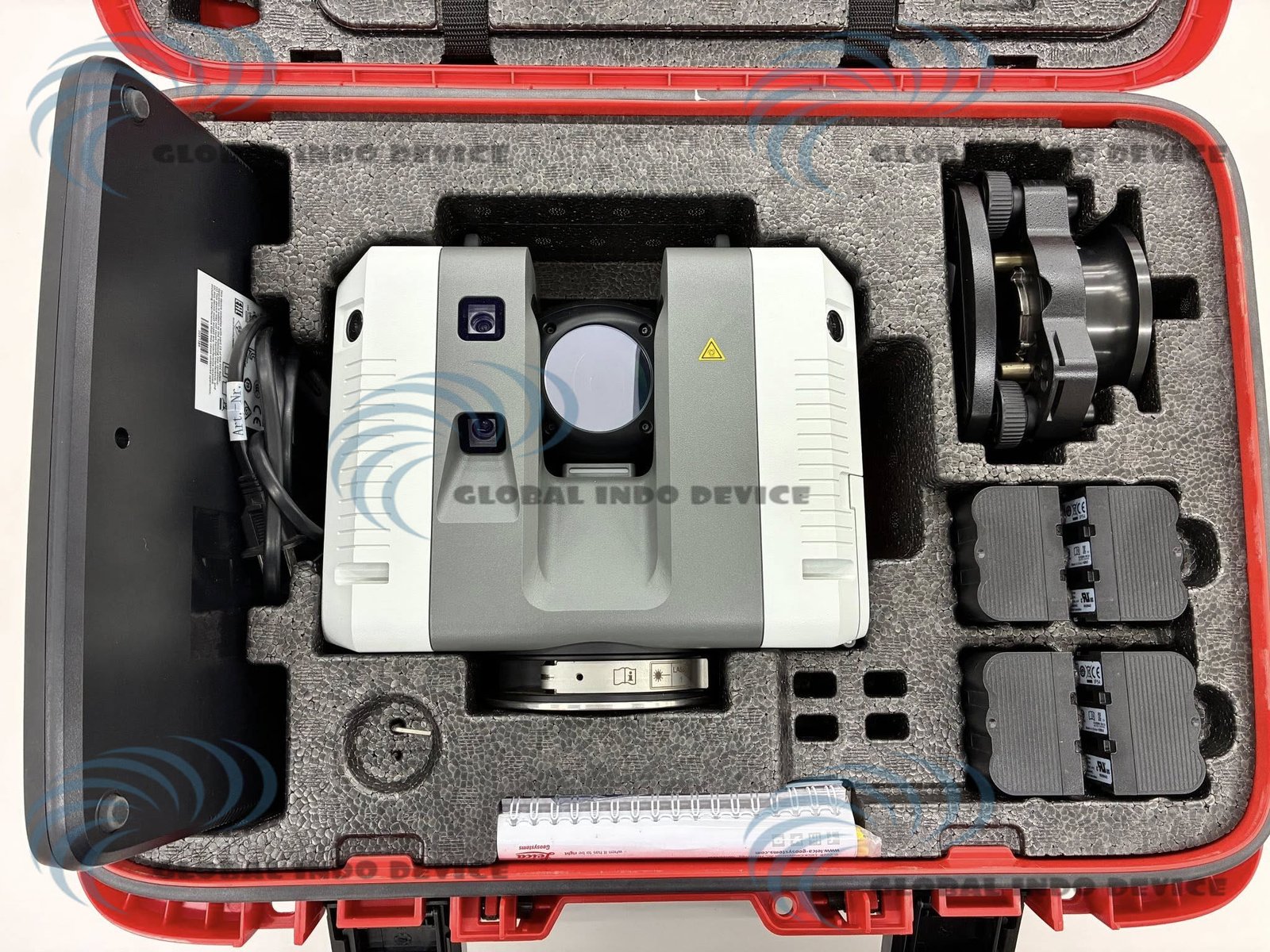
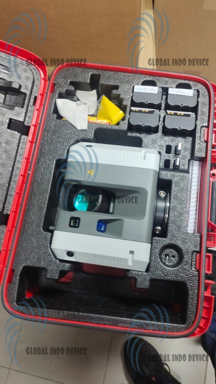
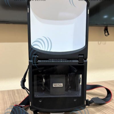
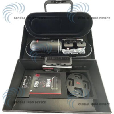
Package Includes:
– RTC360 Laser Scanner
– GVP730 hard carrying case
– GEB361 batteries (4)
– GKL341 Multicharger Pro
– RTC360 Flash Drive- 256GB (2)
– RTC360 Rain Cover
– 1 year RTC360 CCP Basic
– Quick Guide
– System USB Card
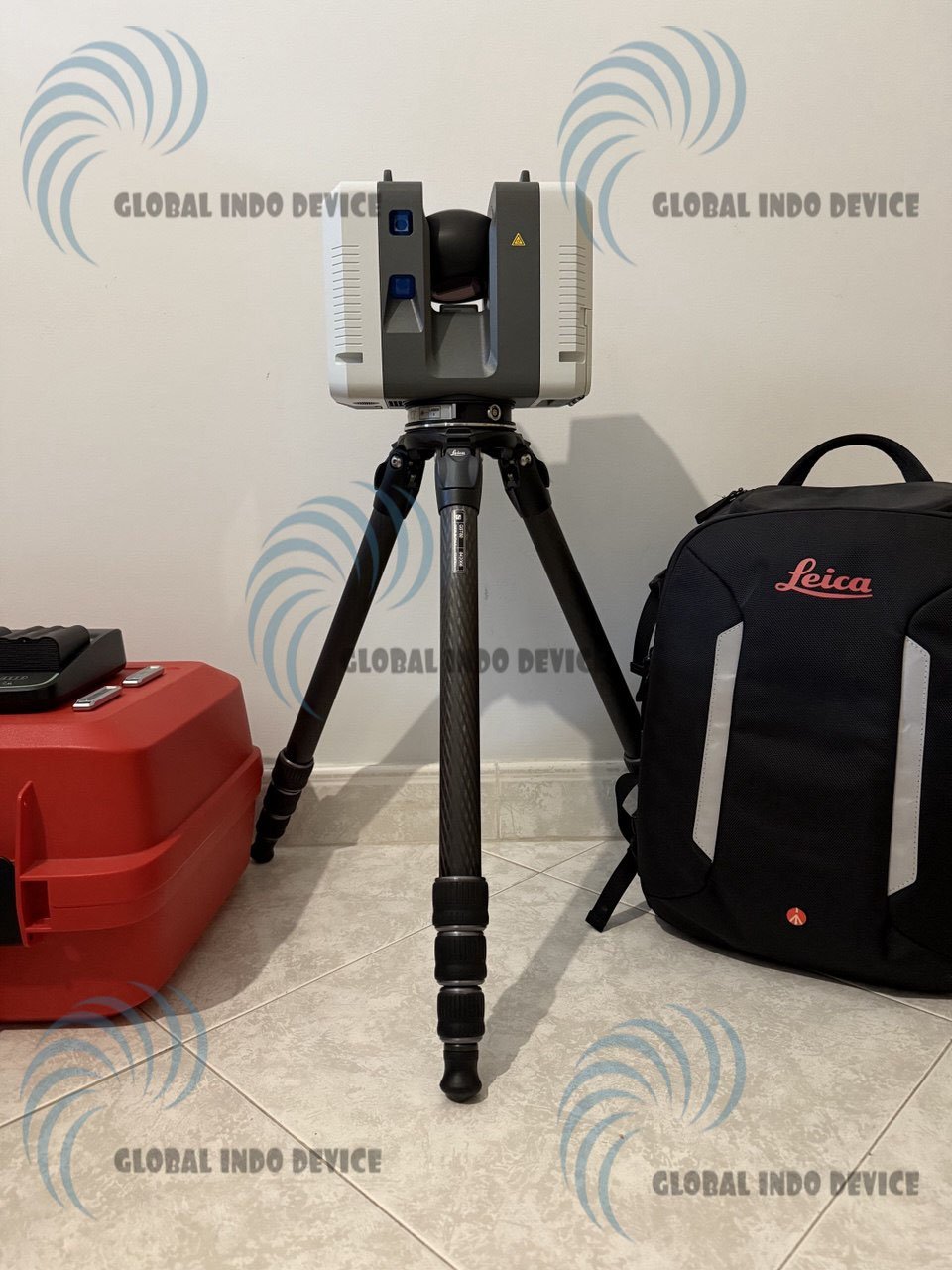
– Backpack and tripod
There are no reviews yet.