
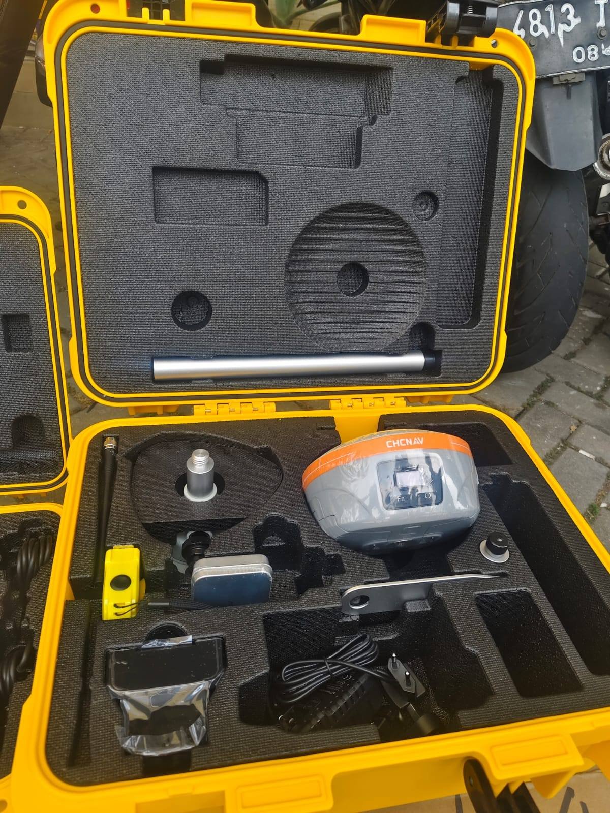
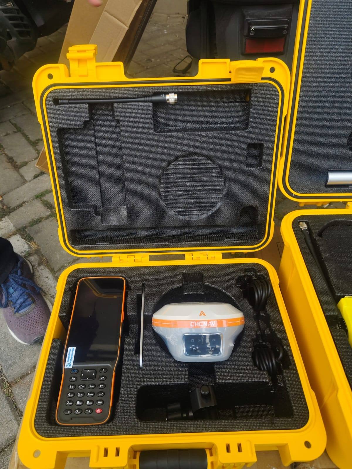
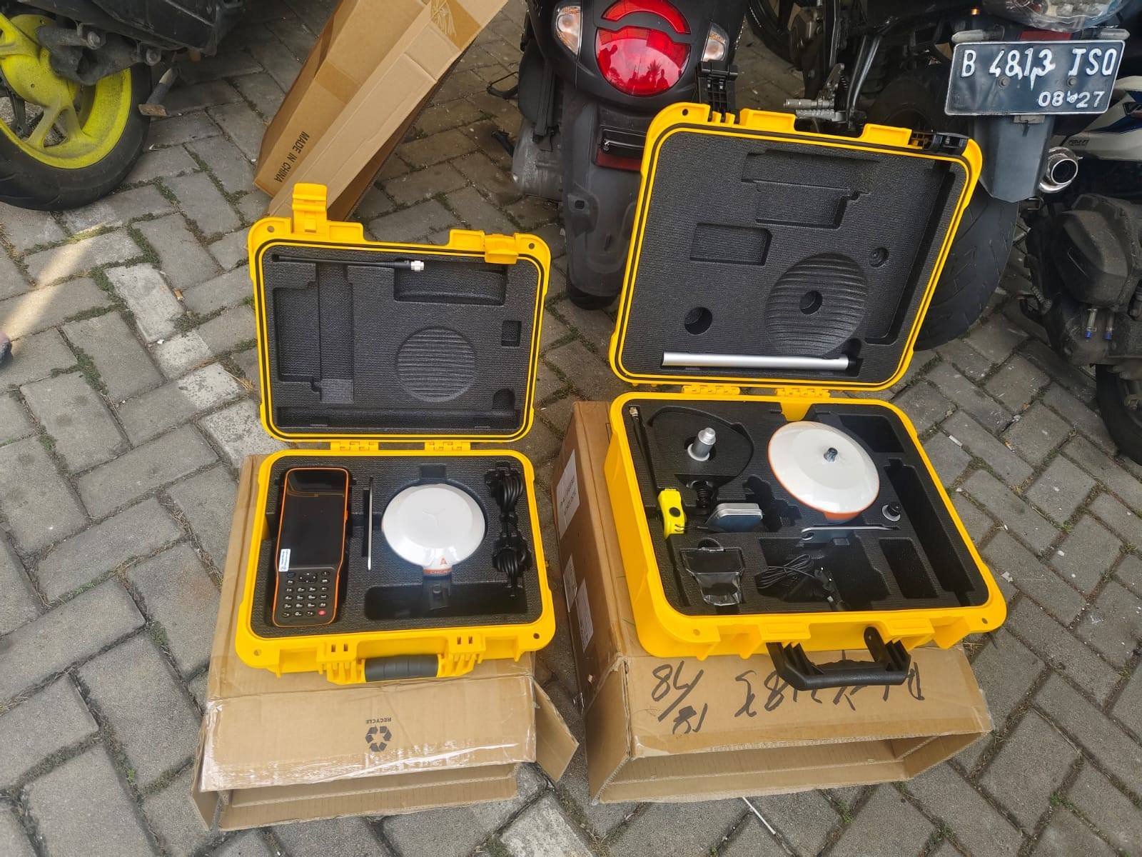
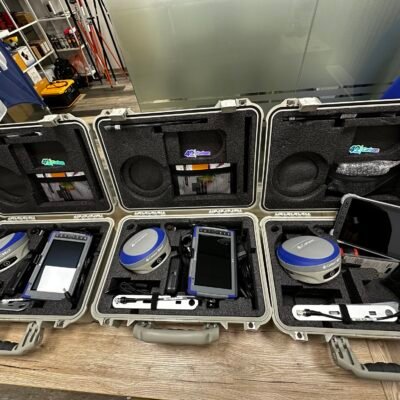
Product details
CHCNAV iBase GNSS Base Rover – Advanced Integrated GNSS RTK System for Precision Surveying
The CHCNAV iBase GNSS Base Rover is a professional integrated GNSS RTK base and rover solution designed for high-precision land surveying, construction positioning, topographic mapping, GIS data collection, and infrastructure measurement applications. Combining advanced multi-constellation GNSS technology, compact field portability, integrated communication systems, and rugged environmental protection, the iBase provides reliable centimeter-level positioning performance in demanding outdoor conditions.
Developed for surveyors, civil engineers, construction professionals, and geospatial specialists, the CHCNAV iBase GNSS system delivers flexible base station and rover operation in one compact platform, improving workflow efficiency while maintaining precise real-time positioning accuracy.
Key Features of CHCNAV iBase GNSS Base Rover
Integrated Base and Rover Functionality
The iBase can operate as both a GNSS base station and rover receiver.
Operational Benefits
- Flexible surveying workflows
- Simplified equipment management
- Reduced hardware requirements
- Faster field deployment
Multi-Constellation GNSS Support
The receiver tracks multiple satellite constellations simultaneously for improved positioning reliability.
Supported GNSS Systems
- GPS
- GLONASS
- Galileo
- BeiDou
- QZSS
- SBAS
High-Precision RTK Positioning
The advanced RTK engine delivers centimeter-level positioning accuracy for professional surveying applications.
RTK Advantages
- Fast RTK initialization
- Stable fixed solutions
- Reliable positioning performance
- High measurement consistency
Integrated UHF Radio Modem
The built-in radio modem supports long-range RTK communication between base and rover units.
Communication Benefits
- Long-distance RTK correction transmission
- Stable field communication
- Efficient base-rover connectivity
- Reduced external equipment requirements
Lightweight and Portable Design
The compact integrated design improves mobility and field productivity.
Portability Features
- Lightweight receiver body
- Compact transport design
- Easy setup and deployment
- Improved field efficiency
Rugged Environmental Protection
Designed for harsh outdoor environments and demanding field operations.
Durability Features
- Waterproof construction
- Dustproof protection
- Shock-resistant housing
- Reliable extreme-weather operation
Applications of CHCNAV iBase GNSS Base Rover
Land Surveying
Supports precise geospatial data collection and boundary determination.
Surveying Applications
- Boundary surveys
- Control point establishment
- Topographic surveys
- Cadastral mapping
Construction and Site Positioning
Provides accurate positioning for construction layout and infrastructure projects.
Construction Uses
- Site layout
- Earthwork positioning
- Structural positioning
- Utility installation
GIS and Mapping
Efficiently captures geospatial information for mapping projects.
GIS Applications
- Asset mapping
- Utility mapping
- Environmental surveys
- Geographic data collection
Civil Engineering Projects
Supports infrastructure measurement and positioning operations.
Engineering Applications
- Road construction
- Bridge positioning
- Drainage surveys
- Infrastructure verification
Agriculture and Machine Control
Suitable for precision agriculture and machine guidance applications.
Agricultural Uses
- Field mapping
- Machine positioning
- Precision farming
- Guidance systems
CHCNAV iBase GNSS Base Rover Technical Specifications
General Specifications
| Specification | Details |
|---|---|
| Product Name | CHCNAV iBase GNSS Base Rover |
| Instrument Type | Integrated GNSS RTK Receiver |
| Manufacturer | CHCNAV |
| Operation Mode | Base & Rover |
| Intended Applications | Surveying, Construction, GIS |
| Positioning Technology | GNSS RTK |
GNSS Tracking Specifications
| Parameter | Specification |
|---|---|
| GPS Signals | L1C/A, L2C, L2P, L5 |
| GLONASS Signals | L1, L2 |
| Galileo Signals | E1, E5a, E5b |
| BeiDou Signals | B1, B2, B3 |
| QZSS Support | Supported |
| SBAS Support | Supported |
Positioning Accuracy Specifications
| Measurement Type | Accuracy |
|---|---|
| RTK Horizontal Accuracy | ±8 mm + 1 ppm |
| RTK Vertical Accuracy | ±15 mm + 1 ppm |
| Static Horizontal Accuracy | ±2.5 mm + 0.5 ppm |
| Static Vertical Accuracy | ±5 mm + 0.5 ppm |
| DGPS Accuracy | Sub-Meter |
RTK Performance Specifications
| Parameter | Specification |
|---|---|
| RTK Initialization Time | Typically < 10 Seconds |
| Initialization Reliability | >99.9% |
| Data Update Rate | Up to 20 Hz |
| Real-Time Positioning | Supported |
Communication Specifications
| Parameter | Specification |
|---|---|
| Integrated UHF Radio | Supported |
| Radio Frequency Range | 410–470 MHz |
| Cellular Network | 4G LTE Supported |
| Bluetooth | Integrated |
| Wi-Fi | Supported |
| NFC | Supported |
Data Storage and Connectivity
| Parameter | Specification |
|---|---|
| Internal Storage | Large Capacity Memory |
| USB Connectivity | Supported |
| Serial Communication | Supported |
| Data Export Formats | Industry Standard Formats |
| Cloud Connectivity | Supported |
Environmental Specifications
| Parameter | Specification |
|---|---|
| Operating Temperature | -40°C to +65°C |
| Storage Temperature | -40°C to +85°C |
| Protection Rating | IP67 |
| Dust Protection | Complete Protection |
| Waterproof Rating | Immersion Resistant |
Power Specifications
| Parameter | Specification |
|---|---|
| Battery Type | Integrated Rechargeable Li-Ion |
| Operating Time | Up to 12 Hours |
| Charging Interface | USB-C |
| External Power Support | Supported |
Physical Specifications
| Parameter | Specification |
|---|---|
| Weight | Approx. 1.4 kg |
| Receiver Design | Compact Integrated Receiver |
| Housing Material | Industrial Reinforced Housing |
| Mounting Compatibility | Standard Survey Pole Compatible |
Advantages of CHCNAV iBase GNSS Base Rover
Efficient Integrated Workflow
The combined base and rover functionality simplifies field operations.
Workflow Benefits
- Reduced equipment complexity
- Faster project setup
- Simplified transportation
- Flexible operational modes
Reliable Centimeter-Level Accuracy
Designed for demanding professional positioning applications.
Accuracy Advantages
- Stable RTK performance
- Fast fixed solution acquisition
- Reliable satellite tracking
- High measurement consistency
Advanced Connectivity and Communication
Supports modern field communication and cloud-based workflows.
Connectivity Features
- UHF radio communication
- Cellular connectivity
- Wireless data transfer
- Cloud integration support
Rugged Field Durability
Built for long-term reliability in harsh outdoor environments.
Durability Benefits
- Waterproof protection
- Dustproof housing
- Shock resistance
- Extreme-weather reliability
Industries That Use CHCNAV iBase GNSS Base Rover
Surveying Industry
- Geodetic surveys
- Boundary mapping
- Control network establishment
Construction Industry
- Site positioning
- Earthwork measurement
- Infrastructure layout
GIS and Mapping
- Utility mapping
- Asset management
- Geographic data collection
Agriculture Industry
- Precision farming
- Guidance systems
- Machine control

There are no reviews yet.