
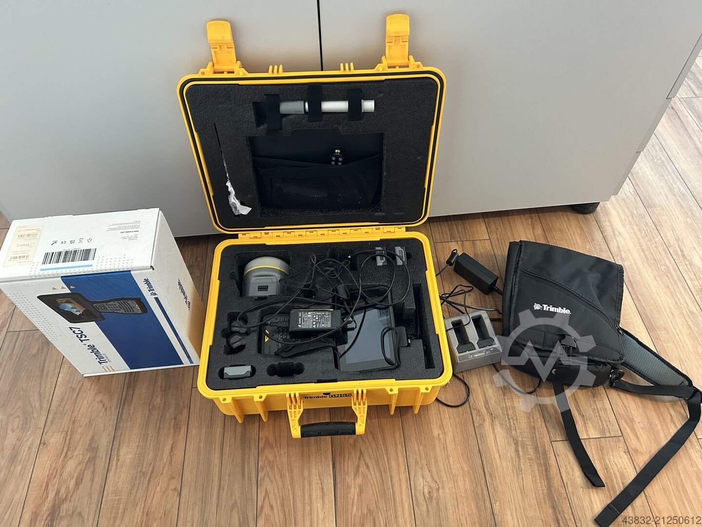
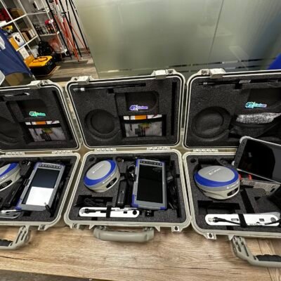
Product details
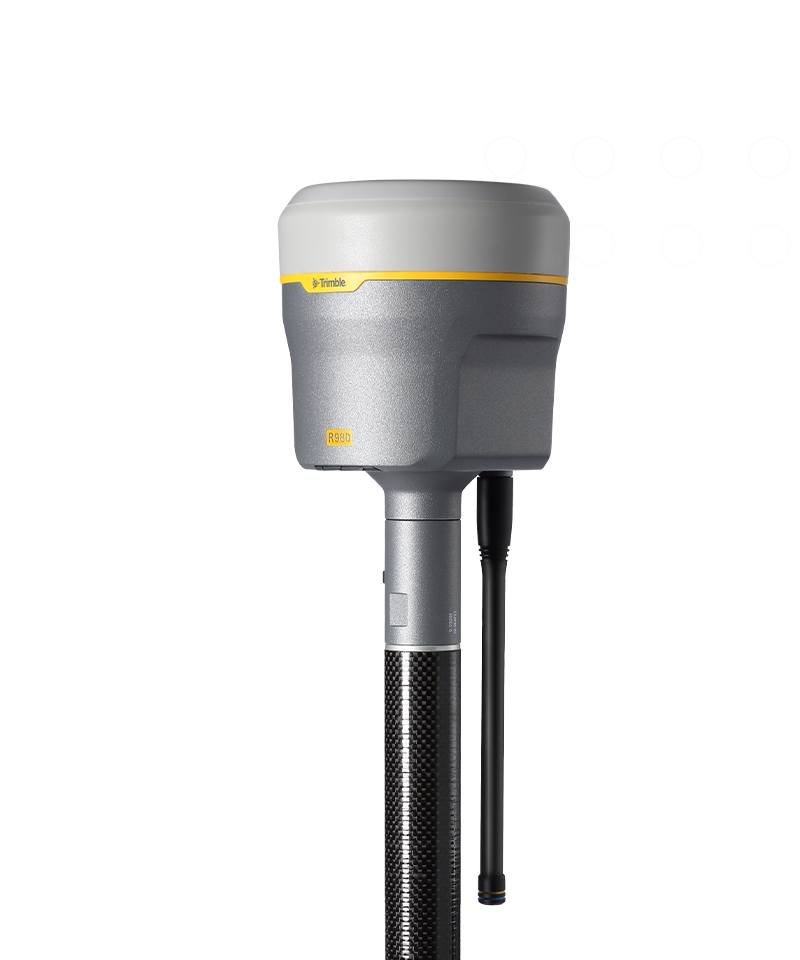
Trimble R980 GNSS System
The Trimble R980 GNSS System is a premium-grade GNSS receiver engineered for surveyors, geospatial professionals, construction engineers, and infrastructure specialists who require unmatched positioning accuracy, reliable connectivity, and maximum productivity in challenging environments. Developed by Trimble Geospatial,, the R980 combines advanced GNSS technology, IMU-based tilt compensation, integrated communication modules, and high-performance signal tracking into one rugged and compact surveying solution.
Built for modern surveying workflows, the Trimble R980 delivers exceptional RTK accuracy, superior satellite tracking, and dependable performance under tree canopy, urban obstructions, and remote field conditions. It integrates seamlessly with Trimble Access software, Trimble Business Center, and multiple Trimble controllers, enabling efficient field-to-office workflows.
Why Choose the Trimble R980 GNSS System?
Advanced GNSS Performance in Difficult Environments
The Trimble R980 uses the powerful Trimble ProPoint® GNSS positioning engine, enabling stable and accurate positioning in environments where conventional GNSS receivers struggle.
Key Advantages
- Superior tracking near buildings and heavy canopy
- Reduced multipath interference
- Faster RTK initialization
- Reliable satellite lock in obstructed areas
- Improved productivity in urban and remote projects
The system supports all major satellite constellations including GPS, GLONASS, Galileo, BeiDou, QZSS, NavIC, and SBAS.
Integrated Trimble TIP™ Tilt Compensation
One of the standout features of the R980 is Trimble TIP™ technology, which allows surveyors to measure and stake points accurately without leveling the survey pole.
Benefits of TIP Technology
- Faster point collection
- Easier access to hard-to-reach areas
- Improved safety in dangerous terrain
- Reduced operator fatigue
- Increased field efficiency
The IMU-based tilt compensation system operates without magnetic calibration and maintains reliable performance around metal structures and vehicles.
Key Features of Trimble R980 GNSS Receiver
Trimble ProPoint GNSS Engine
The advanced positioning engine enhances signal processing and measurement reliability in difficult GNSS environments.
Features
- Multi-frequency GNSS tracking
- Improved RTK positioning
- Advanced multipath mitigation
- Enhanced low-elevation satellite tracking
- Stable positioning under canopy
Integrated Connectivity Options
The Trimble R980 is designed for seamless field connectivity with built-in communication modules.
Communication Features
- Integrated 4G LTE cellular modem
- Dual-band UHF radio (450/900 MHz)
- Bluetooth connectivity
- Wi-Fi support
- USB communication
- Internet-based correction services
This enables uninterrupted correction data access in remote and urban locations.
CenterPoint RTX Support
The R980 supports Trimble CenterPoint RTX correction services, allowing surveyors to achieve RTK-level accuracy without a local base station.
RTX Advantages
- Global correction coverage
- No local base station required
- Internet and satellite correction delivery
- Faster setup in remote locations
- Reduced infrastructure costs
The system can achieve approximately 2 cm horizontal and 3 cm vertical precision using CenterPoint RTX.
Applications of Trimble R980
Land Surveying
Ideal for:
- Boundary surveys
- Topographic mapping
- Construction staking
- Control surveys
- Cadastral mapping
Construction and Infrastructure
Suitable for:
- Road construction
- Bridge alignment
- Site layout
- Earthworks
- Utility installation
Mining and Energy Projects
Perfect for:
- Open-pit mine surveying
- Pipeline positioning
- Oil and gas infrastructure
- Renewable energy projects
- High-precision monitoring
GIS and Mapping
The Trimble R980 supports efficient GIS workflows with reliable field data collection.
GIS Applications
- Asset mapping
- Utility management
- Environmental surveys
- Forestry mapping
- Municipal infrastructure surveys
Trimble R980 Technical Specifications
GNSS Specifications
Satellite Tracking
- GPS
- GLONASS
- Galileo
- BeiDou
- QZSS
- NavIC
- SBAS
Channels
- 672 GNSS channels
Signal Tracking
- Multi-frequency tracking
- Advanced GNSS signal processing
- Real-time satellite optimization
Accuracy Specifications
RTK Accuracy
- Horizontal: 8 mm + 1 ppm RMS
- Vertical: 15 mm + 1 ppm RMS
Static / Fast Static Accuracy
- Horizontal: 3 mm + 0.1 ppm RMS
- Vertical: 3.5 mm + 0.4 ppm RMS
Trimble TIP Accuracy
- RTK + 3 mm + 0.15 mm/° tilt
CenterPoint RTX Accuracy
- Horizontal: 2 cm RMS
- Vertical: 3 cm RMS
Hardware Specifications
Physical Dimensions
| Specification | Details |
|---|---|
| Weight | Approx. 1.13 kg |
| Diameter | Approx. 11.9 cm |
| Height | Approx. 13.6 cm |
| Housing Material | Rugged industrial-grade composite |
| Environmental Protection | IP-rated rugged enclosure |
Environmental Specifications
Operating Conditions
- Dustproof and water-resistant design
- Shock-resistant construction
- Field-ready rugged housing
- Designed for harsh outdoor environments
Operating Temperature
- Engineered for extreme field temperatures
- Suitable for hot, cold, and humid conditions
Power Specifications
Battery System
- Hot-swappable smart battery support
- Long operating duration
- Efficient power management
Charging Options
- External charger
- USB charging support
- Vehicle charging compatibility
Connectivity and Communication
Wireless Communication
Integrated Technologies
- Bluetooth
- Wi-Fi
- Cellular LTE modem
- Dual-band UHF radio
Radio Specifications
- 450 MHz UHF
- 900 MHz UHF
- Internal transmit/receive radio
Compatible Trimble Software
Trimble Access
The R980 integrates seamlessly with Trimble Access for professional surveying workflows.
Features
- Field data collection
- Stakeout workflows
- COGO calculations
- Real-time mapping
- Quality control tools
Trimble Business Center
Compatible with Trimble Business Center for advanced office processing.
Functions
- GNSS data processing
- CAD drafting
- Surface modeling
- Volume calculations
- Reporting and deliverables
Benefits of Using Trimble R980
Improved Survey Productivity
Surveyors can complete projects faster thanks to:
- Faster initialization
- Tilt compensation
- Reliable satellite tracking
- Integrated communications
- Reduced setup time


There are no reviews yet.