
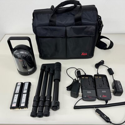
Product details
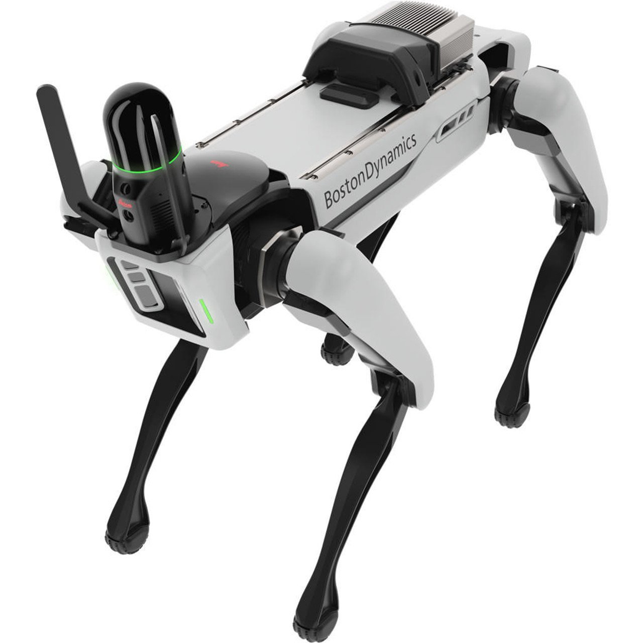
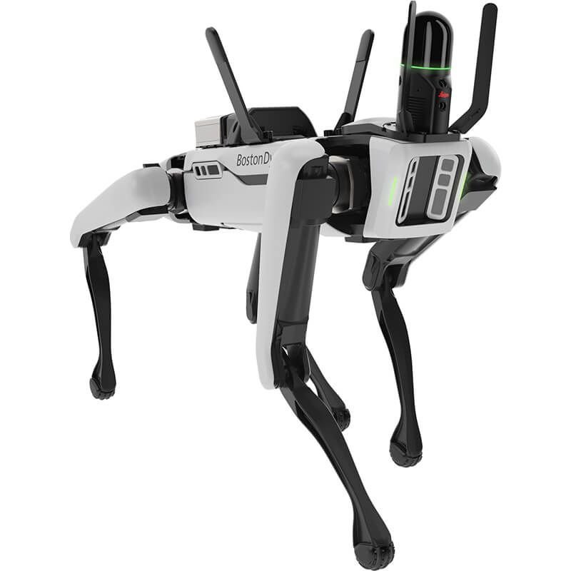
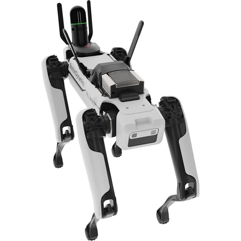
Leica BLK ARC Autonomous Laser Scanning System
The Leica BLK ARC Autonomous Scanner is a next-generation autonomous LiDAR scanning module designed to transform robotic platforms into fully self-operating reality capture systems. Built for integration with autonomous ground vehicles (UGVs) and robotic carriers, it enables high-precision 3D data acquisition in environments that are difficult, dangerous, or inefficient for human surveyors.
Engineered by Leica Geosystems, the BLK ARC combines advanced laser scanning, edge computing, and autonomous navigation capabilities to deliver real-time spatial awareness and fully automated mapping workflows.
Key Features of Leica BLK ARC Autonomous Scanner
Autonomous Reality Capture
The BLK ARC is designed for fully autonomous operation, enabling robots to independently navigate and scan environments without continuous human control. It can follow pre-defined missions or dynamically adjust paths based on real-time obstacle detection.
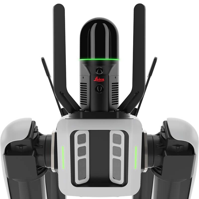
Integrated LiDAR Scanning Technology
It features high-performance laser scanning technology capable of capturing dense 3D point clouds with exceptional accuracy and speed, suitable for detailed mapping of complex environments.
Edge Computing & Onboard Processing
The system includes onboard computing power that allows immediate processing of spatial data, reducing reliance on external workstations and enabling near real-time visualization.
Seamless Robot Integration
The BLK ARC is built to integrate with third-party robotic platforms, particularly autonomous mobile robots (AMRs) and unmanned ground vehicles (UGVs), making it highly adaptable for industrial automation.
SLAM-Based Navigation
Using advanced Simultaneous Localization and Mapping (SLAM) algorithms, the system can understand its surroundings, localize itself, and build maps simultaneously without GNSS dependency.
Cloud Connectivity
Captured data can be synchronized with cloud platforms for processing, collaboration, and remote access, supporting digital twin workflows and BIM integration.
Technical Specifications
Laser Scanning System
- Type: High-precision LiDAR scanner
- Scanning Range: Up to industrial-grade short-to-mid range mapping (optimized for indoor/outdoor hybrid environments)
- Point Cloud Density: Adjustable based on mission requirements
- Accuracy: Millimeter-level precision for close-range scanning
- Scan Speed: Real-time continuous scanning during motion
Autonomous Navigation System
- SLAM Engine: Real-time simultaneous localization and mapping
- Obstacle Detection: Multi-sensor fusion (LiDAR + vision-based inputs depending on platform integration)
- Path Planning: Autonomous route optimization
- Environment Adaptation: Dynamic rerouting in unknown environments
Computing System
- Onboard Processor: Edge computing unit for real-time data processing
- Storage: High-capacity internal storage for point cloud datasets
- Data Handling: Real-time compression and stream optimization
Connectivity
- Wireless Communication: High-speed data transfer capability
- Cloud Integration: Leica cloud ecosystem compatibility
- Data Export Formats: Standard point cloud formats compatible with CAD/BIM systems
Physical Characteristics
- Form Factor: Compact modular scanner unit
- Mounting: Robot-arm or mobile platform compatible interface
- Durability: Industrial-grade housing for harsh environments
- Environmental Resistance: Designed for dust, vibration, and field conditions
System Architecture
Sensor Fusion Layer
The BLK ARC integrates multiple data inputs to ensure accurate spatial perception. This includes LiDAR scanning data combined with positional tracking from robotic platforms.
Processing Layer
All raw scan data is processed through onboard algorithms that clean, align, and structure point clouds in real time.
Mapping Layer
The system builds continuously updated 3D maps that can be used for navigation, inspection, and digital twin creation.
Output Layer
Final datasets can be exported to BIM systems, CAD software, or cloud-based visualization platforms.
Applications of Leica BLK ARC
Construction and Infrastructure
- Automated progress tracking
- As-built documentation
- Structural verification
- Site monitoring without manual surveying
Industrial Facilities
- Factory layout scanning
- Asset documentation
- Maintenance planning
- Safety compliance inspection
Mining and Energy
- Underground mapping
- Hazardous zone scanning
- Volume measurement
- Remote inspection of inaccessible areas
Public Safety and Security
- Emergency site mapping
- Disaster response planning
- Hazard zone assessment
- Post-incident reconstruction
Autonomous Robotics Research
- SLAM algorithm testing
- Robotics navigation development
- AI-driven spatial mapping experiments
Advantages of Leica BLK ARC
Fully Autonomous Operation
Reduces the need for human surveyors in dangerous or repetitive environments.
High Efficiency Data Capture
Rapid scanning allows large areas to be mapped in significantly less time than traditional methods.
Improved Safety
Enables remote data collection in hazardous or restricted environments.
Digital Twin Enablement
Supports creation of highly accurate digital replicas of physical spaces.
Scalability
Can be deployed across multiple robotic platforms for large-scale operations.
Integration Capabilities
Robotics Platforms
The BLK ARC is designed to be compatible with a variety of robotic systems, especially autonomous mobile robots used in industrial environments.
Software Ecosystem
It integrates with Leica’s reality capture software suite and supports third-party BIM and CAD tools.
Cloud Workflow
Data can be uploaded to cloud environments for remote processing, collaboration, and long-term storage.
Operational Workflow
Mission Planning
Operators define scanning routes or autonomous missions via control software.
Autonomous Deployment
The robotic platform executes the mission while the BLK ARC captures spatial data.
Real-Time Processing
Data is processed onboard during scanning for immediate validation.
Post-Processing
Refined point clouds are generated and exported for engineering or analysis workflows.
Environmental Performance
The BLK ARC is engineered for demanding field conditions. It maintains stable performance in environments with dust, vibration, and variable lighting conditions, making it suitable for both indoor and outdoor deployment scenarios.
Future of Autonomous Scanning
The BLK ARC represents a shift toward fully autonomous reality capture systems, where robotics and LiDAR work together to eliminate manual surveying tasks. This evolution supports the growth of smart cities, automated construction sites, and AI-driven infrastructure management.
Specifications
Platform Compatibility
| Specification | Details |
|---|---|
| Compatible Platforms | AMR, UGV, Autonomous Robots |
| Mounting Configuration | Modular Mounting System |
| Payload Adaptability | Optimized for Mobile Robotics |
| Robot Communication Protocol | Industry Compatible |
| Autonomous Mission Support | Supported |
| Navigation Coordination | Integrated |
| Multi-Robot Deployment | Supported |
| Remote Robot Control | Supported |
| Autonomous Fleet Support | Supported |
| Robotics SDK Compatibility | Supported |
| Mobile Platform Synchronization | Real-Time |
Point Cloud & Mapping Data
| Specification | Details |
|---|---|
| Data Type | 3D Point Cloud |
| Point Cloud Density | High Density |
| Mapping Format | Structured Spatial Dataset |
| File Export Formats | Industry Standard Formats |
| Data Storage | Internal + Cloud |
| Scan Registration | Automatic |
| Dataset Optimization | Supported |
| Spatial Alignment | Automatic |
| Georeferencing Support | Supported |
| Data Synchronization | Cloud & Local |
| Digital Twin Workflow | Supported |
| Mesh Generation | Compatible |
| BIM Workflow | Supported |
| Reality Capture Pipeline | End-to-End |
Durability & Field Performance
| Specification | Details |
|---|---|
| Operating Environment | Indoor & Outdoor |
| Industrial Protection | Rugged Industrial Housing |
| Dust Resistance | Industrial Grade |
| Shock Resistance | Supported |
| Vibration Resistance | Supported |
| Low-Light Operation | Supported |
| Harsh Environment Compatibility | Supported |
| Autonomous Field Deployment | Supported |
| Industrial Site Operation | Optimized |
| Tunnel & Underground Use | Supported |
| Construction Site Use | Supported |
| Mining Environment Support | Supported |
Workflow & Mission Capabilities
| Specification | Details |
|---|---|
| Mission Planning | Autonomous |
| Autonomous Start/Stop | Supported |
| Real-Time Mission Monitoring | Supported |
| Live Data Streaming | Supported |
| Remote Mission Control | Supported |
| Multi-Zone Mapping | Supported |
| Scan Replay Capability | Supported |
| Autonomous Mapping Cycle | Supported |
| Rapid Deployment | Supported |
| Minimal Human Intervention | Required |
| Continuous Operation | Optimized |
| Smart Environment Adaptation | Supported |
Supported Industries
| Industry | Use Case |
|---|---|
| Construction | Progress Monitoring & BIM |
| Mining | Underground Mapping |
| Manufacturing | Factory Digitization |
| Oil & Gas | Hazardous Area Inspection |
| Infrastructure | Asset Documentation |
| Energy | Facility Mapping |
| Public Safety | Emergency Scene Documentation |
| Transportation | Tunnel & Rail Mapping |
| Smart Cities | Digital Twin Creation |
| Robotics Research | Autonomous Navigation Testing |
Supported Workflow Platforms
| Platform Type | Compatibility |
|---|---|
| BIM Software | Supported |
| CAD Platforms | Supported |
| GIS Platforms | Supported |
| Reality Capture Software | Supported |
| Cloud Processing Platforms | Supported |
| Digital Twin Platforms | Supported |
| Robotic Fleet Software | Supported |
| Remote Collaboration Systems | Supported |
| Industrial Automation Platforms | Supported |
There are no reviews yet.