
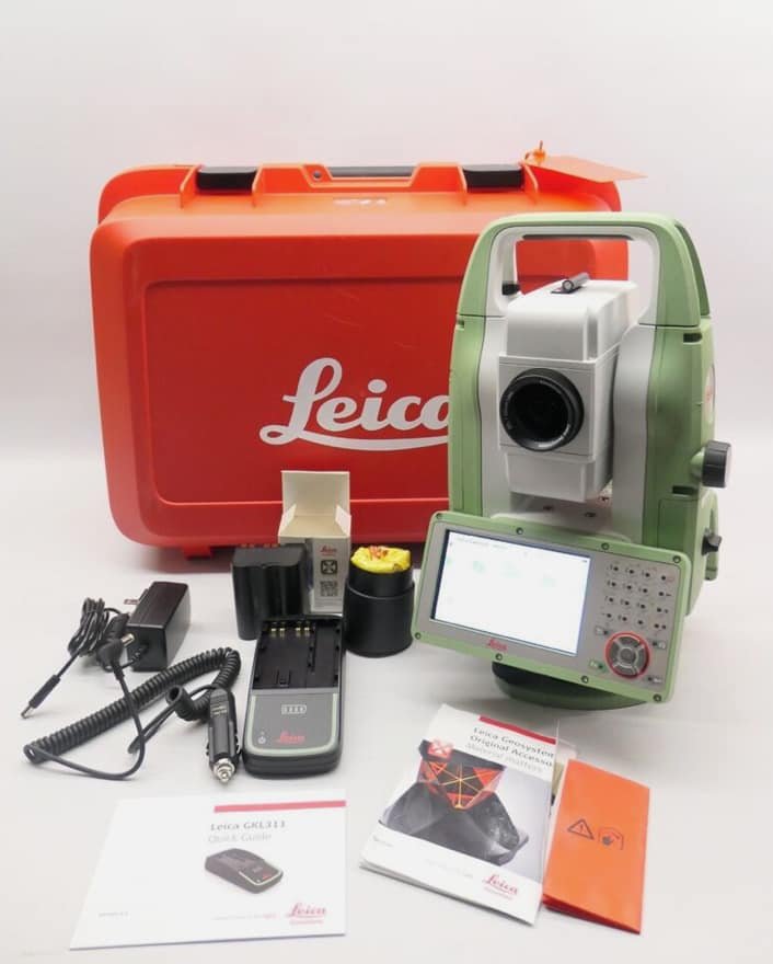
Product details
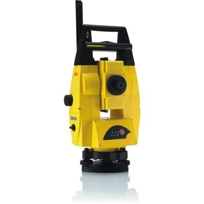
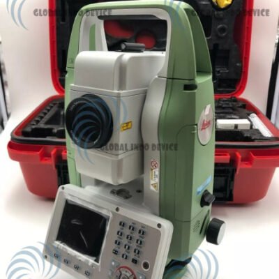
Leica TS10 Manual Total Station
Professional High-Accuracy Manual Total Station for Surveying and Construction
The Leica TS10 Manual Total Station is a powerful and intelligent surveying instrument designed for professionals who require high measurement precision, efficient workflows, and dependable field performance. Developed by Leica Geosystems, the TS10 combines advanced EDM technology, intuitive Leica Captivate software, superior optical performance, and robust field durability to deliver reliable results for land surveying, engineering, construction, and infrastructure applications.
Positioned as a premium manual total station, the Leica TS10 provides advanced digital workflows and modern connectivity while maintaining the simplicity and reliability expected from a professional manual surveying solution.
Why Choose the Leica TS10 Manual Total Station?
The Leica TS10 is engineered to improve productivity, simplify field operations, and deliver exceptional measurement reliability in demanding environments.
Main Advantages
- High-precision angle measurement
- Advanced reflectorless EDM
- Leica Captivate software integration
- Fast and accurate distance measurements
- Large touchscreen interface
- Excellent field durability
- GNSS workflow compatibility
- Modern wireless connectivity
- Intuitive user experience
- Flexible survey data management
The TS10 is designed for survey professionals seeking advanced technology without the complexity of full robotic systems.
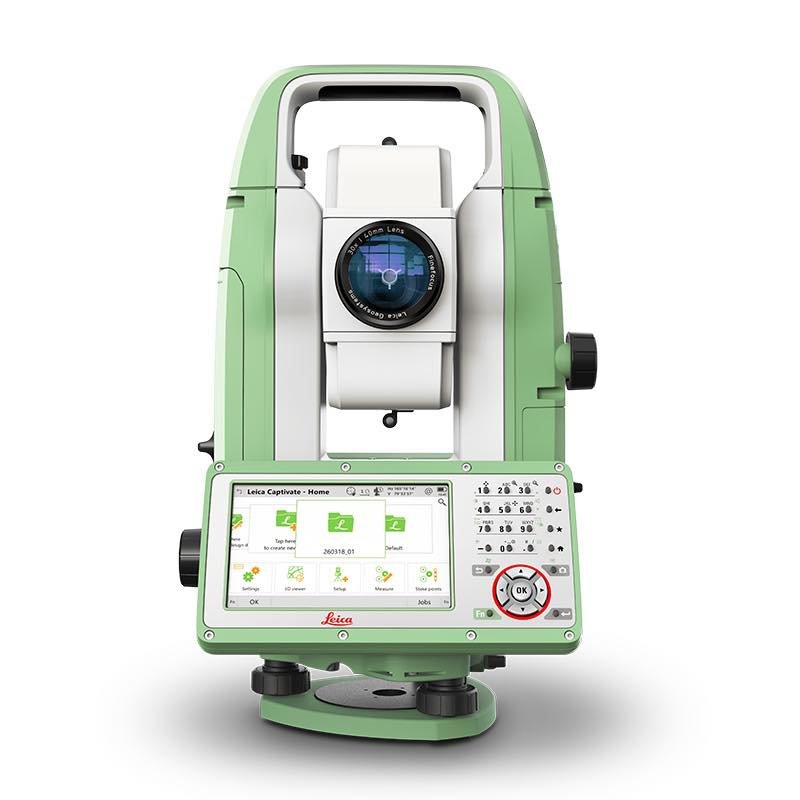
Leica Captivate Software
Intelligent 3D Field Data Visualization
The Leica TS10 operates using Leica Captivate software, providing an immersive and highly visual field surveying experience.
Key Benefits of Leica Captivate
- Real-time 3D data visualization
- Simplified field workflows
- Improved stakeout accuracy
- Faster field decision-making
- Enhanced project understanding
- Reduced operational errors
The software interface transforms complex survey data into visual project information directly on the touchscreen display.
Leica TS10 Angular Accuracy Options
Multiple Precision Configurations
The Leica TS10 is available in several angular accuracy models to match different project requirements.
| Model | Angular Accuracy |
|---|---|
| TS10 1” | 1 Second |
| TS10 2” | 2 Second |
| TS10 3” | 3 Second |
| TS10 5” | 5 Second |
These options allow professionals to select the appropriate precision level for engineering, construction, and geospatial applications.
Advanced EDM Technology
Long-Range and High-Speed Measurement Performance
The Leica TS10 includes powerful EDM technology capable of fast and accurate prism and reflectorless measurements.
Distance Measurement Range
| Measurement Type | Range |
|---|---|
| Reflectorless Measurement | Up to 1,000 m |
| Single Prism | Up to 3,500 m |
| Circular Prism | Up to 10,000 m |
Distance Accuracy
| Measurement Mode | Accuracy |
|---|---|
| Prism Measurement | ±(1 mm + 1.5 ppm) |
| Reflectorless Measurement | ±(2 mm + 2 ppm) |
Measurement Speed
| Mode | Time |
|---|---|
| Fine Measurement | Approximately 1 sec |
| Tracking Measurement | Continuous Fast Tracking |
The advanced EDM system improves productivity for topographic surveys, construction layout, and infrastructure projects.
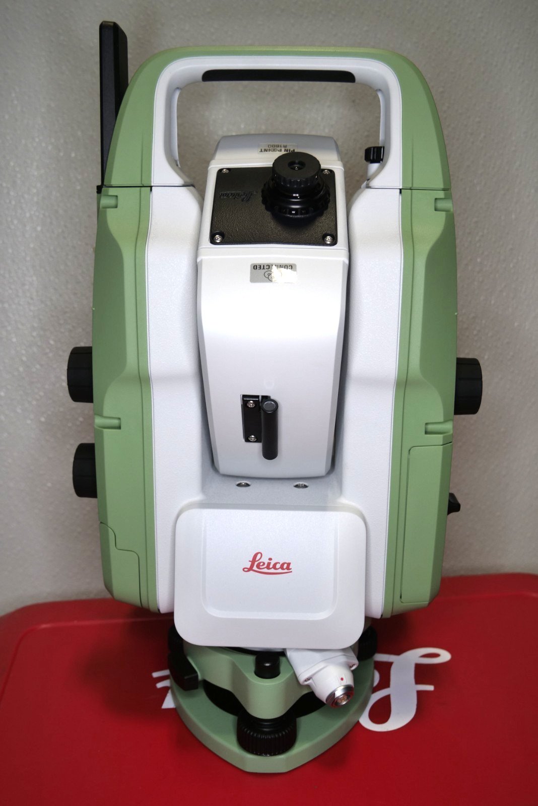
Leica TS10 Technical Specifications
Telescope Specifications
High-Quality Leica Optics
| Feature | Specification |
|---|---|
| Telescope Magnification | 30x |
| Objective Aperture | 45 mm |
| Field of View | 1°30’ |
| Resolving Power | 3” |
| Minimum Focus Distance | 1.7 m |
| Image | Erect |
The premium optical system provides excellent target visibility and sharp image clarity under various environmental conditions.
Compensator Specifications
Automatic Tilt Compensation System
| Feature | Specification |
|---|---|
| Compensator Type | Quadruple Axis Compensator |
| Compensation Range | ±4’ |
| Compensation Accuracy | High Precision Electronic Compensation |
The automatic compensator minimizes angular measurement errors caused by slight instrument movement.
Touchscreen and User Interface
Modern Field Operation Experience
The Leica TS10 features a modern touchscreen interface designed for efficient field productivity.
User Interface Features
- Color Touchscreen Display
- Leica Captivate Interface
- Alphanumeric Keyboard
- Graphical Data Visualization
- Intuitive Menu Navigation
Display Specifications
| Feature | Specification |
|---|---|
| Display Type | Color WVGA Touchscreen |
| Keyboard | Full Alphanumeric |
| Face Display Options | Single or Dual Display |
| Interface | Leica Captivate |
The intuitive display simplifies operation for both experienced surveyors and new users.
AutoHeight Functionality
Intelligent Instrument Height Measurement
The TS10 supports Leica AutoHeight technology for automated instrument height recording.
Benefits of AutoHeight
- Faster setup procedures
- Reduced human error
- Consistent setup documentation
- Improved field efficiency
- Better workflow accuracy
This feature helps improve productivity during repetitive survey setups.
Communication and Connectivity
Modern Digital Surveying Connectivity
The Leica TS10 supports multiple connectivity options for efficient data transfer and collaboration.
Connectivity Features
- Bluetooth
- WLAN / Wi-Fi
- USB Interface
- SD Card Support
- LTE Modem Support
- Serial Communication
Cloud and Office Integration
- Leica Exchange
- Leica ConX
- Leica Infinity
- Cloud Synchronization
These solutions streamline field-to-office workflows and improve project coordination.
Data Storage and File Management
Flexible Survey Data Handling
| Feature | Specification |
|---|---|
| Internal Memory | Large Internal Storage |
| External Storage | SD Card / USB |
| Supported Formats | CSV, DXF, LandXML |
| Data Synchronization | Cloud Enabled |
The storage system supports efficient management of large survey datasets.
Environmental Specifications
Rugged Design for Harsh Field Conditions
The Leica TS10 is engineered to withstand demanding outdoor environments.
| Feature | Specification |
|---|---|
| Protection Rating | IP66 |
| Dust Protection | Yes |
| Waterproof Protection | Yes |
| Operating Temperature | -20°C to +50°C |
| Humidity Resistance | High |
The rugged housing protects the instrument against dust, heavy rain, and difficult construction site conditions.
Battery and Power System
Long Operational Runtime
| Feature | Specification |
|---|---|
| Battery Type | Li-Ion Rechargeable |
| Operating Time | Up to 8 Hours |
| Charging Time | Approximately 4 Hours |
| Hot-Swap Capability | Supported |
The efficient power management system enables reliable all-day operation.
GNSS Integration
Hybrid Surveying Capability
The Leica TS10 integrates seamlessly with Leica GNSS receivers for combined total station and GNSS workflows.
Advantages of GNSS Integration
- Faster control point establishment
- Improved efficiency on large projects
- Seamless coordinate management
- Flexible positioning workflows
- Enhanced infrastructure surveying
This hybrid workflow is especially useful for large construction and engineering projects.
Applications of Leica TS10 Manual Total Station
Construction Layout
Ideal for:
- Building stakeout
- Foundation positioning
- Structural alignment
- Concrete formwork layout
- MEP installation
Land Surveying
Perfect for:
- Boundary surveys
- Topographic mapping
- Elevation measurements
- Site planning
- Property subdivision
Civil Engineering Projects
Widely used for:
- Road construction
- Railway alignment
- Bridge surveying
- Tunnel projects
- Utility installation
Monitoring and Industrial Applications
Suitable for:
- Structural monitoring
- Industrial alignment
- Deformation surveys
- Plant layout
- High-precision control measurements
Benefits of Leica TS10 Technology
Improved Survey Productivity
Leica Captivate software and advanced EDM technology accelerate field workflows.
Reliable Measurement Accuracy
The TS10 delivers highly consistent and repeatable measurements for professional applications.
Advanced Visualization
Real-time 3D project visualization improves understanding and reduces mistakes.
Durable Professional Design
The IP66-rated housing ensures reliable operation in difficult environmental conditions.
Connected Digital Workflow
Cloud synchronization and office software compatibility simplify project management.
Comparison Between Leica TS10 and Conventional Total Stations
| Feature | Leica TS10 | Conventional TS |
|---|---|---|
| 3D Visualization | Advanced | |
| Cloud Connectivity | Integrated | |
| GNSS Compatibility | Full Support | |
| Touchscreen Interface | Yes | |
| Workflow Automation | Enhanced | |
| Data Synchronization | Real-Time | |
| Field Visualization | Interactive |
The Leica TS10 offers significantly more advanced digital surveying capabilities than traditional manual total stations.
Accessories and Compatible Equipment
Supported Accessories
- Leica Field Controllers
- Leica GNSS Receivers
- Survey Prisms
- Carbon Fiber Tripods
- Prism Poles
- Carrying Cases
- External Batteries
- Communication Modules
These accessories improve operational flexibility for specialized surveying applications.
Why Survey Professionals Choose Leica TS10
Surveyors and engineers choose the Leica TS10 because it offers:
- Trusted Leica measurement quality
- Excellent field reliability
- Powerful software integration
- Advanced data visualization
- Strong workflow efficiency
- Durable professional construction
- Scalable project capability
There are no reviews yet.