

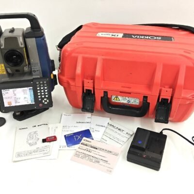
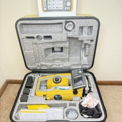
Product details
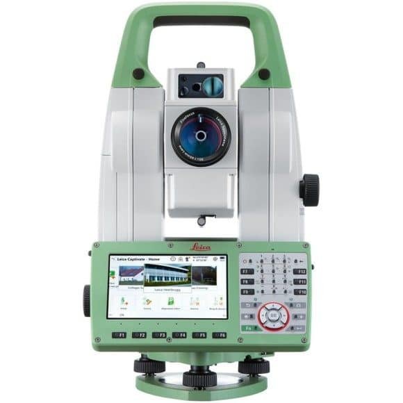
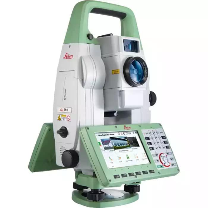
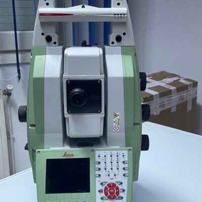
Leica TS16 Total Station
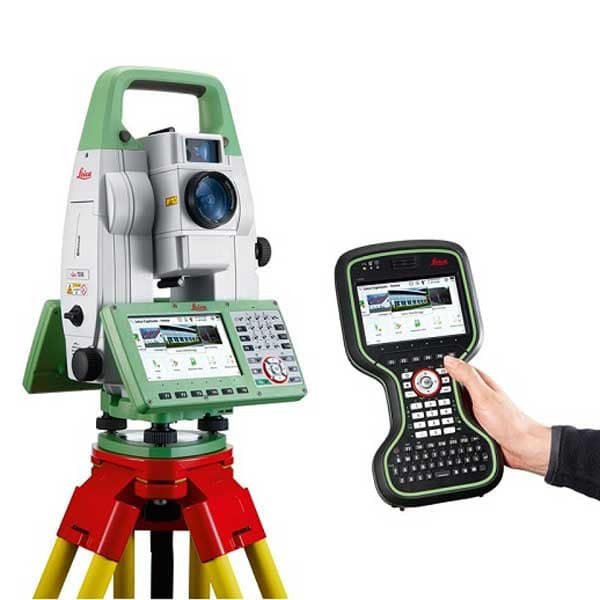
The Leica TS16 Total Station is an advanced robotic surveying instrument designed for professionals who demand maximum accuracy, intelligent automation, and highly efficient digital workflows. Built with Leica Geosystems’ industry-leading technologies, the TS16 combines self-learning robotic functionality, advanced EDM performance, ATRplus target tracking, and Leica Captivate software to deliver exceptional productivity across surveying, engineering, construction, and monitoring applications.
Engineered for demanding field conditions, the Leica TS16 enables surveyors to work faster, smarter, and more accurately while minimizing operational complexity and reducing field crew requirements.
Why Choose the Leica TS16 Total Station?
The Leica TS16 is developed to provide intelligent automation and highly reliable measurement performance for modern geospatial professionals.
Key Advantages
- Self-learning robotic total station
- ATRplus automatic target recognition
- AutoHeight functionality
- Long-range reflectorless EDM
- Leica Captivate software integration
- DynamicLock prism tracking
- GNSS smart integration
- Advanced touchscreen interface
- Superior field durability
- One-person surveying capability
The TS16 is ideal for surveyors seeking advanced automation and connected digital surveying workflows.
Leica Captivate Software
Immersive 3D Surveying and Data Visualization
The Leica TS16 operates with Leica Captivate software, providing a highly visual and intuitive field experience.
Benefits of Leica Captivate
- Real-time 3D project visualization
- Simplified stakeout workflows
- Improved field efficiency
- Enhanced project understanding
- Reduced operational errors
- Faster decision-making
Self-Learning Robotic Technology
Intelligent Automation for Faster Surveying
The Leica TS16 includes advanced self-learning robotic technology capable of automatically adapting to user behavior and field conditions.
Robotic Features
- Automatic prism search
- Intelligent target reacquisition
- Dynamic prism tracking
- One-person operation
- Remote instrument control
- Continuous tracking stability
ATRplus Automatic Target Recognition
Superior Prism Tracking Performance
The TS16 features Leica ATRplus technology for highly accurate and stable automatic target recognition.
ATRplus Benefits
- Fast prism acquisition
- Reliable target locking
- Stable tracking under difficult conditions
- Improved robotic efficiency
- Reduced manual intervention
ATRplus enables continuous operation even in environments with temporary obstructions or difficult visibility.
DynamicLock Technology
High-Speed Robotic Prism Tracking
DynamicLock technology ensures continuous prism tracking while the surveyor moves around the project site.
DynamicLock Advantages
- Fast-moving prism tracking
- Reduced measurement interruptions
- Improved stakeout speed
- Efficient one-person workflows
- Enhanced field productivity
This functionality is especially valuable for large construction and infrastructure projects.
Leica TS16 Angular Accuracy Options
Multiple Precision Configurations
The Leica TS16 is available in several angular accuracy models.
| Model | Angular Accuracy |
|---|---|
| TS16 0.5” | 0.5 Second |
| TS16 1” | 1 Second |
| TS16 2” | 2 Second |
| TS16 3” | 3 Second |
| TS16 5” | 5 Second |
These configurations support everything from standard construction surveys to ultra-high-precision engineering applications.
Advanced EDM Technology
High-Speed and Long-Range Distance Measurement
The Leica TS16 integrates advanced Electronic Distance Measurement (EDM) technology for fast and reliable field measurements.
Distance Measurement Range
| Measurement Type | Range |
|---|---|
| Reflectorless EDM | Up to 1,000 m |
| Single Prism | Up to 3,500 m |
| Circular Prism | Up to 10,000 m |
Measurement Accuracy
| Mode | Accuracy |
|---|---|
| Prism Measurement | ±(1 mm + 1.5 ppm) |
| Reflectorless Measurement | ±(2 mm + 2 ppm) |
Measurement Speed
| Mode | Time |
|---|---|
| Fine Measurement | Approximately 1 sec |
| Tracking Measurement | Continuous High-Speed Tracking |
The EDM system delivers reliable performance even on reflective or difficult surfaces.
Telescope Specifications
Premium Leica Optical System
| Feature | Specification |
|---|---|
| Magnification | 30x |
| Objective Aperture | 45 mm |
| Field of View | 1°30’ |
| Resolving Power | 3” |
| Minimum Focus Distance | 1.7 m |
| Image | Erect |
The optical system provides sharp target visibility under varying lighting and environmental conditions.
Compensator Specifications
Advanced Tilt Compensation
| Feature | Specification |
|---|---|
| Compensator Type | Quadruple Axis |
| Compensation Range | ±4’ |
| Compensation Accuracy | High Precision Electronic Compensation |
The automatic compensator improves measurement consistency and minimizes setup errors.
AutoHeight Functionality
Automated Instrument Height Measurement
Leica AutoHeight technology enables the TS16 to automatically measure and record instrument height.
Benefits of AutoHeight
- Faster setup
- Reduced manual input errors
- Improved workflow consistency
- Enhanced measurement reliability
- Better project documentation
This feature significantly simplifies repetitive field setups.
Display and User Interface
Advanced Touchscreen Operation
The TS16 includes a modern touchscreen interface optimized for professional field workflows.
User Interface Features
- Color WVGA Touchscreen
- Leica Captivate Interface
- Full Alphanumeric Keyboard
- Real-Time 3D Visualization
- Graphical Workflow Navigation
Display Specifications
| Feature | Specification |
|---|---|
| Display Type | Color Touchscreen |
| Keyboard | Full Alphanumeric |
| Display Configuration | Dual Display Available |
| Interface Software | Leica Captivate |
The intuitive interface enhances usability and minimizes training requirements.
Communication and Connectivity
Connected Surveying Workflow
The Leica TS16 supports modern wireless communication and cloud connectivity.
Connectivity Features
- Bluetooth
- WLAN / Wi-Fi
- USB Interface
- SD Card Support
- LTE Modem Compatibility
- Serial Communication
Cloud and Office Integration
- Leica Exchange
- Leica ConX
- Leica Infinity
- Cloud Synchronization
These solutions streamline collaboration between field and office teams.
Data Storage and File Management
Efficient Project Data Handling
| Feature | Specification |
|---|---|
| Internal Storage | Large Internal Memory |
| External Storage | USB / SD Card |
| Supported Formats | DXF, CSV, LandXML |
| Cloud Data Sync | Supported |
The storage system supports efficient management of complex survey datasets.
Environmental Specifications
Rugged Design for Harsh Field Conditions
| Feature | Specification |
|---|---|
| Protection Rating | IP66 |
| Dustproof | Yes |
| Waterproof | Yes |
| Operating Temperature | -20°C to +50°C |
| Humidity Resistance | High |
The TS16 is engineered for reliable operation in demanding outdoor environments.
Battery and Power System
Long Operational Runtime
| Feature | Specification |
|---|---|
| Battery Type | Li-Ion Rechargeable |
| Operating Time | Up to 8 Hours |
| Hot-Swap Support | Available |
| Charging Time | Approximately 4 Hours |
The efficient power system supports full-day robotic surveying operations.
Leica GNSS Smart Integration
Hybrid Total Station and GNSS Workflow
The Leica TS16 integrates seamlessly with Leica GNSS receivers to create highly efficient hybrid positioning workflows.
GNSS Integration Benefits
- Faster control point establishment
- Seamless coordinate management
- Improved productivity on large projects
- Flexible survey positioning
- Efficient infrastructure surveying
This integration is especially useful for large construction and engineering projects requiring mixed measurement workflows.
Applications of Leica TS16 Total Station
Construction and Building Layout
Perfect for:
- Structural layout
- Concrete formwork positioning
- Steel erection alignment
- MEP installation
- High-rise construction
Land and Topographic Surveying
Ideal for:
- Boundary surveys
- Terrain mapping
- Site development
- Utility surveys
- Elevation modeling
Infrastructure and Civil Engineering
Widely used for:
- Highway construction
- Railway alignment
- Tunnel projects
- Bridge monitoring
- Airport construction
Monitoring and Industrial Applications
Suitable for:
- Structural monitoring
- Deformation analysis
- Industrial plant alignment
- Dam monitoring
- Precision control networks
Benefits of Leica TS16 Technology
Intelligent Automation
Self-learning robotic technology improves productivity while reducing manual operation.
Faster One-Person Surveying
Robotic tracking and automatic target recognition reduce crew requirements.
Exceptional Measurement Precision
Advanced EDM and Leica optics deliver highly accurate results.
Real-Time Data Visualization
Leica Captivate provides interactive 3D field visualization for improved decision-making.
Connected Digital Workflow
Cloud synchronization simplifies project coordination and office collaboration.
Comparison Between Leica TS16 and Conventional Total Stations
| Feature | Leica TS16 | Conventional TS |
|---|---|---|
| Robotic Operation | Yes | |
| Automatic Prism Tracking | ATRplus & DynamicLock | |
| One-Person Surveying | Supported | |
| Real-Time 3D Visualization | Advanced | |
| Cloud Connectivity | Integrated | |
| GNSS Hybrid Workflow | Full Support | |
| Workflow Automation | Intelligent |
The Leica TS16 delivers substantially more advanced automation and digital workflow functionality than traditional total stations.
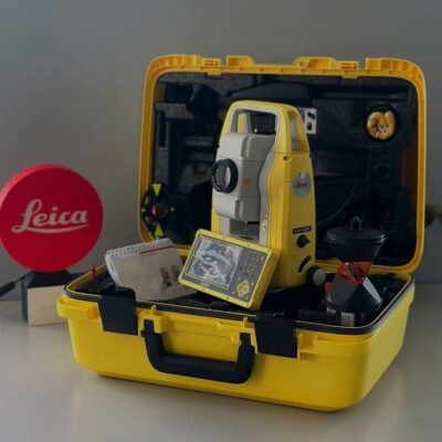
Accessories and Compatible Equipment
Supported Accessories
- Leica CS20 Field Controller
- Leica GNSS Receivers
- Active Prisms
- Survey Tripods
- Carbon Fiber Poles
- External Radios
- Carrying Cases
- Industrial Batteries
There are no reviews yet.