
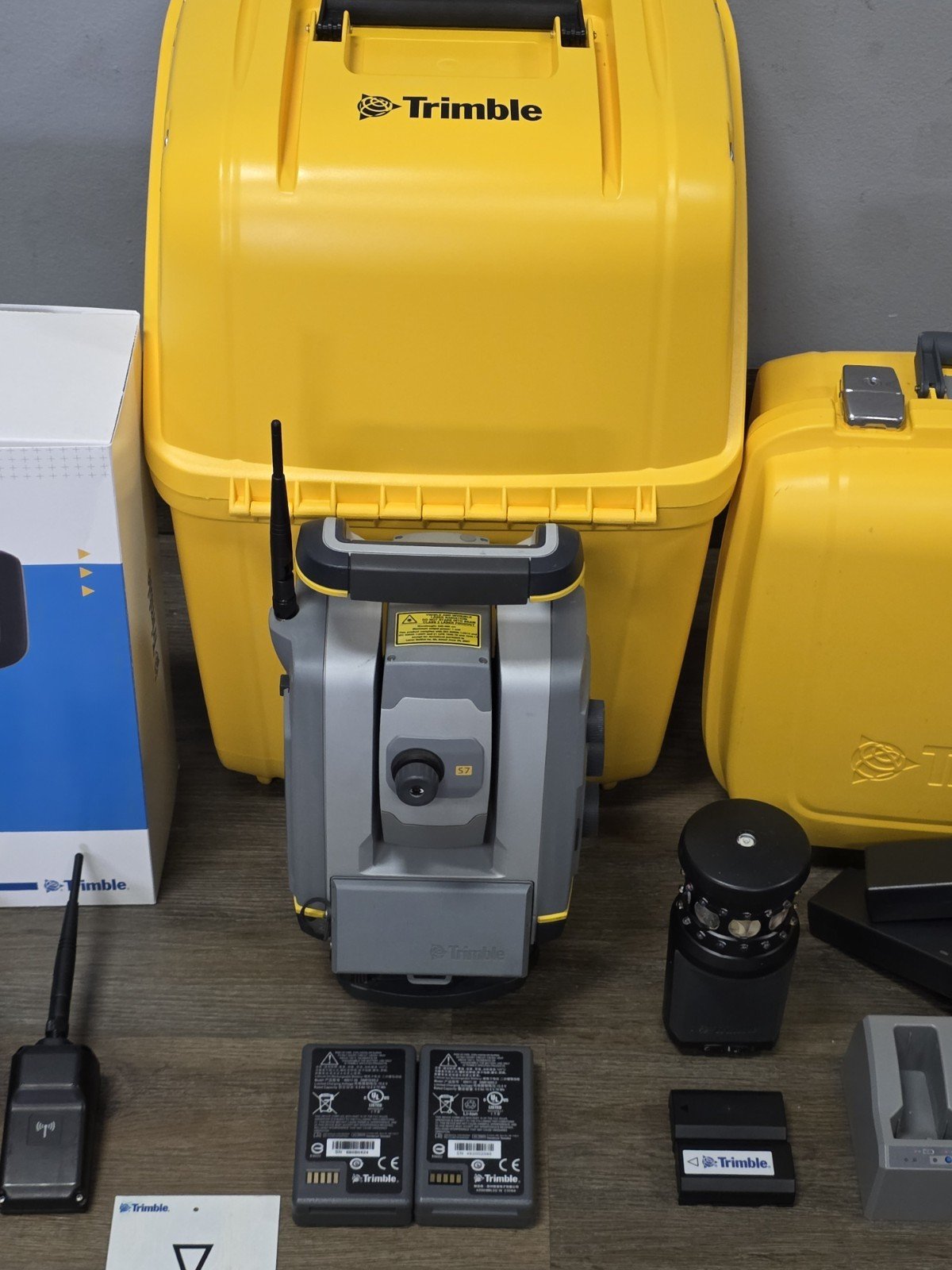
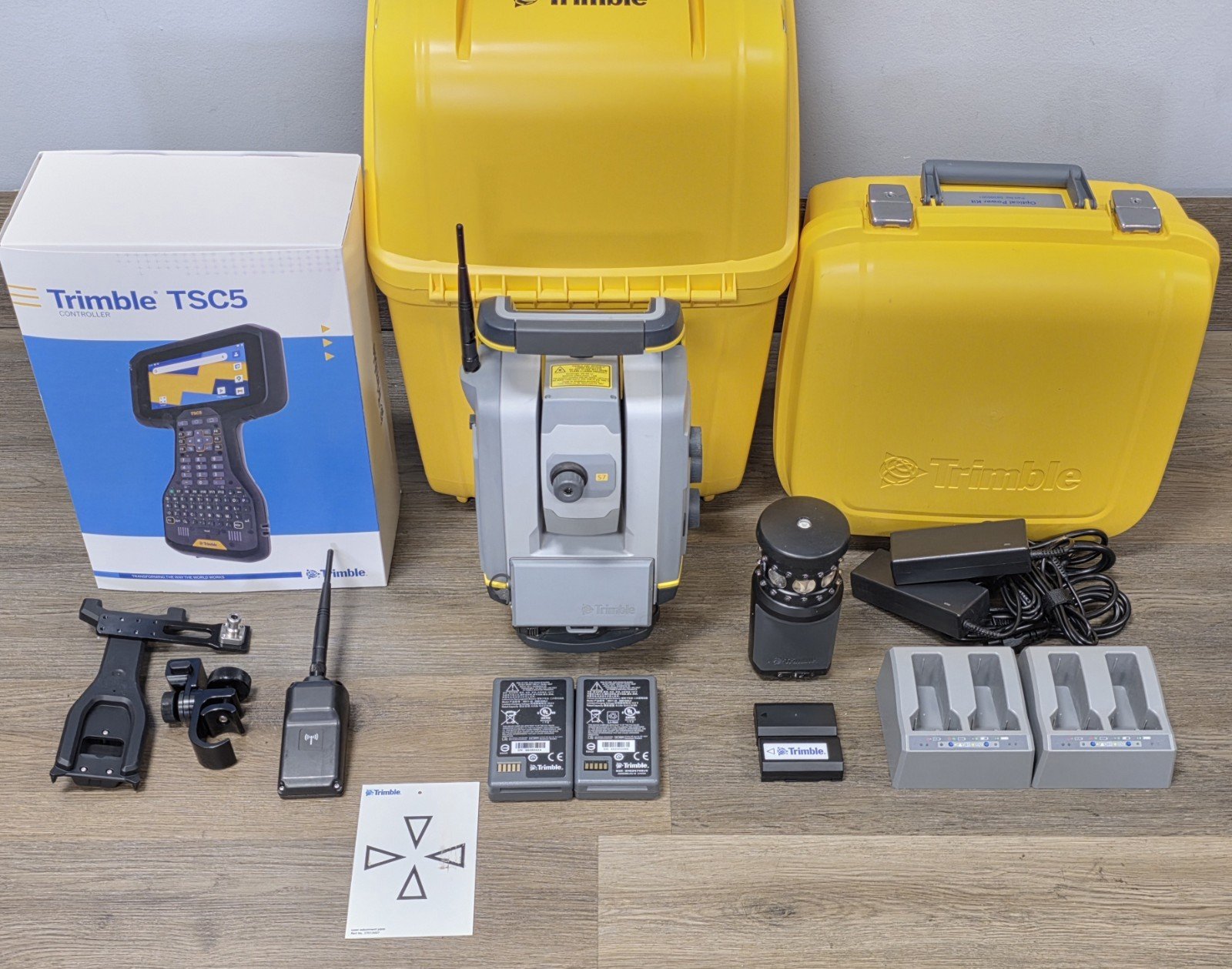
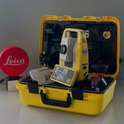
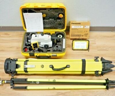
Product details
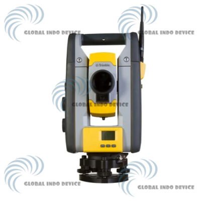
Trimble S7 Survey Total Station – High-Performance Robotic Total Station for Precision Surveying and Scanning
The Trimble S7 Survey Total Station is a professional robotic total station designed for high-accuracy surveying, engineering measurement, construction layout, 3D scanning, and geospatial data collection applications. Combining advanced robotic automation, precision EDM technology, imaging capabilities, and integrated scanning functionality, the Trimble S7 delivers exceptional productivity and reliable field performance for modern surveying professionals.
Developed for surveyors, engineers, contractors, and infrastructure specialists, the Trimble S7 integrates intelligent target tracking, high-speed robotic operation, advanced field software compatibility, and powerful data capture technologies into a versatile surveying platform suitable for complex field environments.
Key Features of Trimble S7 Survey Total Station
High-Precision Robotic Surveying
The Trimble S7 provides accurate robotic measurement capabilities for demanding engineering and construction projects.
Precision Benefits
- Reliable angular accuracy
- Stable distance measurement
- Reduced field errors
- Improved layout precision
Integrated Scanning Technology
The onboard scanning functionality enables rapid collection of dense point cloud data.
Scanning Advantages
- Fast 3D data acquisition
- Dense point cloud generation
- Enhanced site documentation
- Improved as-built workflows
Trimble SureScan Technology
SureScan technology improves scanning consistency and efficiency.
SureScan Features
- Automatic scan management
- Optimized point cloud quality
- Fast scanning workflow
- Reliable surface capture
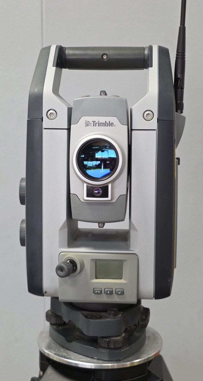
Trimble VISION Imaging System
Integrated camera technology enables remote measurement and field visualization.
Imaging Benefits
- Real-time field imagery
- Remote prism targeting
- Visual documentation
- Safer inaccessible point measurement
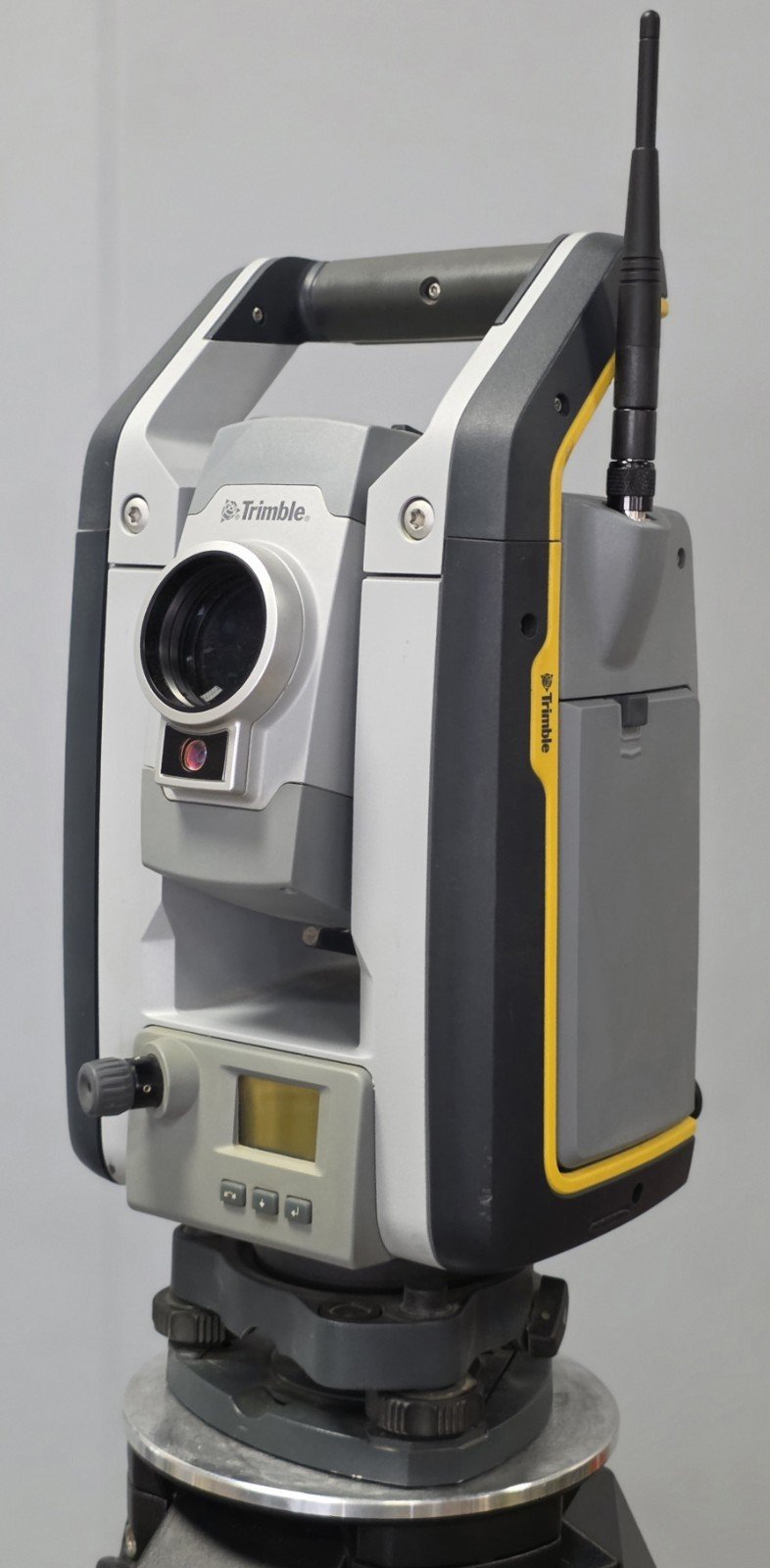
MagDrive Servo Technology
Trimble MagDrive provides silent and efficient robotic motor control.
MagDrive Advantages
- Silent operation
- Faster target locking
- Reduced mechanical wear
- High-speed robotic movement
FineLock and DR Plus EDM Technology
The system combines precision target locking and advanced reflectorless measurement.
EDM Features
- Long-range reflectorless measurement
- High-precision prism tracking
- Accurate inaccessible point capture
- Reliable field measurement
Applications of Trimble S7 Survey Total Station
Land Surveying and Mapping
Designed for professional geospatial data collection and mapping workflows.
Survey Applications
- Boundary surveys
- Topographic mapping
- Control surveys
- Geodetic measurement
Construction Layout
Provides accurate construction positioning and layout operations.
Construction Uses
- Building layout
- Structural alignment
- Anchor bolt positioning
- MEP installation
3D Scanning and Point Cloud Capture
Integrated scanning functionality supports digital construction workflows.
Scanning Applications
- As-built documentation
- Point cloud generation
- Site verification
- Digital twin creation
Civil Engineering Projects
Supports infrastructure measurement and monitoring operations.
Engineering Applications
- Road surveying
- Bridge alignment
- Tunnel positioning
- Utility infrastructure mapping
Industrial Measurement and Monitoring
Suitable for industrial precision measurement applications.
Industrial Uses
- Plant alignment
- Structural monitoring
- Machine positioning
- Deformation analysis
Trimble S7 Survey Total Station Technical Specifications
General Specifications
| Specification | Details |
|---|---|
| Product Name | Trimble S7 Survey Total Station |
| Instrument Type | Robotic Total Station with Scanning |
| Manufacturer | Trimble |
| Operation Mode | Fully Robotic |
| Intended Applications | Surveying, Scanning, Construction |
| Workflow Support | One-Person Operation |
Model Accuracy Options
| Model | Angular Accuracy |
|---|---|
| Trimble S7 1″ | 1 Arc Second |
| Trimble S7 2″ | 2 Arc Seconds |
| Trimble S7 3″ | 3 Arc Seconds |
| Trimble S7 5″ | 5 Arc Seconds |
Telescope Specifications
| Parameter | Specification |
|---|---|
| Telescope Magnification | 30x |
| Objective Aperture | 40 mm |
| Field of View | 1°30′ |
| Minimum Focus Distance | 1.5 m |
| Image | Erect |
| Resolving Power | 3″ |
Angle Measurement Specifications
| Parameter | Specification |
|---|---|
| Reading System | Absolute Encoder |
| Minimum Display | 0.1″/0.5″/1″ |
| Compensator Type | Dual-Axis Compensator |
| Compensation Range | ±5.4′ |
| Automatic Compensation | Supported |
Distance Measurement Specifications
| Parameter | Prism Mode | Reflectorless Mode |
|---|---|---|
| Maximum Range | Up to 5,500 m | Up to 800 m |
| Accuracy | ±(1 mm + 1 ppm) | ±(2 mm + 2 ppm) |
| Measurement Speed | Approx. 0.4 sec | Approx. 1 sec |
| EDM Technology | DR Plus EDM | Reflectorless EDM |
Robotic Tracking Specifications
| Parameter | Specification |
|---|---|
| Servo Technology | MagDrive |
| Automatic Target Recognition | Supported |
| FineLock Technology | Supported |
| Active Tracking | Supported |
| Robotic Rotation | Full Motorized Operation |
Scanning Specifications
| Parameter | Specification |
|---|---|
| Integrated Scanning | Supported |
| Scan Technology | SureScan |
| Point Cloud Capture | High Density |
| Scan Speed | High-Speed Data Collection |
| Surface Visualization | Real-Time |
Imaging Specifications
| Parameter | Specification |
|---|---|
| Integrated Cameras | Multiple Cameras |
| VISION Technology | Supported |
| Remote Viewing | Supported |
| Image Documentation | Supported |
| Video Assistance | Supported |
Communication and Connectivity
| Parameter | Specification |
|---|---|
| Bluetooth | Integrated |
| Wi-Fi | Supported |
| USB Connectivity | Supported |
| Serial Communication | Supported |
| Controller Compatibility | Trimble Controllers Supported |
| Cloud Connectivity | Supported |
Data Management and Software
| Parameter | Specification |
|---|---|
| Internal Storage | Large Capacity Memory |
| CAD Compatibility | Supported |
| BIM Workflow Integration | Supported |
| Point Cloud Export | Supported |
| Trimble Access Compatibility | Supported |
| Trimble Business Center Integration | Supported |
Display and User Interface
| Parameter | Specification |
|---|---|
| Display Type | Color Touchscreen |
| Interface Navigation | Graphical User Interface |
| Keyboard Type | Alphanumeric |
| Screen Illumination | Supported |
| Outdoor Visibility | Optimized |
Environmental Specifications
| Parameter | Specification |
|---|---|
| Operating Temperature | -20°C to +50°C |
| Storage Temperature | -40°C to +70°C |
| Protection Rating | IP65 |
| Dust Resistance | High Protection |
| Water Resistance | Weatherproof Construction |
Power Specifications
| Parameter | Specification |
|---|---|
| Battery Type | Rechargeable Li-Ion |
| Operating Time | Up to 6–8 Hours |
| Hot Swap Battery | Supported |
| External Power Support | Supported |
| Charging Time | Approx. 4 Hours |
Physical Specifications
| Parameter | Specification |
|---|---|
| Weight | Approx. 5.8 kg |
| Instrument Design | Compact Robotic Platform |
| Housing Material | Industrial Reinforced Housing |
| Mount Type | Standard Tribrach |
Advantages of Trimble S7 Survey Total Station
Advanced Surveying and Scanning Integration
Combines robotic surveying and 3D scanning into one professional platform.
Workflow Benefits
- Reduced equipment requirements
- Faster project completion
- Efficient point cloud capture
- Simplified field operations
Exceptional Measurement Accuracy
Designed for high-precision engineering and construction projects.
Accuracy Advantages
- Reliable robotic tracking
- Stable EDM performance
- High-precision angle measurement
- Consistent data quality
Intelligent Field Operation
The advanced robotic and imaging systems improve operational efficiency.
Operational Features
- Remote targeting
- Automated workflows
- Visual field guidance
- Improved user productivity
Rugged and Reliable Construction
Built for demanding field environments and long-term durability.
Durability Features
- Weather-resistant design
- Industrial-grade housing
- Dustproof protection
- Harsh-environment reliability
Industries That Use Trimble S7 Survey Total Station
Construction Industry
- Building layout
- Structural positioning
- Digital construction workflows
Surveying Industry
- Topographic mapping
- Geospatial surveys
- Control point establishment
Civil Engineering
- Infrastructure surveying
- Tunnel and bridge alignment
- Utility mapping
Industrial Sector
- Plant alignment
- Structural monitoring
- Industrial scanning
There are no reviews yet.