
Product details
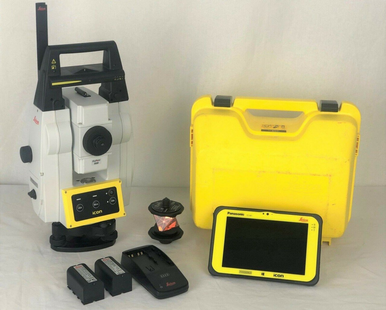
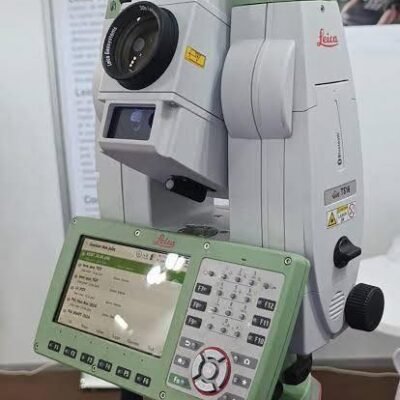
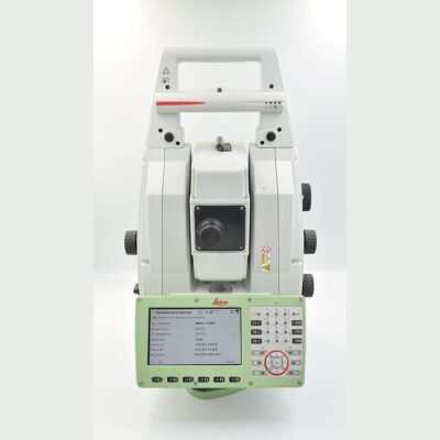
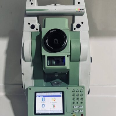
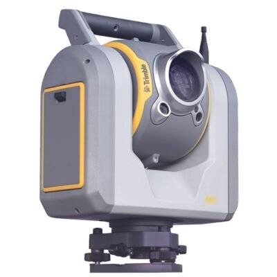
Leica iCR70 R500 Smart Robotic Total Station
Advanced Robotic Total Station for Construction Layout and Surveying
The Leica iCR70 R500 Smart Robotic Total Station is a high-performance robotic total station engineered for modern construction layout, surveying, and machine guidance applications. Designed with intelligent automation, reflectorless measurement technology, and advanced robotic functionality, this smart total station enhances productivity, accuracy, and efficiency on demanding job sites.
Built for construction professionals, surveyors, civil engineers, and infrastructure contractors, the Leica iCR70 R500 delivers reliable measurement performance with intuitive field workflows and seamless integration into digital construction environments.
Why Choose Leica iCR70 R500 Smart Robotic Total Station
Intelligent Robotic Survey Technology
The Leica iCR70 R500 combines robotic automation with precision angle and distance measurement technology to improve field productivity and reduce manual operation.
Key Advantages
- Fully robotic operation
- Reflectorless measurement capability
- High-precision angle accuracy
- Smart target tracking
- Fast prism locking
- Long-range measurement performance
- Construction-focused workflows
- Integrated wireless communication
- Rugged field-ready design
- Seamless software integration
Leica iCR70 R500 Applications
Construction Layout
The system is ideal for:
- Building layout
- Structural positioning
- Foundation marking
- Anchor bolt placement
- Concrete formwork alignment
- Interior layout
- MEP installation positioning
- Site verification
Surveying and Engineering
Surveyors and engineers can use the Leica iCR70 R500 for:
- Topographic surveys
- Control point establishment
- As-built documentation
- Boundary surveys
- Infrastructure measurements
- Elevation checks
- Deformation monitoring
- Geospatial mapping
Infrastructure Projects
Suitable for:
- Road construction
- Bridge construction
- Railway alignment
- Tunnel projects
- Airport infrastructure
- Utility installation
- Industrial plant construction
Leica iCR70 R500 Main Features
Fully Robotic Operation
The Leica iCR70 R500 allows a single operator to perform layout and surveying tasks efficiently using robotic automation technology.
Robotic Benefits
- Increased productivity
- Reduced manpower requirements
- Faster point measurements
- Improved workflow efficiency
- Enhanced site safety
R500 Reflectorless EDM Technology
The integrated R500 Electronic Distance Measurement (EDM) technology enables accurate reflectorless measurements.
Reflectorless Measurement Benefits
- Measurements without prism
- Faster inaccessible point capture
- Improved safety in hazardous areas
- Efficient façade measurements
- Simplified site documentation
Smart Target Tracking
Advanced target tracking technology enables stable prism lock and reliable target acquisition.
Tracking Features
- Automatic prism tracking
- Fast target recognition
- Continuous target lock
- Stable measurement performance
High-Precision Angle Measurement
The instrument provides precise horizontal and vertical angle measurements for demanding engineering applications.
Angle Accuracy Benefits
- Accurate construction layout
- Reliable survey control
- Consistent positioning performance
- Reduced rework
Wireless Connectivity
The Leica iCR70 R500 supports multiple communication technologies for flexible field operation.
Connectivity Options
- Bluetooth
- Wi-Fi
- USB communication
- Radio communication support
- Data transfer compatibility
Rugged Construction Design
Built for harsh construction environments, the instrument delivers dependable field performance.
Durability Features
- Dustproof housing
- Waterproof protection
- Shock-resistant construction
- Industrial-grade materials
- Weather-resistant design
Leica iCR70 R500 Technical Specifications
General Specifications
Instrument Type
- Smart robotic total station
- Reflectorless surveying instrument
- Construction layout system
Intended Applications
- Construction layout
- Engineering surveys
- Topographic mapping
- Infrastructure positioning
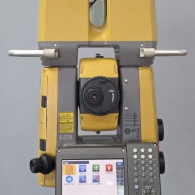
Telescope Specifications
Telescope Design
Magnification
- Approximately 30x magnification
Image
- Erect image
Objective Aperture
- High-quality optical system
Focusing Range
- Short minimum focusing distance for confined spaces
Distance Measurement Specifications
Prism Measurement Range
Standard Prism Range
- Long-range prism measurement capability
Reflectorless Range
- Up to approximately 500 meters reflectorless measurement
Distance Accuracy
Prism Accuracy
- High-precision millimeter-level measurement accuracy
Reflectorless Accuracy
- Reliable non-prism measurement performance
Angle Measurement Specifications
Angle Accuracy
Horizontal Accuracy
- Available in multiple accuracy classes
Vertical Accuracy
- High-precision angular measurement
Angle Reading System
Technology
- Absolute encoder technology
Measurement Method
- Digital electronic angle reading
Robotic System Specifications
Automatic Target Recognition
Tracking Capability
- Intelligent prism tracking system
Search Function
- Automatic prism search functionality
Locking Speed
- Fast prism acquisition and locking
EDM Specifications
Measurement Technology
EDM Type
- Coaxial laser EDM system
Laser Class
- Safe construction-grade laser technology
Measurement Time
- Fast distance acquisition
Compensator Specifications
Tilt Compensation
Compensator Type
- Dual-axis compensator
Compensation Range
- Automatic leveling correction
Environmental Specifications
Operating Conditions
Operating Temperature
- Approximately -20°C to +50°C
Storage Temperature
- Suitable for field transportation and storage
Humidity Resistance
- High operational humidity tolerance
Protection Rating
Environmental Protection
- IP-rated dust and water resistance
Shock Resistance
- Rugged construction-grade protection
Power Specifications
Battery System
Battery Type
- Rechargeable lithium-ion battery
Charging Options
- Fast charging capability
Display and User Interface
Interface Features
Touchscreen Display
- High-visibility color display
User Controls
- Intuitive field operation controls
Software Interface
- Construction-focused workflows
Leica iCR70 R500 Workflow Benefits
Faster Construction Layout
The robotic system improves productivity by allowing single-operator layout workflows.
Reduced Human Error
Automated target tracking and digital measurements help reduce positioning mistakes and improve consistency.
Improved Field Efficiency
Fast setup and smart workflows reduce project downtime and increase daily productivity.
Enhanced Site Safety
Reflectorless measurements and robotic operation minimize exposure to hazardous construction environments.
Leica iCR70 R500 Industries
Construction Industry
- Commercial construction
- Residential development
- Industrial construction
- Infrastructure projects
Civil Engineering
- Road construction
- Bridge engineering
- Utility installation
- Drainage systems
Surveying and Geospatial
- Land surveying
- GIS mapping
- Topographic surveys
- As-built verification
Industrial Engineering
- Plant alignment
- Structural monitoring
- Industrial installation
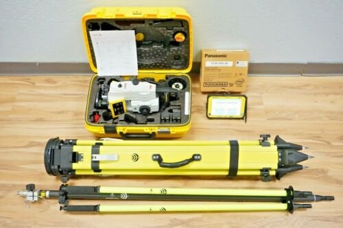
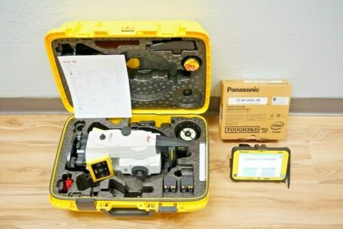
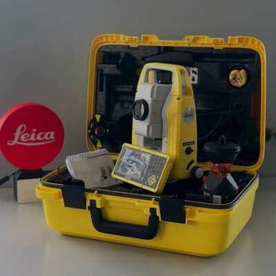
Leica iCR70 R500 Package Contents
Package Includes
- Leica iCR70 R500 robotic total station
- Rechargeable batteries
- Battery charger
- Carrying case
- USB communication cable
- Calibration tools
- User documentation
Optional Accessories
Available Accessories
- Survey prisms
- Robotic poles
- Field controllers
- Tripods
- Data collectors
- External radios
- Mounting brackets
There are no reviews yet.