
Product details
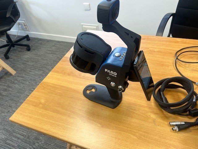
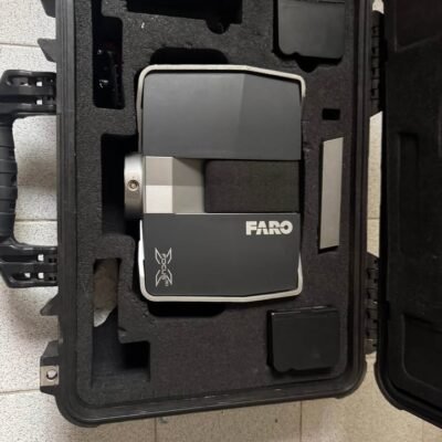
FARO Orbis Mobile – Advanced Mobile Scanning Solution
The FARO Technologies Orbis Mobile is a next-generation mobile scanning system designed to capture accurate spatial data in dynamic environments. Combining advanced SLAM (Simultaneous Localization and Mapping) technology with high-speed laser scanning, Orbis Mobile enables professionals to document spaces quickly and efficiently without compromising precision.
This system is ideal for industries such as construction, architecture, engineering, and facility management where fast and reliable data capture is essential.
Key Features of FARO Orbis Mobile
SLAM-Based Mobile Mapping
Orbis Mobile uses cutting-edge SLAM algorithms to map environments in real time. This allows users to scan complex spaces without relying on GPS or fixed reference points.
High-Speed Data Capture
The system captures millions of data points per second, enabling rapid scanning of large indoor and outdoor environments.
Lightweight and Portable Design
Designed for mobility, Orbis Mobile is compact and easy to carry, making it suitable for fieldwork and confined spaces.
Seamless Integration
The scanner integrates with FARO software platforms, ensuring smooth data processing, visualization, and export for further analysis.
Benefits of Using Orbis Mobile
Faster Project Completion
Mobile scanning significantly reduces the time required for site documentation compared to traditional methods.
Improved Accuracy
Advanced sensor fusion and SLAM technology provide reliable and consistent measurement results.
Reduced Operational Costs
By minimizing manual measurements and repeat visits, Orbis Mobile helps reduce labor and project costs.
Enhanced Workflow Efficiency
Real-time data capture and processing streamline workflows across multiple industries.
Applications of FARO Orbis Mobile
Construction and BIM
Capture accurate site conditions for Building Information Modeling (BIM), ensuring better planning and coordination.
Architecture and Engineering
Quickly document structures and environments for design, renovation, and analysis.
Facility Management
Maintain up-to-date digital records of buildings and infrastructure for maintenance and operations.
Public Safety and Forensics
Assist in scene documentation with precise spatial data for investigation and analysis.
How FARO Orbis Mobile Works
Orbis Mobile utilizes LiDAR sensors combined with SLAM technology to continuously map the environment as the user moves. The system processes spatial data in real time, generating detailed 3D point clouds that can be analyzed and shared.
This approach eliminates the need for stationary setups, allowing for faster and more flexible data collection.
Technical Highlights
Scanning Technology
LiDAR-based mobile scanning
Real-time SLAM processing
High-density point cloud generation
Data Output
3D point clouds
Compatible with industry-standard formats
Integration with FARO software ecosystem
Usability
Intuitive user interface
Quick setup and operation
Suitable for both beginners and professionals
Why Choose FARO Orbis Mobile
Mobility and Flexibility
Unlike traditional static scanners, Orbis Mobile allows continuous scanning while moving through environments.
Reliable Performance
Built with proven FARO technology, it ensures consistent results in challenging conditions.
Scalable Solution
Suitable for projects of all sizes, from small indoor scans to large infrastructure mapping.
Ideal Users
Surveyors
Engineers
Architects
Construction professionals
Facility managers
SPECIFICATIONS;
Performance;
Range : 120m
Points Per Second : 640,000
Field of View : 360° x 290°
No. of LIDAR channels : 32
Camera : Full 360° image of 8M pixels captured every second
Mobile Scanning;
Precision : 5mm
Trajectory & Mapping : Robust SLAM powered by GeoSLAM technology
Settings : Automatic Standard and Preset Processing Environments
Stationary Flash Scanning;
Precision : 2mm
Duration : 15 sec. including color
Resolution : 19M points (13mm @ 10m)
Registration : Real Time and Fully Automatic with GeoSLAM technology
General Specifications;
Environment : Indoor and Outdoor
Laser Class : Class 1, Eye Safe
Weight : Scanner: 2.10kg, Datalogger: 0.95kg, Battery: 0.55kg
Transport Case Dimensions : 500mm x 625mm x 250mm
Operating Temperature : 0° to +40°C
Manufacturer Warranty : 1 Year
Data/Processing;
Data : Point clouds with Intensity and Color, 360° Images, Trajectory
Raw Mobile Data Size : 350MB/min uncompressed
Flash Scan Data Size : 125MB
Desktop Processing : FARO Connect for Mobile and Flash Scans, FARO Scene for Advanced Registration
Cloud Processing : Fully automated with FARO Sphere XG
Output : Mobile scan: E57, LAS, LAZ, PLY, TXT –
Flash scan: E57
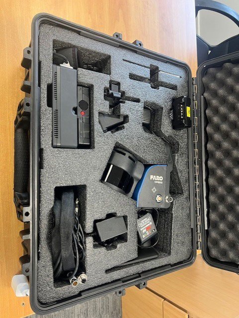
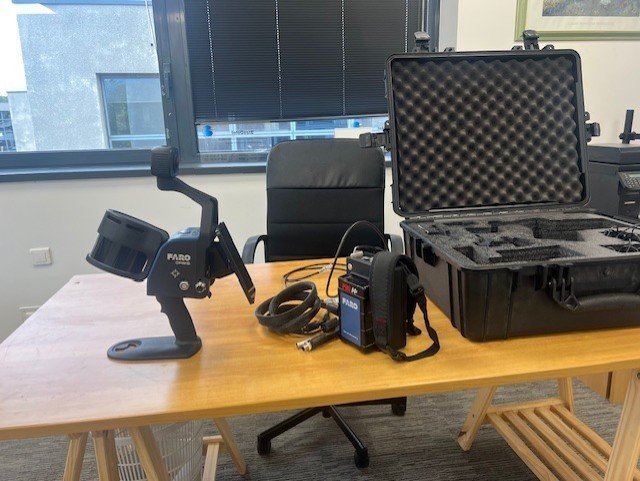
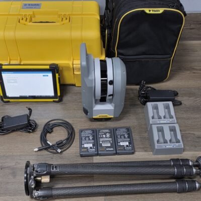
Package Includes:
– (1) FARO Orbis Mobile Scanner (Replacement handle P/NACCS-MNT-0031)
– (1) Datalogger
– (1) Datalogger Battery (P/N:ACCS-PWR-0030)
– (1) Battery Charging Kit(P/NACCS-PWR-0031)
– (1) Phone Mount (P/NACCS-MNT-0032)
– (1) FARO Orbis-Cable (P/NACCS-PWR-0032)
– (1) Quadlock
– (1) Datalogger Shoulder Strap
– (1) USB Flash Drive
– (1) Monopod and Datalogger adapter (P/NACCS-TRPD-0030)
– (1) Mobile Scanner adapter for the monopod (P/NACCS-MNT-0030)
– (1) Transportation case (P/NACCS-CASE-0030)
There are no reviews yet.