
Product details
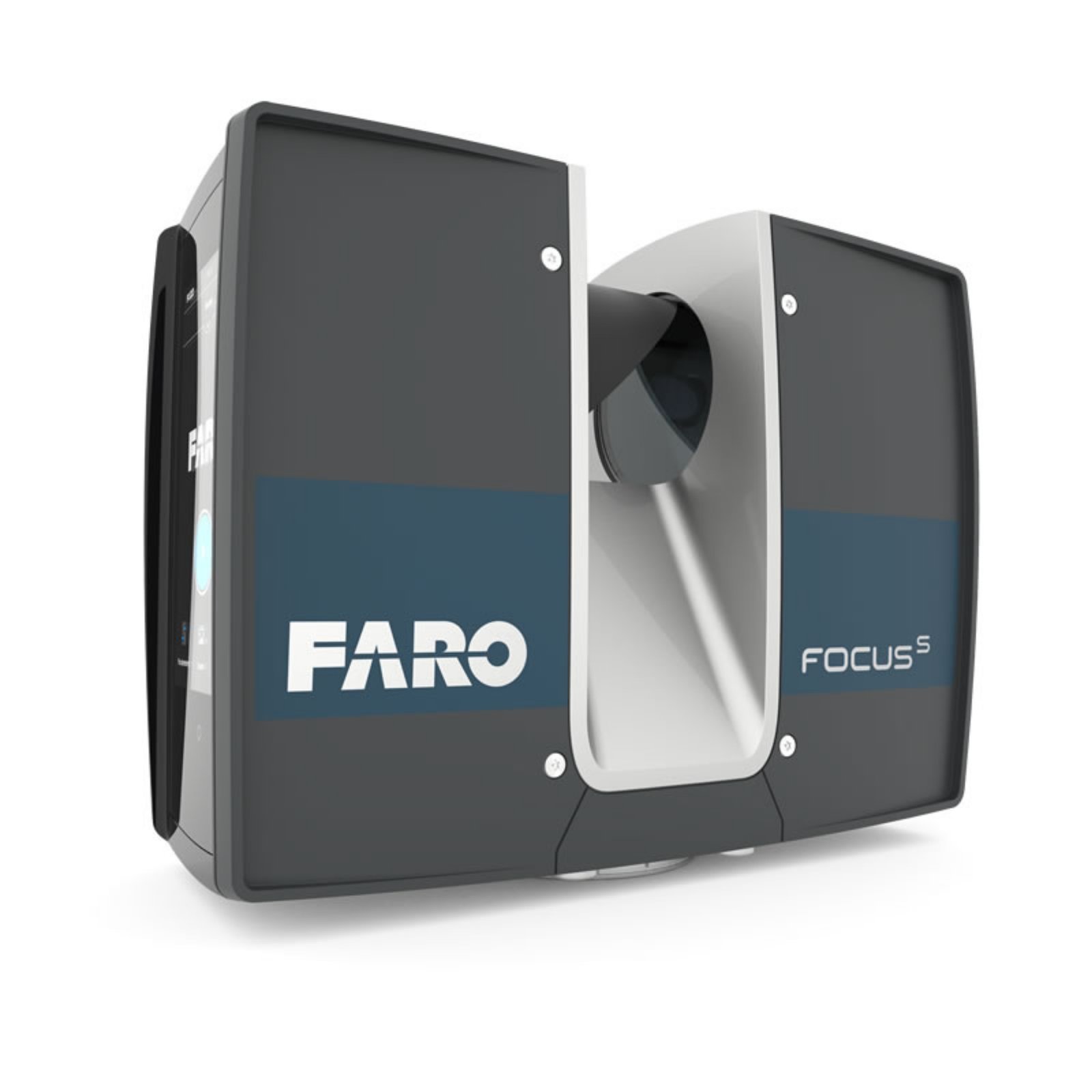
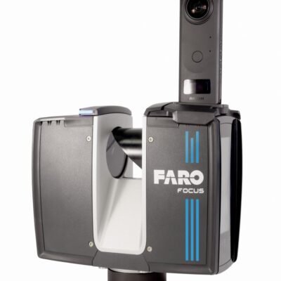
FARO Focus S350 Survey Scanner – Long-Range High-Precision 3D Laser Scanning Solution
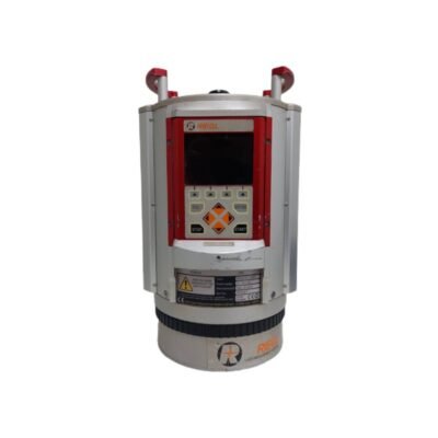
The FARO Focus S350 Survey Scanner is a professional long-range terrestrial laser scanner developed for high-accuracy 3D reality capture, infrastructure documentation, industrial measurement, BIM workflows, forensic investigation, and geospatial surveying applications. Designed with advanced laser scanning technology, superior range performance, and ultra-fast point cloud acquisition, the Focus S350 delivers exceptional scanning precision for demanding indoor and outdoor projects.
Manufactured by FARO Technologies, the Focus S350 combines long-distance scanning capability, HDR imaging, integrated positioning sensors, lightweight portability, and intelligent data processing into a compact scanning platform optimized for modern engineering and digital construction workflows.
Key Features of FARO Focus S350 Survey Scanner
Long-Range Laser Scanning Technology
The Focus S350 provides extended-range scanning capability for large-scale projects and infrastructure environments.
Long-Range Advantages
- Large-area reality capture
- Reduced scanner setups
- Improved field efficiency
- Faster project completion
High-Precision Point Cloud Capture
The advanced scanning engine generates highly detailed and accurate 3D point cloud data.
Accuracy Benefits
- Precise surface measurement
- Reliable 3D modeling
- Detailed structural documentation
- Accurate engineering analysis
Ultra-Fast Scanning Performance
The high-speed laser system enables rapid acquisition of dense point clouds.
Speed Features
- Millions of points captured per second
- Efficient site documentation
- Reduced field time
- Improved productivity
Integrated HDR Imaging System
The onboard HDR camera captures realistic color information and textures.
Imaging Benefits
- High-quality image capture
- Realistic scan visualization
- Enhanced digital documentation
- Improved project presentation
Onsite Registration Support
The scanner supports efficient field registration workflows for improved project management.
Workflow Advantages
- Real-time scan verification
- Reduced revisit requirements
- Faster data validation
- Improved field coordination
Rugged Outdoor Durability
Designed for reliable operation in harsh industrial and outdoor conditions.
Durability Features
- Weather-resistant construction
- Dustproof housing
- Industrial-grade protection
- Reliable environmental performance
Applications of FARO Focus S350 Survey Scanner
Architecture and Building Documentation
Captures accurate 3D building data for architectural workflows.
Architectural Applications
- Building documentation
- Heritage preservation
- Renovation planning
- Interior modeling
BIM and Digital Construction
Supports advanced BIM and digital twin workflows.
BIM Applications
- As-built BIM modeling
- Construction verification
- Clash detection
- Digital twin creation
Industrial Plant and Factory Scanning
Ideal for industrial facility measurement and modernization projects.
Industrial Uses
- Plant documentation
- Piping measurement
- Equipment positioning
- Facility modernization
Infrastructure and Civil Engineering
Provides accurate infrastructure measurement and structural analysis.
Engineering Applications
- Bridge scanning
- Tunnel documentation
- Highway mapping
- Structural monitoring
Public Safety and Forensics
Supports precise forensic and incident documentation.
Forensic Applications
- Crime scene capture
- Accident reconstruction
- Evidence preservation
- Emergency response documentation
FARO Focus S350 Survey Scanner Technical Specifications
General Specifications
| Specification | Details |
|---|---|
| Product Name | FARO Focus S350 Survey Scanner |
| Instrument Type | Terrestrial Laser Scanner |
| Manufacturer | FARO Technologies |
| Scanning Technology | Phase Shift Laser Scanning |
| Intended Applications | BIM, Surveying, Industrial Scanning |
| Data Output | High-Density 3D Point Cloud |
Scanning Specifications
| Parameter | Specification |
|---|---|
| Maximum Scanning Range | Up to 350 m |
| Minimum Range | 0.6 m |
| Measurement Speed | Up to 976,000 points/sec |
| Distance Accuracy | ±1 mm |
| Vertical Field of View | 300° |
| Horizontal Field of View | 360° |
Laser Specifications
| Parameter | Specification |
|---|---|
| Laser Class | Class 1 |
| Laser Wavelength | Near Infrared |
| Measurement Principle | Phase Shift |
| Reflectorless Measurement | Supported |
| Eye Safety Certification | IEC Certified |
Point Cloud Specifications
| Parameter | Specification |
|---|---|
| Point Density | Adjustable |
| Scan Resolution | Multiple Configurable Levels |
| Scan Quality Settings | Supported |
| Real-Time Point Visualization | Supported |
| Point Cloud Colorization | Supported |
Imaging Specifications
| Parameter | Specification |
|---|---|
| Integrated Camera | HDR Camera System |
| Image Capture | High Resolution |
| HDR Support | Supported |
| Texture Mapping | Supported |
| Colorized Point Clouds | Supported |
Positioning and Sensor Specifications
| Parameter | Specification |
|---|---|
| Integrated GPS | Supported |
| Electronic Compass | Supported |
| Altimeter | Supported |
| Tilt Sensor | Supported |
| Dual-Axis Compensator | Supported |
Connectivity and Data Management
| Parameter | Specification |
|---|---|
| Wi-Fi Connectivity | Supported |
| SD Card Storage | Supported |
| USB Interface | Supported |
| Ethernet Connectivity | Supported |
| Remote Scanner Operation | Supported |
Software Compatibility
| Parameter | Specification |
|---|---|
| FARO SCENE Compatibility | Supported |
| Autodesk ReCap Compatibility | Supported |
| BIM Software Integration | Supported |
| CAD Software Compatibility | Supported |
| Point Cloud Export Formats | Industry Standard Formats |
Environmental Specifications
| Parameter | Specification |
|---|---|
| Operating Temperature | -20°C to +55°C |
| Storage Temperature | -40°C to +70°C |
| Protection Rating | IP54 |
| Dust Resistance | Supported |
| Humidity Resistance | Supported |
Power Specifications
| Parameter | Specification |
|---|---|
| Battery Type | Rechargeable Li-Ion |
| Operating Time | Up to 4.5 Hours |
| Hot Swap Battery | Supported |
| External Power Supply | Supported |
| Charging Time | Approx. 3 Hours |
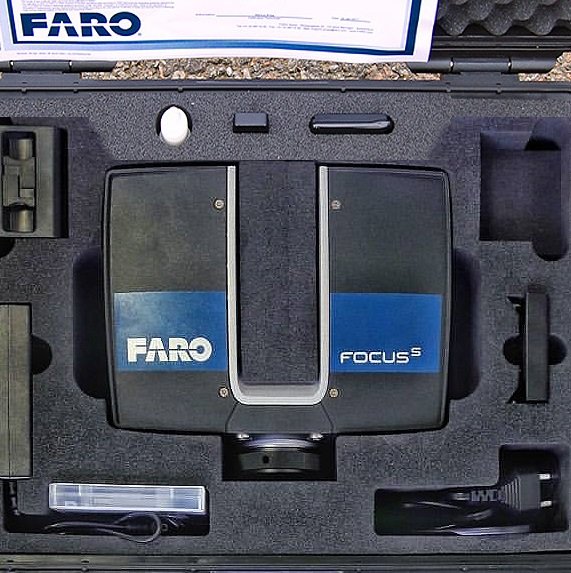
Physical Specifications
| Parameter | Specification |
|---|---|
| Weight | Approx. 4.2 kg |
| Scanner Design | Compact Portable Design |
| Housing Material | Industrial Reinforced Housing |
| Mounting System | Standard Tripod Mount |
Advantages of FARO Focus S350 Survey Scanner
Exceptional Long-Range Performance
The extended scanning range improves efficiency for large infrastructure and industrial projects.
Productivity Benefits
- Fewer scanner setups
- Faster site coverage
- Reduced field labor
- Improved operational efficiency
Highly Accurate 3D Reality Capture
Designed for demanding engineering and geospatial applications.
Accuracy Advantages
- Dense point cloud generation
- Reliable structural measurement
- Precise surface modeling
- High-quality documentation
Portable and Lightweight Operation
The compact design simplifies transportation and field deployment.
Mobility Benefits
- Easy transport
- Fast setup
- Flexible scanning operation
- Improved field productivity
Advanced BIM and CAD Workflow Integration
Supports seamless integration with modern engineering and construction platforms.
Workflow Features
- BIM-ready point clouds
- CAD integration
- Digital twin support
- As-built modeling workflows
Industries That Use FARO Focus S350 Survey Scanner
Architecture and Construction
- Building documentation
- BIM modeling
- Renovation planning
Industrial Engineering
- Plant scanning
- Factory modernization
- Equipment measurement
Infrastructure and Civil Engineering
- Bridge inspection
- Tunnel scanning
- Transportation infrastructure
Public Safety and Forensics
- Incident reconstruction
- Crime scene documentation
- Emergency response analysis
There are no reviews yet.