
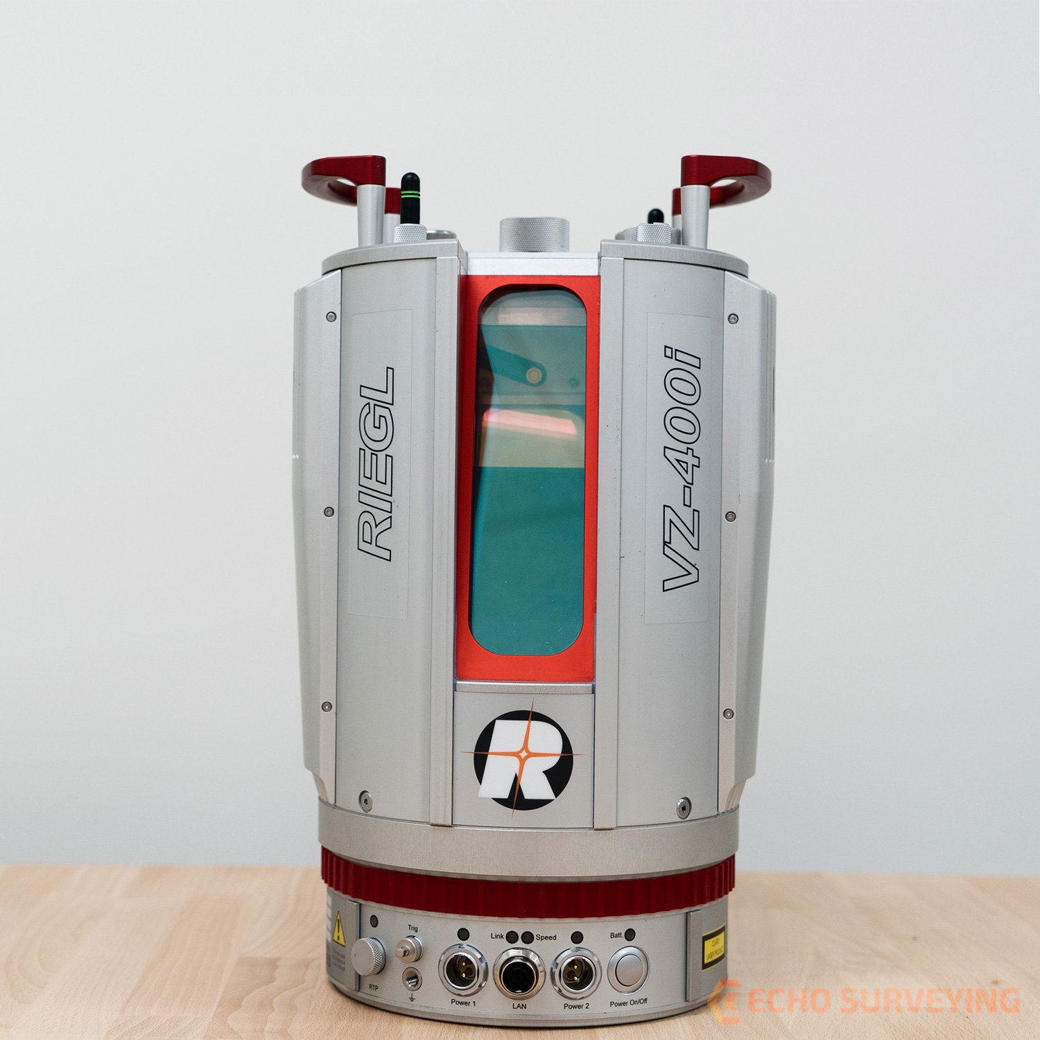
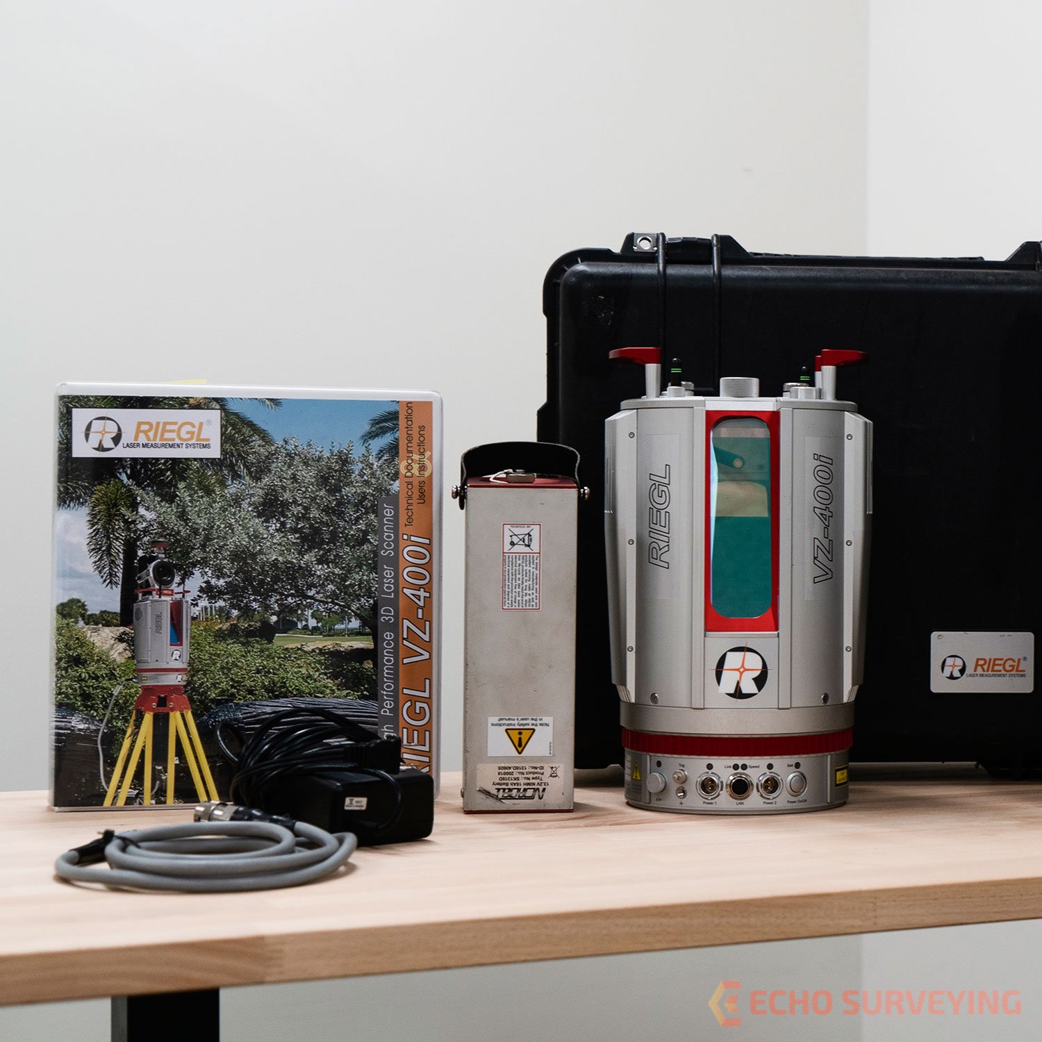
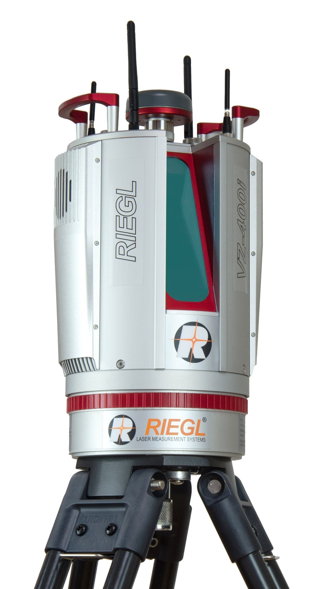
Product details
RIEGL VZ-400i Survey Scanner – High-Speed Professional 3D Laser Scanning System for Geospatial and Industrial Applications
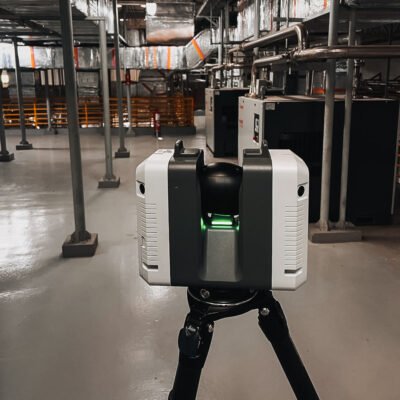
The RIEGL VZ-400i Survey Scanner is an advanced terrestrial laser scanning system engineered for high-precision 3D reality capture, topographic surveying, industrial measurement, infrastructure inspection, mining applications, forestry analysis, and BIM documentation. Combining high-speed pulse laser technology, intelligent waveform processing, integrated imaging systems, and automated workflow functionality, the VZ-400i delivers exceptional performance for demanding geospatial and engineering projects.
Developed by RIEGL, the VZ-400i is designed to provide accurate long-range point cloud acquisition with superior scanning speed, real-time registration capability, and advanced connectivity features. Its rugged construction and professional-grade performance make it ideal for both outdoor surveying and industrial environments.
Key Features of RIEGL VZ-400i Survey Scanner
High-Speed Laser Scanning Technology
The VZ-400i provides ultra-fast point cloud acquisition for efficient large-area scanning.
Speed Advantages
- Rapid data collection
- Reduced field operation time
- Efficient large-scale scanning
- Improved project productivity
Long-Range High-Precision Measurement
The scanner delivers accurate long-distance scanning performance for demanding geospatial projects.
Measurement Benefits
- Accurate long-range capture
- Reliable surface modeling
- High-density point clouds
- Precise engineering documentation
Waveform-LiDAR Processing Technology
Advanced waveform processing improves measurement reliability and target detection.
Waveform Processing Features
- Enhanced target recognition
- Improved vegetation penetration
- Accurate multi-target detection
- Reliable complex surface capture
Integrated Camera and Imaging System
The onboard camera system enhances visual documentation and scan colorization.
Imaging Benefits
- Realistic scan visualization
- High-resolution image capture
- Improved project documentation
- Colorized point clouds
Real-Time Registration and Data Visualization
Supports efficient field verification and project quality control.
Workflow Features
- Real-time scan alignment
- Immediate data validation
- Reduced resurvey requirements
- Improved field coordination
Rugged Industrial Durability
Designed for harsh outdoor and industrial environments.
Durability Features
- Weather-resistant housing
- Dustproof protection
- Shock-resistant construction
- Reliable extreme-environment operation
Applications of RIEGL VZ-400i Survey Scanner
Topographic and Geospatial Surveying
Provides accurate terrain and infrastructure measurement for surveying professionals.
Surveying Applications
- Topographic mapping
- Corridor mapping
- Control surveys
- Terrain modeling
Mining and Quarry Measurement
Supports efficient mine surveying and stockpile analysis.
Mining Applications
- Open-pit mining surveys
- Quarry documentation
- Volume calculation
- Slope stability analysis
Forestry and Environmental Monitoring
Ideal for vegetation analysis and environmental data collection.
Forestry Uses
- Forest inventory
- Vegetation analysis
- Environmental monitoring
- Biomass measurement
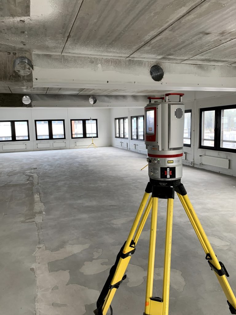
Infrastructure and Civil Engineering
Captures detailed infrastructure data for engineering analysis.
Engineering Applications
- Bridge inspection
- Tunnel documentation
- Highway scanning
- Structural assessment
Industrial Plant and BIM Documentation
Supports digital construction and industrial facility modeling.
BIM Applications
- As-built documentation
- Industrial plant scanning
- BIM modeling
- Facility modernization
RIEGL VZ-400i Survey Scanner Technical Specifications
General Specifications
| Specification | Details |
|---|---|
| Product Name | RIEGL VZ-400i Survey Scanner |
| Instrument Type | Terrestrial Laser Scanner |
| Manufacturer | RIEGL |
| Scanning Technology | Waveform-LiDAR |
| Intended Applications | Surveying, Mining, BIM, Infrastructure |
| Data Output | High-Density 3D Point Clouds |
Scanning Specifications
| Parameter | Specification |
|---|---|
| Maximum Measurement Range | Up to 800 m |
| Minimum Measurement Range | Approx. 1.5 m |
| Measurement Rate | Up to 500,000 points/sec |
| Range Accuracy | Up to 5 mm |
| Field of View (Vertical) | 100° |
| Field of View (Horizontal) | 360° |
Laser Specifications
| Parameter | Specification |
|---|---|
| Laser Class | Class 1 |
| Laser Wavelength | Near Infrared |
| Measurement Principle | Time-of-Flight |
| Waveform Processing | Supported |
| Multi-Target Capability | Supported |
Point Cloud Specifications
| Parameter | Specification |
|---|---|
| Point Density | Configurable |
| Scan Resolution | Adjustable |
| Real-Time Visualization | Supported |
| Point Cloud Colorization | Supported |
| Automatic Registration | Supported |
Imaging Specifications
| Parameter | Specification |
|---|---|
| Integrated Camera | High-Resolution Camera |
| Image Capture | Supported |
| HDR Imaging | Supported |
| Colorized Scans | Supported |
| Visual Documentation | Supported |
Positioning and Sensor Specifications
| Parameter | Specification |
|---|---|
| GNSS Support | Integrated |
| IMU Integration | Supported |
| Electronic Compass | Supported |
| Tilt Compensation | Supported |
| Positioning Sensors | Advanced Integrated Sensors |
Connectivity and Communication
| Parameter | Specification |
|---|---|
| Wi-Fi Connectivity | Supported |
| LAN Connectivity | Supported |
| USB Interface | Supported |
| Remote Operation | Supported |
| Wireless Data Transfer | Supported |
Software Compatibility
| Parameter | Specification |
|---|---|
| RiSCAN PRO Compatibility | Supported |
| CAD Software Integration | Supported |
| BIM Workflow Compatibility | Supported |
| Autodesk ReCap Support | Supported |
| Point Cloud Export Formats | Industry Standard Formats |
Environmental Specifications
| Parameter | Specification |
|---|---|
| Operating Temperature | -10°C to +50°C |
| Storage Temperature | -20°C to +60°C |
| Protection Rating | IP64 |
| Dust Protection | Supported |
| Water Resistance | Weather Resistant |
Power Specifications
| Parameter | Specification |
|---|---|
| Battery Type | Rechargeable Li-Ion |
| Operating Time | Up to 4 Hours |
| External Power Support | Supported |
| Power Consumption | Optimized Low Consumption |
| Charging Time | Approx. 3 Hours |
Physical Specifications
| Parameter | Specification |
|---|---|
| Weight | Approx. 9.7 kg |
| Scanner Design | Industrial Portable Design |
| Housing Material | Reinforced Industrial Housing |
| Mounting System | Standard Tripod Mount |
Advantages of RIEGL VZ-400i Survey Scanner
Exceptional Long-Range Scanning Capability
The advanced laser system efficiently captures large environments with high accuracy.
Productivity Benefits
- Reduced scanning positions
- Faster field coverage
- Improved project efficiency
- Reliable long-range capture
High-Accuracy Waveform-LiDAR Performance
Designed for precise geospatial and industrial measurement applications.
Accuracy Advantages
- Reliable target detection
- Detailed point cloud generation
- Accurate terrain modeling
- Enhanced vegetation penetration
Advanced Workflow Automation
The intelligent software and real-time registration improve operational efficiency.
Workflow Features
- Automatic scan alignment
- Real-time project validation
- Faster post-processing
- Efficient field operation
Rugged Outdoor Reliability
Built for demanding industrial and environmental conditions.
Durability Benefits
- Weather-resistant operation
- Dustproof protection
- Industrial-grade durability
- Reliable harsh-environment performance
Industries That Use RIEGL VZ-400i Survey Scanner
Surveying and Geospatial Industry
- Topographic mapping
- Corridor surveys
- Terrain modeling
Mining Industry
- Stockpile measurement
- Open-pit mine surveys
- Quarry documentation
Forestry and Environmental Monitoring
- Vegetation analysis
- Forest inventory
- Environmental studies
Industrial and Infrastructure Engineering
- Plant scanning
- Structural analysis
- Infrastructure inspection
There are no reviews yet.