
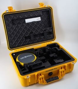
GeoMax Zenith60 Pro Survey Receiver
Rated 0 out of 5
0 Reviews
The GeoMax Zenith60 Pro is a high-performance GNSS RTK smart antenna featuring 800+ channels, IMU tilt compensation, multi-constellation tracking, IP68 durability, and seamless X-PAD software integration for professional surveying and construction workflows.
The GeoMax Zenith60 Pro is a high-performance GNSS RTK smart antenna featuring 800+ channels, IMU tilt compensation, multi-constellation tracking, IP68 durability, and seamless X-PAD software integration for professional surveying and construction workflows.
Categories: Total Station
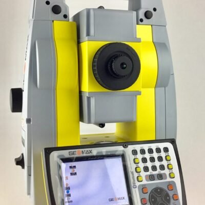
Geomax Zoom 90 R A10, 2″ Robotic Total Station
Rated 0 out of 5
0 Reviews
The GeoMax Zoom90 R A10 Robotic Total Station, developed by GeoMax, is a high-precision surveying solution designed for automated field operations. Featuring STReAM360 tracking technology, reflectorless measurement, and seamless software integration, it delivers accuracy, efficiency, and reliability for construction and geospatial projects.
The GeoMax Zoom90 R A10 Robotic Total Station, developed by GeoMax, is a high-precision surveying solution designed for automated field operations. Featuring STReAM360 tracking technology, reflectorless measurement, and seamless software integration, it delivers accuracy, efficiency, and reliability for construction and geospatial projects.
Categories: Total Station
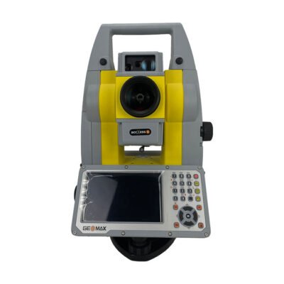
GeoMax Zoom95 5” Robotic TS
Rated 0 out of 5
0 Reviews
The GeoMax Zoom95 5” Robotic Total Station is a high-performance one-person surveying solution with robotic prism tracking, STReAM360 automation, advanced EDM technology, and seamless X-PAD software integration for construction and geospatial applications.
The GeoMax Zoom95 5” Robotic Total Station is a high-performance one-person surveying solution with robotic prism tracking, STReAM360 automation, advanced EDM technology, and seamless X-PAD software integration for construction and geospatial applications.