
Leica GS07 CS20 Survey System
Rated 0 out of 5
0 Reviews
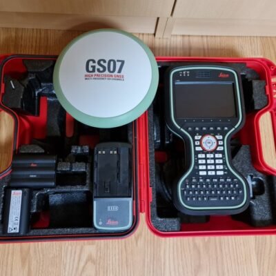
The Leica GS07 CS20 Survey System combines the Leica GS07 GNSS receiver with the Leica CS20 field controller to deliver reliable RTK positioning, efficient field data collection, and seamless surveying workflows. Designed for surveying, mapping, GIS, and construction applications, the system offers rugged durability, multi-constellation GNSS tracking, and advanced Leica Captivate integration for professional field operations.
The Leica GS07 CS20 Survey System combines the Leica GS07 GNSS receiver with the Leica CS20 field controller to deliver reliable RTK positioning, efficient field data collection, and seamless surveying workflows. Designed for surveying, mapping, GIS, and construction applications, the system offers rugged durability, multi-constellation GNSS tracking, and advanced Leica Captivate integration for professional field operations.