
Product details
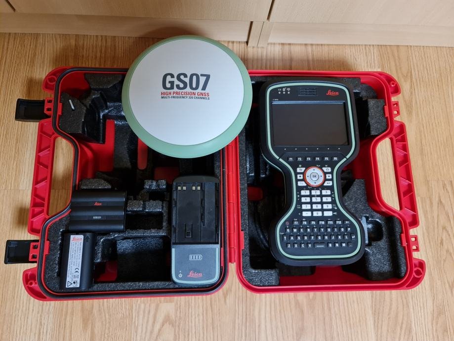
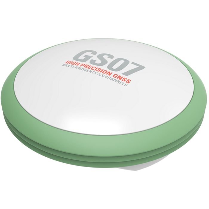
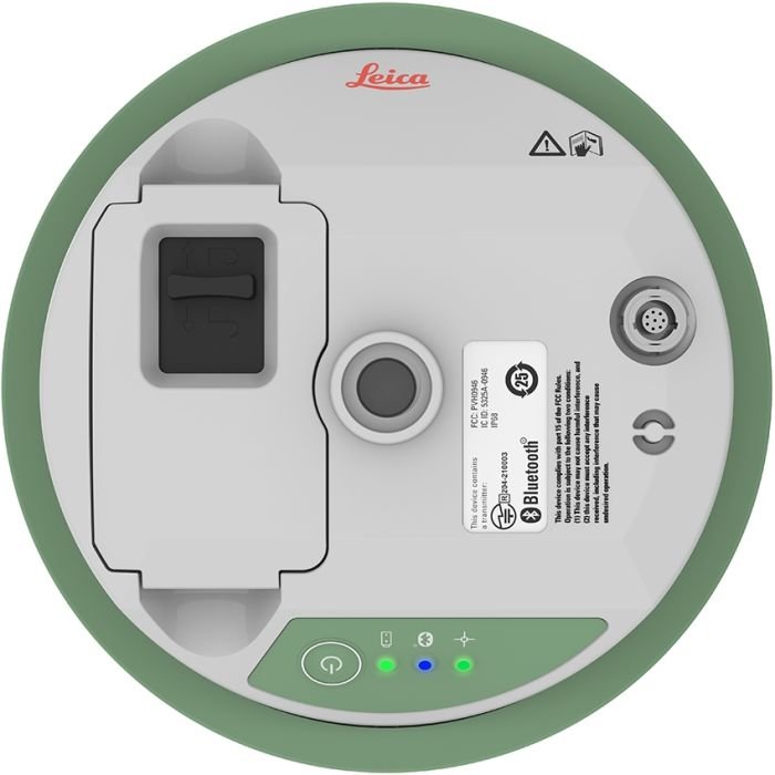
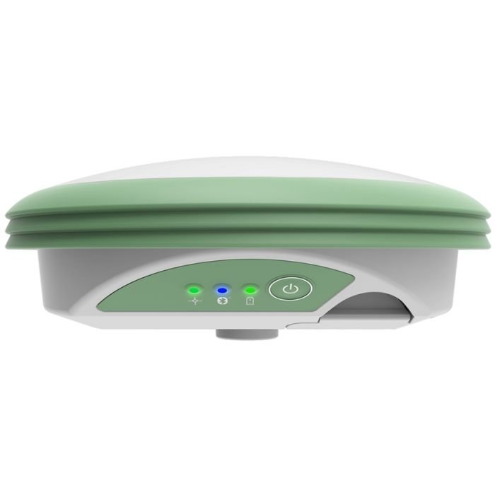
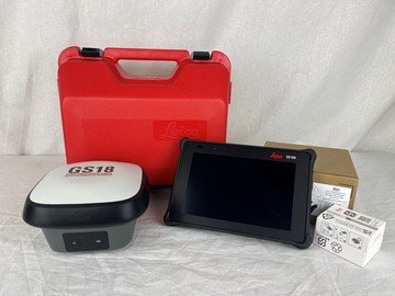
Leica GS07 CS20 Survey System
Professional GNSS Survey Solution for Accurate Field Data Collection
The Leica GS07 CS20 Survey System is a versatile and high-precision GNSS surveying solution designed for professional surveyors, engineers, mapping specialists, and construction professionals. Developed by Leica Geosystems, the system combines the reliable Leica GS07 GNSS receiver with the advanced Leica CS20 field controller to deliver efficient data collection, accurate RTK positioning, and seamless field-to-office workflows.
Built for demanding surveying and geospatial environments, the Leica GS07 CS20 Survey System offers flexible operation, rugged durability, multi-constellation satellite tracking, and full compatibility with Leica Captivate software for enhanced productivity in the field.
Why Choose Leica GS07 CS20 Survey System
Reliable GNSS Survey Performance
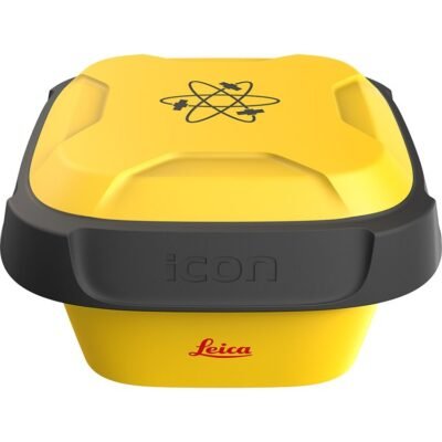
The Leica GS07 receiver provides dependable GNSS positioning performance for surveying, construction layout, GIS mapping, and infrastructure development projects.
Key Benefits
- Accurate RTK positioning
- Stable satellite tracking
- Reliable field performance
- Efficient survey workflows
Complete Field Survey Solution
Combined with the Leica CS20 controller, the system provides an integrated field solution for data collection, stakeout, mapping, and survey management.
Workflow Advantages
- Simplified field operation
- Real-time project visualization
- Efficient data handling
- Seamless office integration
Rugged Design for Harsh Environments
The Leica GS07 and CS20 are engineered for long-term operation in demanding outdoor conditions including dust, rain, vibration, and temperature fluctuations.
Key Features of Leica GS07 CS20 Survey System
Multi-Constellation GNSS Tracking
The system supports multiple satellite constellations to improve signal reliability and positioning accuracy.
Supported Satellite Systems
- GPS
- GLONASS
- Galileo
- BeiDou
- QZSS
- SBAS
High-Accuracy RTK Positioning
The Leica GS07 supports RTK corrections for centimeter-level positioning in real-time surveying applications.
RTK Features
- Rapid initialization
- Stable correction reception
- Reliable long-baseline performance
- Fast signal reacquisition
Leica CS20 Smart Field Controller
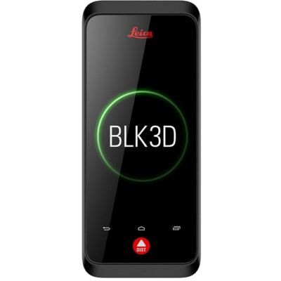
The Leica CS20 controller features an advanced touchscreen interface and Leica Captivate software for intuitive field workflows.
CS20 Controller Features
- Large sunlight-readable display
- Touchscreen operation
- Full keyboard functionality
- Real-time map visualization
- Wireless connectivity
Flexible Survey Workflows
The system supports a wide range of survey methods including RTK surveys, static observations, GIS mapping, and construction stakeout.
General Specifications
| Specification | Details |
|---|---|
| Product Name | Leica GS07 GNSS Receiver |
| System Configuration | Leica GS07 + Leica CS20 |
| Manufacturer | Leica Geosystems |
| GNSS Technology | Multi-Frequency GNSS |
| Primary Applications | Surveying, Mapping, Construction |
| Positioning Methods | RTK, Static, DGPS |
| Operating Mode | Rover / Base |
| Workflow Integration | Leica Captivate Platform |
| Field Deployment | Professional Survey Operations |
GNSS Tracking Specifications
Satellite Tracking Performance
| Specification | Details |
|---|---|
| GPS Tracking | Supported |
| GLONASS Tracking | Supported |
| Galileo Tracking | Supported |
| BeiDou Tracking | Supported |
| QZSS Support | Supported |
| SBAS Support | Supported |
| Multi-Frequency Capability | Supported |
| Satellite Channel Capacity | Advanced Multi-Channel Engine |
| Signal Acquisition | Fast |
| Signal Stability | High |
| RTK Compatibility | Supported |
| PPP Support | Supported |
| Real-Time Tracking | Supported |
| Signal Reacquisition | Rapid Recovery |
Positioning Accuracy Specifications
RTK & Static Accuracy
| Specification | Details |
|---|---|
| RTK Horizontal Accuracy | Centimeter-Level Precision |
| RTK Vertical Accuracy | High-Precision Elevation |
| Static Survey Accuracy | Survey Grade |
| Initialization Time | Rapid |
| Network RTK Support | Supported |
| Long Baseline RTK | Supported |
| Dynamic Positioning Stability | High |
| Repeatability | Excellent |
| Stakeout Accuracy | Optimized |
| Measurement Reliability | High Precision |
Communication Specifications
Connectivity Features
| Specification | Details |
|---|---|
| Bluetooth Connectivity | Supported |
| Wi-Fi Connectivity | Supported |
| Cellular Communication | Supported |
| NTRIP Support | Supported |
| USB Interface | Supported |
| Serial Communication | Supported |
| Wireless Data Transfer | Supported |
| Remote Configuration | Supported |
| Cloud Synchronization | Supported |
| Real-Time Data Streaming | Supported |
Leica CS20 Controller Specifications
Field Controller Features
| Specification | Details |
|---|---|
| Controller Model | Leica CS20 |
| Operating System | Leica Captivate Environment |
| Display Type | Sunlight-Readable Touchscreen |
| Keyboard | Full Alphanumeric Keyboard |
| User Interface | Touch & Physical Key Operation |
| Data Visualization | Real-Time Mapping |
| Wireless Communication | Integrated |
| Rugged Design | Industrial Field Grade |
| Data Storage | Internal Storage |
| USB Connectivity | Supported |
| Battery System | Rechargeable |
| Field Workflow Optimization | Supported |
Physical Specifications
Hardware & Ruggedness
| Specification | Details |
|---|---|
| Receiver Housing | Rugged Industrial Housing |
| Dust Resistance | Industrial Grade |
| Water Resistance | Supported |
| Shock Resistance | Supported |
| Vibration Resistance | Supported |
| Outdoor Operation | Optimized |
| Weight | Portable Lightweight Design |
| Pole Mount Compatibility | Supported |
| Tripod Compatibility | Supported |
| Construction Durability | Field-Ready |
Power Specifications
Battery & Operation
| Specification | Details |
|---|---|
| Battery Type | Rechargeable Lithium-Ion |
| Operating Time | Full-Day Survey Operation |
| External Power Support | Supported |
| Intelligent Power Management | Supported |
| Charging Interface | Industrial Charger |
| Low Power Consumption | Optimized |
| Hot-Swap Capability | Supported |
Environmental Specifications
Field Performance
| Specification | Details |
|---|---|
| Operating Environment | Outdoor Survey & Construction |
| Extreme Temperature Support | Supported |
| Humidity Resistance | Supported |
| Rain Operation | Supported |
| Dusty Environment Compatibility | Supported |
| UV Resistance | Supported |
| Industrial Site Compatibility | Supported |
| Harsh Outdoor Conditions | Optimized |
Survey Workflow Specifications
Supported Survey Operations
| Workflow | Capability |
|---|---|
| RTK Surveying | Supported |
| Static Surveying | Supported |
| Stakeout | Supported |
| GIS Data Collection | Supported |
| Construction Layout | Supported |
| Topographic Survey | Supported |
| Boundary Survey | Supported |
| Infrastructure Mapping | Supported |
Data Management Specifications
Survey Data Handling
| Specification | Details |
|---|---|
| Real-Time Data Collection | Supported |
| Coordinate System Compatibility | Multiple Coordinate Systems |
| CAD Integration | Supported |
| GIS Compatibility | Supported |
| BIM Workflow Support | Supported |
| Data Export Formats | Industry Standard Formats |
| Cloud Collaboration | Supported |
| Survey Data Logging | Supported |
Software Compatibility
Leica Ecosystem Integration
| Software Platform | Compatibility |
|---|---|
| Leica Captivate | Supported |
| Leica Infinity | Supported |
| Leica Geo Office | Supported |
| CAD Software | Supported |
| BIM Platforms | Supported |
| GIS Platforms | Supported |
| Cloud Collaboration Systems | Supported |
| Construction Workflow Platforms | Supported |
Applications of Leica GS07 CS20 Survey System
Land Surveying
The Leica GS07 CS20 system is ideal for professional surveying applications requiring reliable GNSS positioning.
Survey Applications
- Topographic mapping
- Boundary surveys
- Control point establishment
- Elevation surveys
Construction Layout
The system supports accurate construction positioning and stakeout operations.
Construction Tasks
- Building layout
- Foundation positioning
- Utility installation
- Structural alignment
GIS & Mapping
The Leica GS07 CS20 enables efficient GIS data collection and mapping workflows.
GIS Applications
- Asset mapping
- Infrastructure documentation
- Environmental monitoring
- Utility surveys

There are no reviews yet.