
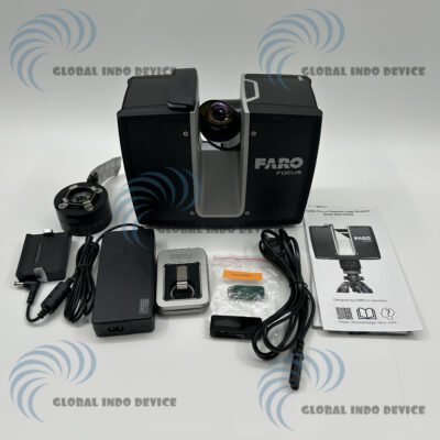
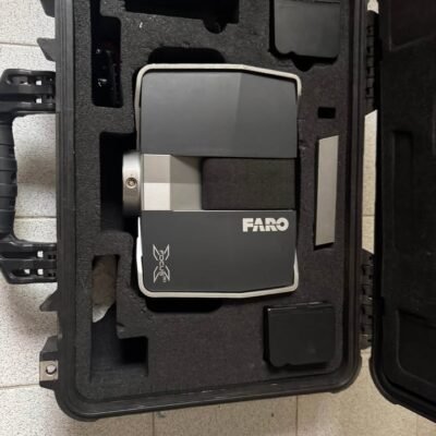
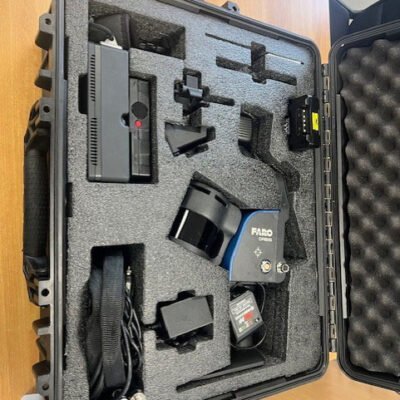
Product details
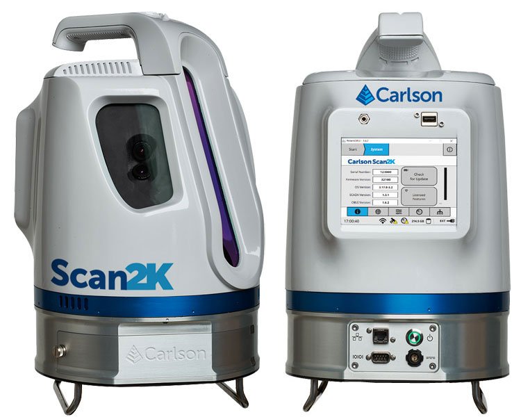
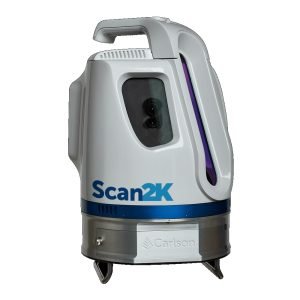
Carlson Scan2K LiDAR Scanner
High-Precision Long-Range Laser Scanning Solution for Surveying and Mapping
The Carlson Scan2K LiDAR Scanner is a professional long-range terrestrial laser scanning system designed for high-accuracy 3D data acquisition, topographic mapping, mining surveys, infrastructure documentation, and industrial measurement applications. Engineered to deliver reliable point cloud capture with exceptional speed and precision, the Scan2K combines advanced LiDAR technology, robust field durability, and seamless software integration for demanding geospatial workflows.
Designed for surveyors, engineers, mining professionals, construction specialists, and geospatial experts, the Carlson Scan2K provides efficient reality capture solutions for large-scale projects requiring detailed spatial data and accurate 3D modeling.
Why Choose the Carlson Scan2K LiDAR Scanner?
The Carlson Scan2K is engineered to maximize productivity while delivering highly detailed and accurate scanning results in challenging field environments.
Key Advantages
- Long-range LiDAR scanning capability
- High-speed point cloud acquisition
- High-accuracy 3D measurement
- Rugged field-ready construction
- Large-area scanning efficiency
- Seamless Carlson software integration
- Fast survey-grade data capture
- Industrial and mining workflow compatibility
- Efficient topographic modeling
- Reliable operation in harsh environments
Advanced LiDAR Scanning Technology
High-Speed Reality Capture System
The Carlson Scan2K uses advanced laser scanning technology to rapidly capture millions of measurement points for highly detailed 3D spatial datasets.
Scanning Capabilities
- Terrain mapping
- Topographic surveys
- Mine site scanning
- Structural documentation
- Infrastructure inspection
- Volume calculations
- Industrial plant modeling
- As-built documentation
Long-Range Scanning Performance
Efficient Large-Area Data Acquisition
The Scan2K is optimized for large-scale projects requiring extended measurement range and high point density.
Long-Range Benefits
- Reduced instrument setups
- Faster project completion
- Efficient coverage of large sites
- Improved operational productivity
- Enhanced scanning flexibility
Specifications
High-Precision Laser Measurement System
| Feature | Specification |
|---|---|
| Measurement Technology | Terrestrial LiDAR |
| Scanning Method | Laser Pulse Scanning |
| Measurement Range | Up to 2,000 m |
| Measurement Accuracy | Survey Grade Precision |
| Point Cloud Generation | High Density |
| Laser Class | Eye-Safe Laser System |
| Distance Measurement Speed | High-Speed Acquisition |
Point Cloud Performance
Dense and Accurate 3D Data Capture
| Feature | Specification |
|---|---|
| Point Acquisition Rate | High-Speed Multi-Point Capture |
| Point Cloud Density | Adjustable |
| Scan Resolution | Multiple Resolution Modes |
| Data Quality | High-Precision Spatial Data |
| Real-Time Visualization | Supported |
Scanning Range and Coverage
Large-Area Survey Capability
| Feature | Specification |
|---|---|
| Maximum Scanning Range | Up to 2 km |
| Field of View | Wide-Angle Coverage |
| Horizontal Scanning | Full Rotation Capability |
| Vertical Coverage | Extended Vertical Scanning |
Accuracy and Precision
Survey-Grade Measurement Reliability
| Feature | Specification |
|---|---|
| Positional Accuracy | High Precision |
| Angular Accuracy | Survey Grade |
| Repeatability | Excellent |
| Data Stability | High Reliability |
Integrated Imaging and Visualization
Enhanced Point Cloud Interpretation
The Carlson Scan2K supports integrated visualization workflows for improved field analysis and documentation.
Imaging Features
- Real-time scan visualization
- Point cloud preview
- Colorized data workflows
- Spatial inspection capability
- High-detail scene reconstruction
Software Integration
Carlson Software Workflow Compatibility
The Scan2K integrates seamlessly with Carlson’s geospatial software ecosystem.
Compatible Software Solutions
- Carlson Point Cloud
- Carlson Survey
- Carlson Civil
- Carlson Mining
- CAD Platforms
- BIM Processing Workflows
Workflow Benefits
- Efficient point cloud processing
- Surface modeling
- Volume calculations
- Feature extraction
- CAD integration
- Engineering analysis
Data Storage and File Management
Efficient Large Dataset Handling
| Feature | Specification |
|---|---|
| Internal Data Storage | High Capacity |
| External Storage Support | Available |
| Data Export Formats | LAS, LAZ, XYZ, PTS |
| File Transfer | USB / Network Transfer |
| Point Cloud Management | Integrated |
Communication and Connectivity
Modern Digital Workflow Integration
Connectivity Features
- USB Interface
- Ethernet Communication
- Wireless Connectivity
- External Data Transfer Support
Data Workflow Advantages
- Faster project synchronization
- Efficient field data transfer
- Improved collaboration
- Simplified processing workflow
Rugged Environmental Design
Built for Harsh Field Conditions
The Carlson Scan2K is engineered for reliable performance in demanding outdoor and industrial environments.
| Feature | Specification |
|---|---|
| Environmental Protection | Industrial Grade |
| Dust Resistance | High |
| Water Resistance | Weather Resistant |
| Operating Temperature | Wide Operational Range |
| Field Durability | Rugged Construction |
Power and Battery System
Reliable Long-Duration Operation
| Feature | Specification |
|---|---|
| Power Supply | Rechargeable Battery |
| Battery Runtime | Extended Field Operation |
| External Power Support | Available |
| Charging System | Integrated |
Applications of Carlson Scan2K LiDAR Scanner
Mining and Quarry Surveying
Perfect for:
- Open-pit mine mapping
- Stockpile volume calculation
- Quarry measurement
- Slope stability monitoring
- Tunnel documentation
Infrastructure and Civil Engineering
Widely used for:
- Highway corridor mapping
- Bridge documentation
- Railway surveying
- Utility corridor inspection
- Construction progress monitoring
Industrial Plant Documentation
Ideal for:
- As-built plant modeling
- Industrial facility inspection
- Equipment clearance analysis
- Structural documentation
- Maintenance planning
Topographic and Land Surveying
Suitable for:
- Terrain modeling
- Contour generation
- Boundary mapping
- Site development
- Geospatial data collection
BIM and Reality Capture Workflows
Advanced 3D Modeling Integration
The Carlson Scan2K supports Building Information Modeling (BIM) and digital twin applications.
BIM Workflow Benefits
- Accurate as-built models
- Efficient renovation planning
- Structural analysis support
- Improved project visualization
- Enhanced construction coordination
There are no reviews yet.