
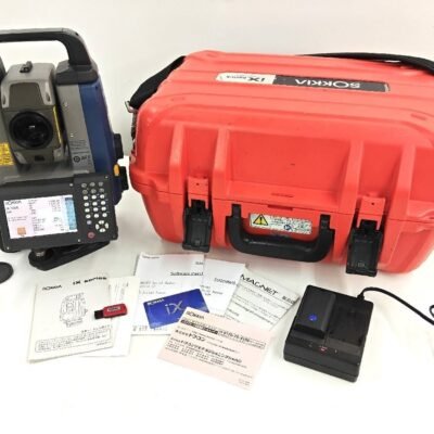
Product details
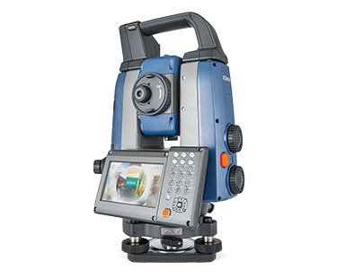
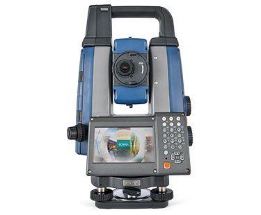
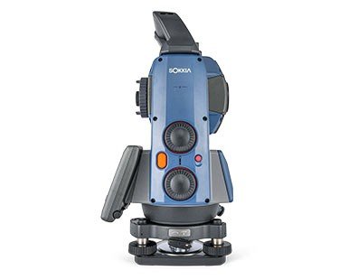
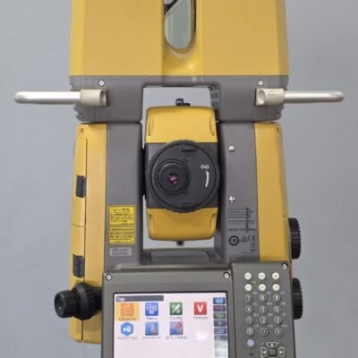
Sokkia iX-1200/600 Robotic Total Station – Ultra-Precision Intelligent Surveying System for Digital Construction
The Sokkia iX-1200/600 Robotic Total Station is a next-generation high-precision robotic total station engineered for advanced surveying, construction layout, BIM integration, monitoring, and digital infrastructure applications. Developed to deliver superior positioning performance in demanding field environments, the iX-1200/600 combines intelligent robotic automation, ultra-fast prism tracking, long-range EDM technology, and high-accuracy angle measurement into one professional surveying platform.
Built for surveyors, engineers, contractors, and geospatial professionals, the Sokkia iX series provides exceptional operational efficiency through one-person robotic workflows, advanced communication systems, and intelligent target tracking technologies designed for modern construction and infrastructure projects.
Key Features
Ultra-High Precision Angle Measurement
The iX-1200/600 delivers highly accurate angular measurements suitable for precision-critical surveying and engineering applications.
Accuracy Benefits
- High-precision horizontal and vertical measurements
- Reduced layout deviation
- Improved project quality
- Reliable engineering-grade performance
Intelligent Robotic Automation
The robotic system enables efficient single-operator surveying and layout workflows.
Robotic Features
- One-person field operation
- Automatic prism tracking
- Motorized target positioning
- Remote operation capability
UltraTrac Advanced Prism Tracking Technology
The intelligent UltraTrac system continuously locks onto moving prisms while maintaining stable positioning accuracy.
Tracking Advantages
- Rapid prism acquisition
- Stable target lock
- Reduced signal loss
- Improved productivity in dynamic environments
High-Speed Reflectorless EDM Technology
The advanced EDM engine provides fast and reliable long-range measurements.
EDM Capabilities
- Long-distance reflectorless measurement
- Fast data acquisition
- Precise inaccessible point measurement
- High-speed surveying workflows
Hybrid Positioning Integration
The system supports integrated GNSS and robotic workflows for seamless positioning solutions.
Hybrid Advantages
- GNSS compatibility
- Improved field flexibility
- Faster site setup
- Enhanced positioning efficiency
Touchscreen Field Interface
The onboard color touchscreen provides intuitive operation and graphical field management.
Interface Features
- User-friendly navigation
- Real-time map display
- Graphical project visualization
- Efficient workflow management
Applications of Sokkia iX-1200/600 Robotic Total Station
Digital Construction Layout
Optimized for modern construction and BIM-based workflows.
Construction Applications
- Building layout
- Structural positioning
- Concrete anchor layout
- MEP installation
Land Surveying and Mapping
Provides high-accuracy geospatial data collection for professional surveying.
Surveying Uses
- Boundary surveys
- Topographic mapping
- Geodetic control
- Infrastructure surveys
Civil Engineering and Infrastructure
Supports critical infrastructure measurement and positioning operations.
Engineering Applications
- Highway construction
- Bridge alignment
- Tunnel surveying
- Utility corridor mapping
BIM and Smart Construction
Integrates efficiently into digital construction ecosystems.
BIM Applications
- BIM model verification
- As-built documentation
- Digital twin creation
- Construction validation
Industrial Measurement and Monitoring
Suitable for industrial alignment and monitoring projects.
Industrial Uses
- Machine installation
- Structural monitoring
- Plant alignment
- Precision manufacturing layout
Sokkia iX-1200/600 Robotic Total Station Technical Specifications
General Specifications
| Specification | Details |
|---|---|
| Product Name | Sokkia iX-1200/600 Robotic Total Station |
| Instrument Type | Robotic Total Station |
| Series | iX Series |
| Operation Mode | Fully Robotic |
| Intended Applications | Surveying, Construction, BIM |
| Workflow Type | One-Person Operation |
Model Accuracy Options
| Model | Angular Accuracy |
|---|---|
| iX-1201 | 1 Arc Second |
| iX-1203 | 3 Arc Seconds |
| iX-1205 | 5 Arc Seconds |
| iX-603 | 3 Arc Seconds |
| iX-605 | 5 Arc Seconds |
Telescope Specifications
| Parameter | Specification |
|---|---|
| Telescope Length | 171 mm |
| Objective Aperture | 45 mm |
| Magnification | 30x |
| Resolving Power | 2.5″ |
| Field of View | 1°30′ |
| Minimum Focus | 1.3 m |
| Image | Erect |
Angle Measurement Specifications
| Parameter | Specification |
|---|---|
| Angle Reading System | Absolute Encoder |
| Minimum Display | 0.1″/0.5″/1″ |
| Dual-Axis Compensation | Supported |
| Compensator Range | ±6′ |
| Automatic Correction | Supported |
Distance Measurement Specifications
| Parameter | Prism Mode | Reflectorless Mode |
|---|---|---|
| Maximum Measurement Range | Up to 6,000 m | Up to 800 m |
| Accuracy | ±(1 mm + 1 ppm) | ±(2 mm + 2 ppm) |
| Measurement Time | Approx. 0.9 sec | Approx. 1.0 sec |
| Laser Class | Class 1 | Class 3R |
Robotic Tracking Specifications
| Parameter | Specification |
|---|---|
| Tracking Technology | UltraTrac |
| Automatic Prism Recognition | Supported |
| Tracking Speed | High-Speed Continuous Tracking |
| Search Capability | Automatic Search |
| Servo Motors | High-Speed Precision Motors |
Communication and Connectivity
| Parameter | Specification |
|---|---|
| Bluetooth | Integrated |
| Wireless LAN | Supported |
| USB Port | Supported |
| RS-232C | Supported |
| Remote Controller Compatibility | Supported |
| Cloud Connectivity | Supported |
Data Management Specifications
| Parameter | Specification |
|---|---|
| Internal Memory | Large Capacity Storage |
| USB Data Export | Supported |
| CAD Compatibility | Supported |
| BIM Workflow Support | Supported |
| Survey Software Integration | Supported |
Display and User Interface
| Parameter | Specification |
|---|---|
| Display Type | Color Touchscreen LCD |
| Display Configuration | Dual Display |
| Keyboard | Backlit Alphanumeric |
| Interface Navigation | Graphical Interface |
| Screen Visibility | Outdoor Optimized |
Environmental Specifications
| Parameter | Specification |
|---|---|
| Operating Temperature | -20°C to +50°C |
| Storage Temperature | -40°C to +70°C |
| Protection Rating | IP65 |
| Dust Resistance | High Protection |
| Water Resistance | Weatherproof Design |
Power Specifications
| Parameter | Specification |
|---|---|
| Battery Type | Rechargeable Li-Ion |
| Operating Time | Up to 14 Hours |
| Hot Swap Battery | Supported |
| Charging Time | Approx. 4 Hours |
| External Power Support | Supported |
Physical Specifications
| Parameter | Specification |
|---|---|
| Weight | Approx. 7.3 kg |
| Instrument Design | Compact Robotic Design |
| Housing Material | Reinforced Industrial Body |
| Mounting System | Standard Tribrach |
Advantages of Sokkia iX-1200/600 Robotic Total Station
Exceptional Field Productivity
The robotic automation system dramatically improves surveying efficiency.
Productivity Benefits
- Reduced manpower requirements
- Faster data collection
- Increased daily output
- Efficient single-operator workflows
Reliable High-Precision Performance
Designed for demanding engineering and construction environments.
Accuracy Advantages
- Stable prism tracking
- High-precision EDM
- Consistent positioning accuracy
- Reduced measurement errors
Advanced Digital Construction Integration
Supports modern BIM and digital construction workflows.
Workflow Features
- BIM-ready integration
- CAD compatibility
- Digital layout support
- Cloud-enabled workflows
Rugged and Durable Construction
Built for reliable long-term operation in challenging outdoor environments.
Durability Features
- Weather-resistant housing
- Dustproof protection
- Industrial-grade durability
- Harsh-environment reliability
Industries That Use Sokkia iX-1200/600 Robotic Total Station
Construction Industry
- Building construction
- Infrastructure positioning
- Structural layout
Civil Engineering
- Road and bridge projects
- Tunnel alignment
- Utility infrastructure
Surveying Industry
- Geospatial mapping
- Control surveys
- Topographic measurement
Industrial Sector
- Plant installation
- Precision alignment
- Monitoring systems
There are no reviews yet.