
Product details
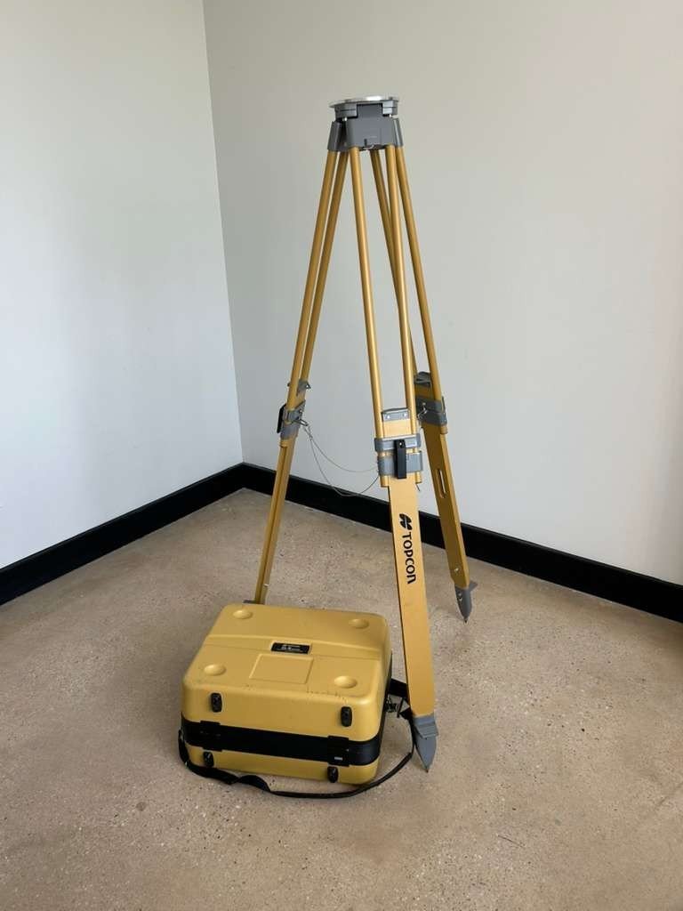
Topcon GLS-2200S 3D Laser Scanner and Tripod
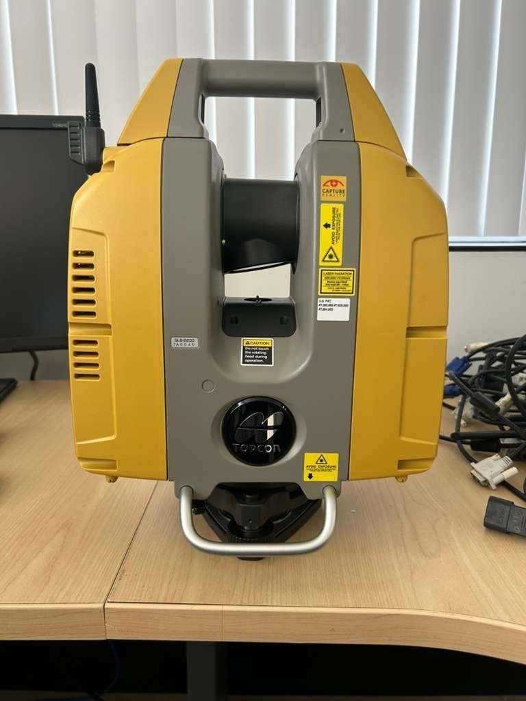
The Topcon GLS-2200S is a high-performance 3D laser scanner designed for accurate and efficient data capture in surveying, construction, and industrial applications. Paired with a stable tripod system, it ensures precise measurements and reliable results even in challenging environments.
This scanner is engineered to deliver high-density point cloud data, making it a valuable tool for professionals who require detailed spatial information.
Key Features of Topcon GLS-2200S
High-Precision Laser Scanning
The GLS-2200S provides accurate 3D measurements with advanced laser technology, ensuring detailed and reliable data collection.
Long-Range Scanning Capability
Designed for both short and long-range applications, the scanner captures large areas efficiently without compromising accuracy.
Integrated Imaging System
The built-in camera allows users to capture color information, enhancing the visualization of point cloud data.
Stable Tripod Support
The included tripod ensures stability during scanning, reducing vibration and improving measurement accuracy.
Benefits of Using GLS-2200S
Improved Survey Efficiency
Fast data acquisition reduces field time and increases productivity for surveyors and engineers.
High Data Accuracy
Accurate point cloud generation supports precise modeling, measurement, and analysis.
Reliable Field Performance
The system is built to perform in various environmental conditions, ensuring consistent results.
Enhanced Data Visualization
Integrated imaging enables realistic representation of scanned environments.
Applications
Land Surveying
Capture accurate terrain data for mapping and land development projects.
Construction and BIM
Support Building Information Modeling (BIM) workflows with precise 3D data.
Industrial Inspection
Inspect structures, machinery, and facilities with high-resolution scanning.
Infrastructure Projects
Document roads, bridges, and large-scale infrastructure efficiently.
How the GLS-2200S Works
The scanner emits laser pulses that measure distances to surrounding objects. These measurements are combined to create a detailed 3D point cloud of the environment. The tripod ensures the device remains stable during operation, improving the consistency of the captured data.
Technical Highlights
Scanning Performance
High-speed laser measurement
Dense point cloud generation
Long-range scanning capability
Data Output
3D point cloud data
Colorized scan results
Compatible with industry-standard formats
System Design
Durable and field-ready construction
User-friendly interface
Tripod-mounted for stability
Why Choose Topcon GLS-2200S
Precision and Reliability
Built with advanced technology, the GLS-2200S ensures accurate and repeatable measurements.
Efficient Workflow Integration
Compatible with surveying and BIM software for seamless data processing.
Versatile Use
Suitable for a wide range of industries, from construction to industrial inspection.
Ideal Users
Surveyors
Civil engineers
Construction professionals
Infrastructure planners
Industrial inspectors
A high-performance scanning solution that’s simple to use
Quickly tackle any job with the latest in scanning and workflow technology. The GLS-2200 features a unique survey style setup and user-friendly processing software that turn lengthy scanning processes into fast and easy workflows
– Unique scanning mode that can capture dense wet concrete data and larger areas
– Get cleaner data with 1mm Plane Fit accuracy through MAGNET Collage
– HDR imaging capability enhances 3D model rendering results
– Surveyor-style setup synchronizes the scanner with the same coordinate system as the design file, reducing post-processing time
– Unequaled 200m setup target range reduces number of setups
– API that allows 3rd party software to directly interface with the scanner for unique industry applications
Reference object to be measured:
Detail : Prominent objects, archaeological sites, historical building, etc.
High Speed : Accident investigations, disasters areas, short timeframe projects, etc.
Low Power : Heavy pedestrian areas, laser limitation areas, etc.
Standard : Large structure, large residential areas, volume measurements, etc.
Close : Hard-to-measure objects in close proximity with each other.*
Close (High Power) : Objects which cannot easily be measured, even with CLose mode.
Road : Existing asphalt or concrete road surface.
Road (High Power) : New asphalt road surface
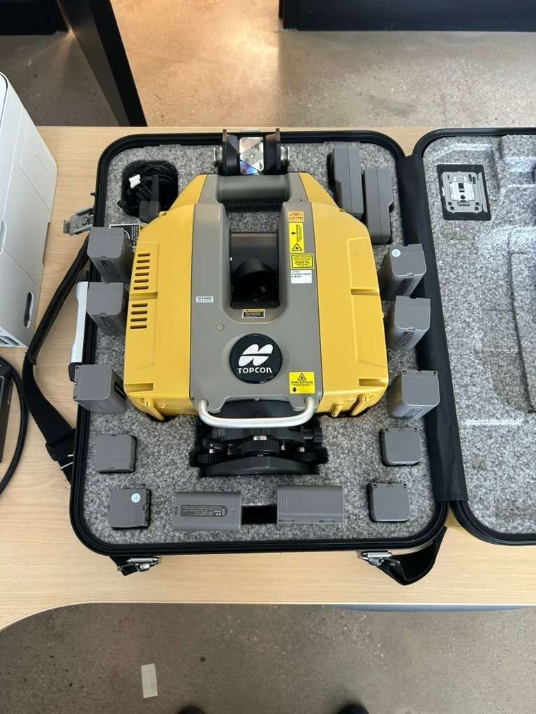
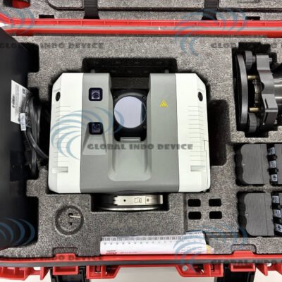
Package Includes:
– Topcon GLS-2200 Long Range 500 m
– Software magnet collage SCN Scan Kit Perpetual
– Battery (BDC72) 4 pieces
– Battery Charger (CDC77) 2 pieces
– Charging Cable (EDC113) 2 pieces
– Carrying case
– Silica gel
– Cloth wipe
– SD card
– SD card case
– Tool kit
– Target sheet
– Centering target
– Instruction manual
– Warranty card
There are no reviews yet.