
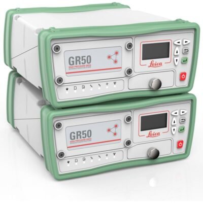
Product details
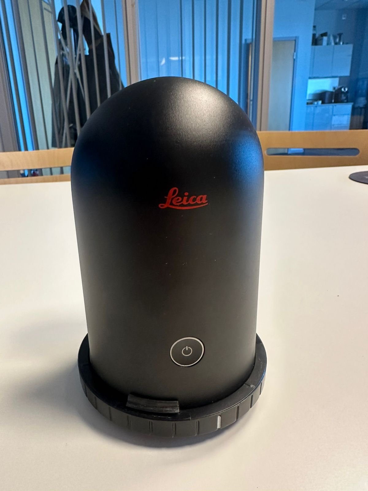
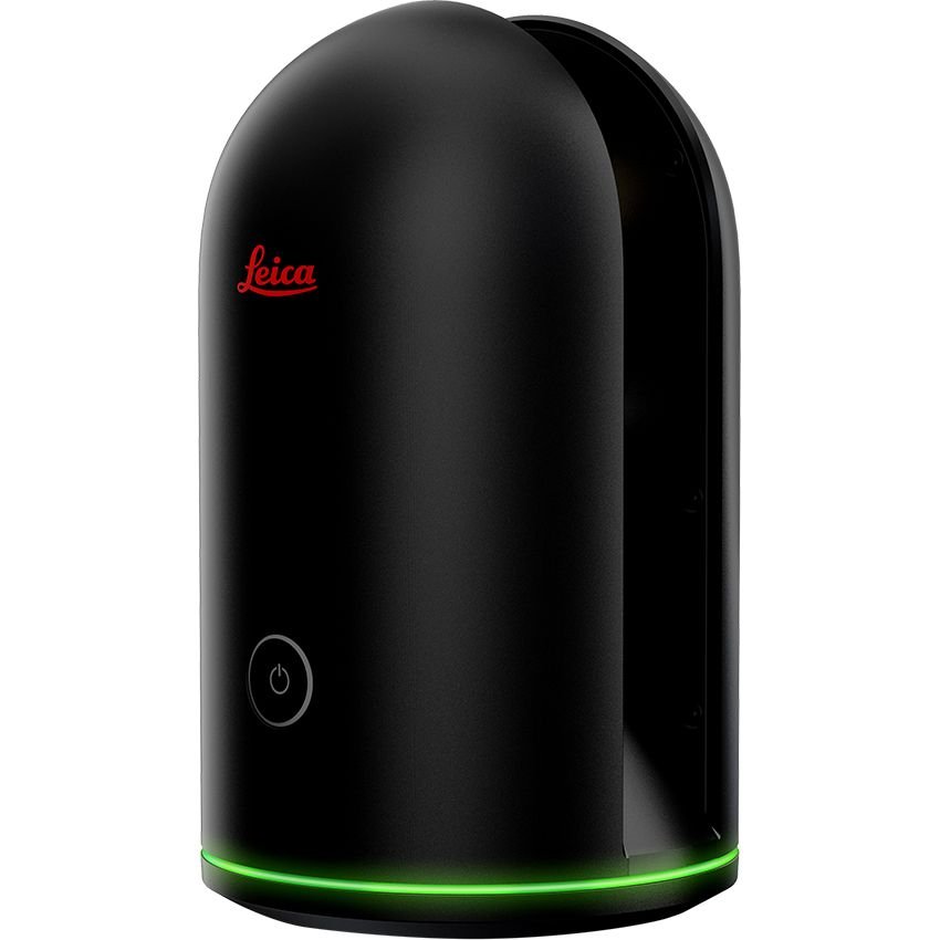
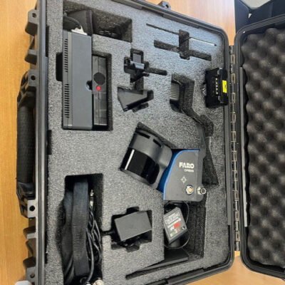
Leica BLK360 G1 Imaging Scanner
The Leica BLK360 G1 Imaging Scanner is a lightweight and highly portable 3D imaging laser scanner designed for rapid reality capture, immersive visualization, and accurate spatial documentation. Developed by Leica Geosystems, the BLK360 G1 combines LiDAR scanning, panoramic imaging, and thermal imaging technology into a compact all-in-one solution for architecture, engineering, construction, surveying, and facility management professionals.
Built to simplify 3D scanning workflows, the Leica BLK360 G1 enables users to quickly capture high-resolution point clouds and panoramic imagery with minimal setup time, making it ideal for indoor and outdoor documentation projects.
Why Choose Leica BLK360 G1 Imaging Scanner
Fast and Efficient Reality Capture
The Leica BLK360 G1 is designed to accelerate field documentation and reduce scanning complexity.
Key Benefits
- Rapid scan acquisition
- Simple one-button operation
- Portable lightweight design
- Fast setup and deployment
- Efficient field workflows
Integrated Imaging and LiDAR Technology
The scanner combines high-accuracy laser scanning with immersive panoramic imaging and thermal imaging capabilities.
Imaging Advantages
- Full-color panoramic imagery
- Accurate 3D point cloud generation
- Thermal imaging integration
- High-detail spatial documentation
Compact and Portable Design
The Leica BLK360 G1 is one of the most compact professional imaging laser scanners available for mobile field operations.
Portability Benefits
- Lightweight transportation
- Easy tripod mounting
- Quick relocation between scan positions
- Ideal for indoor and confined spaces
Key Features of Leica BLK360 G1 Imaging Scanner
High-Speed 3D Laser Scanning
The BLK360 G1 captures dense point cloud data for detailed 3D modeling and documentation.
Scanning Features
- Full dome scanning capability
- High-density point clouds
- Rapid scan speed
- Accurate geometry capture
- Automatic scan registration support
Panoramic Imaging System
Integrated panoramic cameras capture high-resolution imagery for immersive visualization and textured point clouds.
Imaging Capabilities
- HDR panoramic imaging
- Full-color visualization
- 360-degree image capture
- Photo-realistic project documentation
Thermal Imaging Technology
The scanner includes thermal imaging functionality for building diagnostics and inspection workflows.
Thermal Applications
- Heat loss detection
- Moisture inspection
- HVAC analysis
- Building diagnostics
Mobile Device Integration
The Leica BLK360 G1 integrates with mobile devices and Leica software platforms for efficient scan control and data transfer.
Workflow Features
- Wireless connectivity
- Remote scan operation
- Mobile visualization
- Cloud collaboration support
General Specifications
| Specification | Details |
|---|---|
| Product Name | Leica BLK360 G1 Imaging Scanner |
| Product Type | Imaging Laser Scanner |
| Manufacturer | Leica Geosystems |
| Primary Applications | Reality Capture, BIM, Surveying |
| Scanning Technology | LiDAR Laser Scanning |
| Imaging Technology | Panoramic HDR Imaging |
| Thermal Imaging | Integrated |
| Form Factor | Compact Portable Scanner |
| Workflow Integration | Leica Reality Capture Ecosystem |
Laser Scanning Specifications
LiDAR Performance
| Specification | Details |
|---|---|
| Scanning Principle | Time-of-Flight Laser Measurement |
| Scan Coverage | Full Dome Scanning |
| Point Cloud Generation | High-Density 3D Data |
| Measurement Accuracy | Millimeter-Level Precision |
| Scan Speed | High-Speed Capture |
| Range Measurement | Professional Indoor & Outdoor Capability |
| Scan Resolution | Adjustable |
| Automatic Registration Support | Supported |
| Real-Time Scan Visualization | Supported |
| Surface Geometry Capture | High Precision |
| Reflective Surface Handling | Optimized |
| Low-Light Scanning | Supported |
Imaging Specifications
Panoramic Camera System
| Specification | Details |
|---|---|
| Imaging Type | HDR Panoramic Imaging |
| Panoramic Coverage | 360° |
| Image Resolution | High Resolution |
| Full-Color Capture | Supported |
| HDR Capability | Supported |
| Image Alignment | Automatic |
| Point Cloud Colorization | Supported |
| Photo Documentation | Supported |
| Immersive Visualization | Supported |
Thermal Imaging Specifications
Infrared Imaging Features
| Specification | Details |
|---|---|
| Thermal Imaging | Integrated |
| Infrared Capture | Supported |
| Building Diagnostics | Supported |
| Thermal Inspection Workflows | Supported |
| Heat Signature Detection | Supported |
| Moisture Detection Support | Supported |
| HVAC Inspection Capability | Supported |
| Thermal Overlay Visualization | Supported |
Connectivity Specifications
Wireless Communication & Data Transfer
| Specification | Details |
|---|---|
| Wi-Fi Connectivity | Supported |
| Mobile Device Integration | Supported |
| Wireless Data Transfer | Supported |
| USB Connectivity | Supported |
| Cloud Synchronization | Supported |
| Remote Scanner Operation | Supported |
| Real-Time Visualization | Supported |
| Mobile App Compatibility | Supported |
Physical Specifications
Hardware Design & Portability
| Specification | Details |
|---|---|
| Housing Design | Compact Industrial Housing |
| Weight | Lightweight Portable Design |
| Tripod Compatibility | Supported |
| Compact Form Factor | Optimized |
| Field Portability | Excellent |
| Indoor Scanning Optimization | Supported |
| Outdoor Scanning Capability | Supported |
| Rugged Field Design | Supported |
Power Specifications
Battery & Operation
| Specification | Details |
|---|---|
| Battery Type | Rechargeable Lithium-Ion |
| Battery Runtime | Extended Field Operation |
| Charging System | Integrated Charging |
| External Power Support | Supported |
| Intelligent Power Management | Supported |
| Power Efficiency | Optimized |
Environmental Specifications
Field Operation Performance
| Specification | Details |
|---|---|
| Operating Environment | Indoor & Outdoor |
| Temperature Resistance | Supported |
| Humidity Resistance | Supported |
| Dust Resistance | Industrial Grade |
| Low-Light Operation | Supported |
| Construction Site Compatibility | Supported |
| Building Interior Operation | Optimized |
| Rugged Operation | Supported |
Data Management Specifications
Point Cloud & Imaging Data
| Specification | Details |
|---|---|
| Point Cloud Data | Supported |
| Image Data Management | Supported |
| Colorized Point Clouds | Supported |
| Data Export Formats | Industry Standard Formats |
| BIM Workflow Compatibility | Supported |
| CAD Integration | Supported |
| GIS Compatibility | Supported |
| Cloud Collaboration | Supported |
| Scan Registration Workflow | Supported |
Software Compatibility
Leica Ecosystem Integration
| Software Platform | Compatibility |
|---|---|
| Leica Cyclone | Supported |
| Leica REGISTER 360 | Supported |
| Leica BLK Edition | Supported |
| Autodesk ReCap | Supported |
| BIM Platforms | Supported |
| CAD Software | Supported |
| Point Cloud Processing Software | Supported |
| Cloud Collaboration Systems | Supported |
Applications of Leica BLK360 G1 Imaging Scanner
Architecture & Building Documentation
The Leica BLK360 G1 is ideal for building documentation and architectural reality capture workflows.
Typical Applications
- Existing condition surveys
- Interior documentation
- Building renovation planning
- Heritage preservation
Construction & BIM
The scanner supports construction verification and BIM data acquisition.
Construction Applications
- As-built documentation
- Progress monitoring
- Clash detection support
- Site verification
Facility Management
The BLK360 G1 helps facility managers create accurate digital records of buildings and assets.
Facility Applications
- Asset documentation
- Space management
- Maintenance planning
- Digital twin workflows
Surveying & Mapping
The scanner supports professional surveying and spatial data collection.
Survey Applications
- Interior mapping
- Site documentation
- 3D spatial surveys
- Point cloud generation
Thermal Inspection
Integrated thermal imaging enables building diagnostics and inspection workflows.
Inspection Applications
- Energy efficiency analysis
- Heat loss detection
- HVAC inspection
- Moisture analysis
Advantages of Leica BLK360 G1 Imaging Scanner
Rapid Reality Capture
Quick scan acquisition improves field productivity.
Compact Professional Design
Lightweight construction simplifies transportation and deployment.
Integrated Imaging Workflow
Combines LiDAR, panoramic imaging, and thermal imaging in one device.
Accurate Spatial Documentation
Produces high-quality point clouds and immersive imagery.
Seamless Software Integration
Compatible with Leica and third-party reality capture platforms.
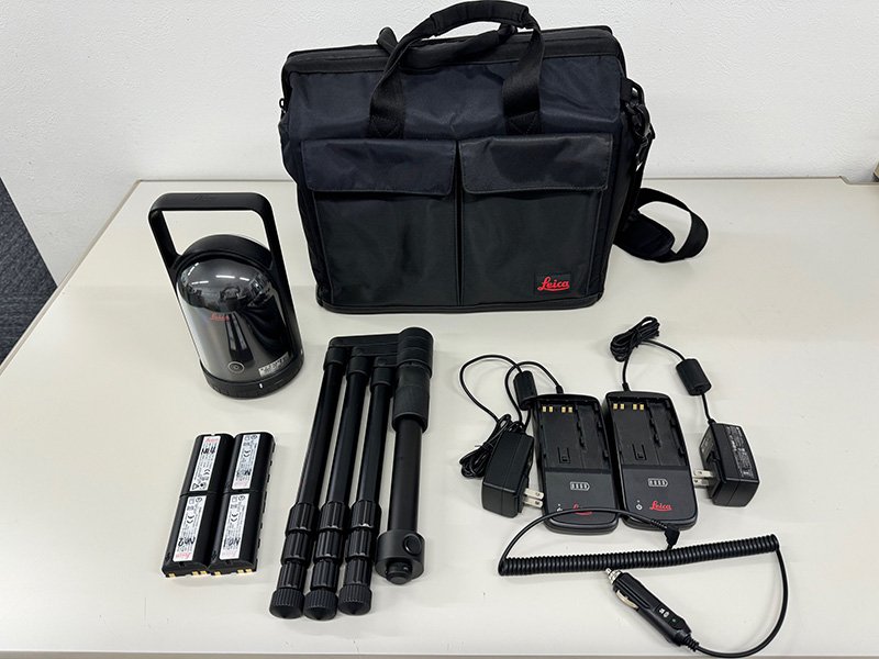
Package Contents
Included Components
- Leica BLK360 G1 Imaging Scanner
- Rechargeable Batteries
- Battery Charger
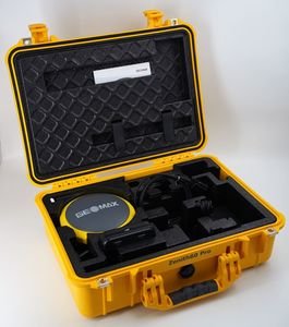
- Carrying Case
- USB Communication Accessories
- Quick Setup Guide
- Calibration Documentation
- Software Access Information
Optional Accessories
Expansion Options
- Professional Tripod Systems
- Additional Batteries
- Mobile Device Mounts
- Extended Storage Solutions
- Cloud Collaboration Services
- Point Cloud Processing Software
- Protective Transport Cases
- BIM Workflow Integration Tools
Industries Using Leica BLK360 G1
| Industry | Application |
|---|---|
| Architecture | Building Documentation |
| Construction | BIM & As-Built Capture |
| Surveying | Spatial Data Collection |
| Facility Management | Asset Documentation |
| Engineering | Infrastructure Inspection |
| Real Estate | Property Visualization |
| Heritage Preservation | Historical Site Recording |
| Energy | Thermal Inspection |
There are no reviews yet.