

Product details
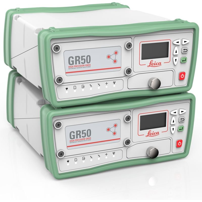
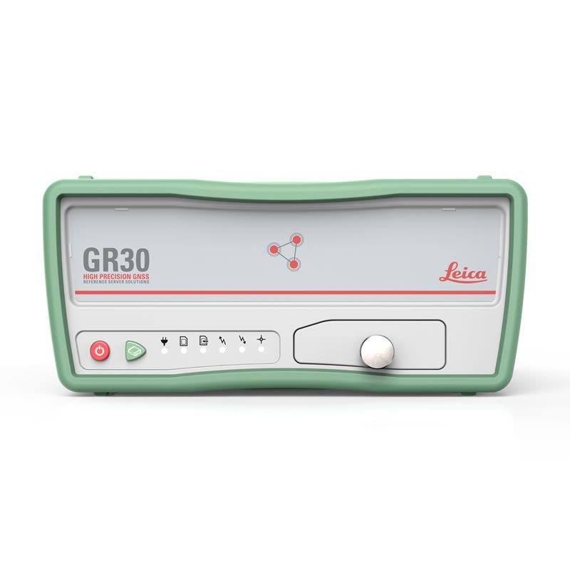
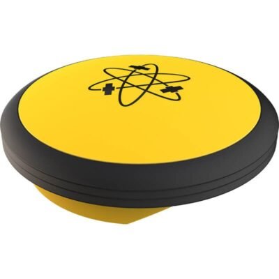
Leica GR30 GR50 Reference Receiver
The Leica GR30 GR50 Reference Receiver is a powerful and reliable GNSS reference station solution designed for permanent monitoring networks, geodetic infrastructure, scientific research, deformation monitoring, and high-precision positioning applications. Developed by Leica Geosystems, the Leica GR30 and GR50 receivers provide continuous multi-frequency GNSS tracking, secure data handling, advanced remote management, and exceptional long-term operational stability.
Engineered for demanding reference station environments, the Leica GR30 GR50 series supports uninterrupted high-precision GNSS data acquisition for continuously operating reference stations (CORS), tectonic monitoring, meteorological studies, infrastructure monitoring, and national geospatial networks.
Why Choose Leica GR30 GR50 Reference Receiver
Professional Reference Station Performance
The Leica GR30 and GR50 are built specifically for permanent GNSS reference station installations requiring long-term operational reliability and high positioning accuracy.
Key Benefits
- Continuous 24/7 GNSS tracking
- High-precision geodetic positioning
- Reliable long-term stability
- Advanced monitoring capabilities
- Secure remote operation
Multi-Constellation GNSS Tracking
The receivers simultaneously track multiple satellite constellations and frequencies to maximize positioning reliability and data quality.
Supported Satellite Systems
- GPS
- GLONASS
- Galileo
- BeiDou
- QZSS
- NavIC
- SBAS
Designed for Critical Infrastructure
The Leica GR30 GR50 receivers are ideal for critical GNSS infrastructure requiring maximum uptime and secure operation.
Typical Applications
- CORS networks
- Geodetic monitoring
- Structural monitoring
- Earthquake monitoring
- Scientific research
- Atmospheric analysis
Key Features of Leica GR30 GR50 Reference Receiver
Advanced GNSS Reference Technology
The receivers deliver stable GNSS signal tracking with advanced interference mitigation and secure data handling.
Performance Features
- Continuous signal tracking
- Multi-frequency support
- High-precision timing
- Long-term data stability
- Secure data logging
Robust Remote Management
The systems support advanced remote monitoring and configuration for efficient network management.
Remote Management Features
- Web-based configuration
- Remote firmware updates
- Alarm notifications
- Network management tools
- Remote diagnostics
Professional Data Integrity
The Leica GR30 and GR50 are engineered for reliable scientific-grade data collection.
Data Features
- RINEX data logging
- Real-time data streaming
- Secure storage
- Automated backup support
- High-speed data export
Rugged Industrial Reliability
The receivers are designed for permanent installation in demanding environments.
Durability Advantages
- Industrial-grade housing
- Stable long-term operation
- Environmental protection
- Reliable thermal performance
- Low-maintenance design
Leica GR30 GR50 Reference Receiver Specifications
General Specifications
| Specification | Details |
|---|---|
| Product Name | Leica GR30 GR50 Reference Receiver |
| Product Type | GNSS Reference Station Receiver |
| Manufacturer | Leica Geosystems |
| Primary Applications | CORS, Geodesy, Monitoring |
| GNSS Technology | Multi-Frequency GNSS |
| Installation Type | Permanent Reference Station |
| Operational Mode | Continuous 24/7 Monitoring |
| Receiver Architecture | Professional Geodetic GNSS Engine |
| Workflow Integration | Geodetic & Monitoring Networks |
GNSS Tracking Specifications
Satellite Tracking Performance
| Specification | Details |
|---|---|
| GPS Tracking | Supported |
| GLONASS Tracking | Supported |
| Galileo Tracking | Supported |
| BeiDou Tracking | Supported |
| QZSS Support | Supported |
| NavIC Support | Supported |
| SBAS Support | Supported |
| Multi-Frequency Tracking | Supported |
| Multi-Constellation Capability | Supported |
| Satellite Channel Capacity | High-Capacity GNSS Engine |
| Signal Acquisition | Fast |
| Signal Stability | Excellent |
| Real-Time Tracking | Continuous |
| GNSS Timing Capability | High Precision |
| Interference Mitigation | Advanced |
| Signal Reacquisition | Rapid Recovery |
Positioning Accuracy Specifications
Geodetic Accuracy Performance
| Specification | Details |
|---|---|
| Static Positioning Accuracy | Geodetic Grade |
| RTK Data Generation | Supported |
| Reference Station Accuracy | High Precision |
| Long-Term Stability | Excellent |
| Timing Precision | High Stability |
| Measurement Repeatability | Exceptional |
| Baseline Processing | Supported |
| Scientific Data Accuracy | Optimized |
| Continuous Monitoring Stability | High Reliability |
Data Logging Specifications
Data Recording & Storage
| Specification | Details |
|---|---|
| RINEX Logging | Supported |
| Internal Data Storage | Supported |
| Real-Time Data Streaming | Supported |
| Raw Observation Logging | Supported |
| Data Export Formats | Industry Standard Formats |
| Long-Term Data Archiving | Supported |
| High-Speed Data Handling | Supported |
| Secure Data Recording | Supported |
| Automated Data Transfer | Supported |
Communication Specifications
Connectivity & Network Integration
| Specification | Details |
|---|---|
| Ethernet Connectivity | Supported |
| USB Connectivity | Supported |
| Serial Communication | Supported |
| Remote Network Access | Supported |
| Web Server Interface | Supported |
| NTRIP Support | Supported |
| FTP Data Transfer | Supported |
| TCP/IP Communication | Supported |
| Real-Time Correction Streaming | Supported |
| Remote Diagnostics | Supported |
| Alarm Notification System | Supported |
Timing & Synchronization Specifications
Precision Timing Features
| Specification | Details |
|---|---|
| GNSS Timing Support | Supported |
| Precision Time Synchronization | Supported |
| Timing Stability | High Precision |
| External Timing Integration | Supported |
| Continuous Timing Operation | Supported |
| Network Timing Compatibility | Supported |
Physical Specifications
Hardware & Mechanical Design
| Specification | Details |
|---|---|
| Housing Design | Industrial Rack-Mount Design |
| Installation Type | Permanent Fixed Installation |
| Environmental Protection | Industrial Grade |
| Shock Resistance | Supported |
| Vibration Resistance | Supported |
| Thermal Stability | Optimized |
| Cooling Design | Passive / Efficient Thermal Management |
| Compact Design | Rack Integration Optimized |
| Long-Term Operational Reliability | High |
Power Specifications
Power & Electrical Features
| Specification | Details |
|---|---|
| Power Input | Industrial DC Power |
| Power Consumption | Low Power Operation |
| Backup Power Support | Supported |
| Surge Protection | Supported |
| Power Stability | Optimized |
| Continuous Operation Capability | 24/7 |
| Redundant Power Options | Supported |
Environmental Specifications
Permanent Installation Performance
| Specification | Details |
|---|---|
| Operating Environment | Permanent Outdoor & Indoor Installations |
| Extreme Temperature Operation | Supported |
| Humidity Resistance | Supported |
| Dust Protection | Industrial Grade |
| Long-Term Environmental Stability | Supported |
| Weather Monitoring Integration | Supported |
| Remote Site Deployment | Supported |
| Harsh Environmental Operation | Optimized |
Security Specifications
Network & Data Security
| Specification | Details |
|---|---|
| Secure Remote Access | Supported |
| User Authentication | Supported |
| Network Security Features | Supported |
| Secure Firmware Management | Supported |
| Encrypted Communication Support | Supported |
| Data Integrity Protection | Supported |
| Remote Monitoring Security | Supported |
Monitoring & Scientific Applications
CORS Networks
The Leica GR30 GR50 receivers are ideal for continuously operating reference station networks.
CORS Applications
- National GNSS networks
- Regional reference stations
- RTK correction services
- Permanent positioning infrastructure
Geodetic Monitoring
The receivers support long-term geodetic and tectonic monitoring projects.
Geodetic Applications
- Crustal movement monitoring
- Earth deformation analysis
- Tectonic studies
- Plate movement observation
Structural Monitoring
The systems are widely used for infrastructure monitoring applications.
Monitoring Targets
- Bridges
- Dams
- Buildings
- Towers
- Tunnels
Meteorological & Atmospheric Research
GNSS data collected by the receivers can support atmospheric and weather-related studies.
Scientific Research
The Leica GR30 and GR50 are suitable for universities, research institutions, and geospatial laboratories.
Software Compatibility
Supported Geospatial Platforms
| Software Platform | Compatibility |
|---|---|
| Leica Spider Software | Supported |
| Leica Infinity | Supported |
| GNSS Processing Software | Supported |
| Geodetic Analysis Platforms | Supported |
| Monitoring Systems | Supported |
| GIS Software | Supported |
| Scientific Data Platforms | Supported |
| RTK Network Systems | Supported |
Advantages of Leica GR30 GR50
Continuous Reliability
Designed for uninterrupted 24/7 GNSS operation.
High-Precision Data
Provides geodetic-grade measurement performance.
Advanced Network Integration
Supports modern reference station and RTK infrastructure.
Secure Data Handling
Ensures safe long-term data collection and transmission.
Flexible Scientific Applications
Suitable for geodesy, meteorology, infrastructure monitoring, and research.
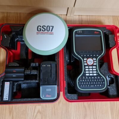
Standard Package Contents
Included Components
- Leica GR30 or GR50 Receiver
- Power Supply System
- Ethernet Communication Accessories
- Mounting Hardware
- GNSS Configuration Software
- User Documentation
- Data Communication Interfaces
Optional Accessories
Expansion Options
- GNSS Reference Antennas
- Lightning Protection Kits
- Environmental Enclosures
- Backup Power Systems
- External Storage Modules
- Remote Monitoring Tools
- RTK Network Integration Packages
- Scientific Data Processing Software
Industries Using Leica GR30 GR50
| Industry | Application |
|---|---|
| Geodesy | National GNSS Networks |
| Surveying | Reference Stations |
| Civil Engineering | Structural Monitoring |
| Research | Scientific Observation |
| Meteorology | Atmospheric Analysis |
| Transportation | Infrastructure Monitoring |
| Energy | Facility Monitoring |
| Government | Geospatial Infrastructure |
There are no reviews yet.