
Product details
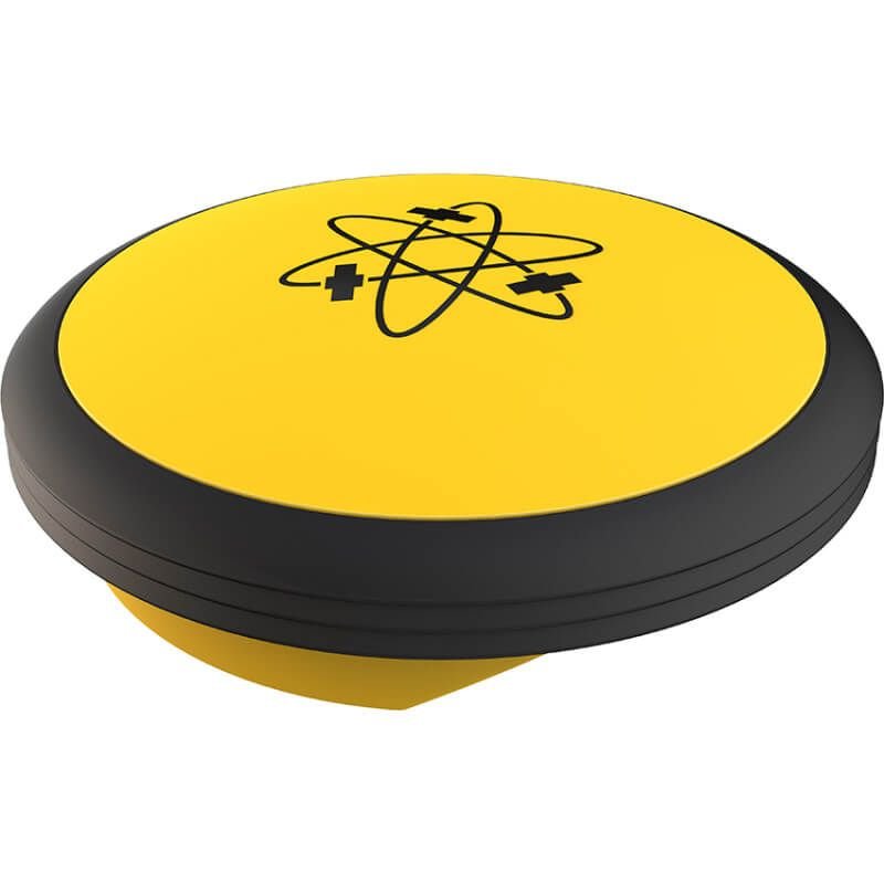
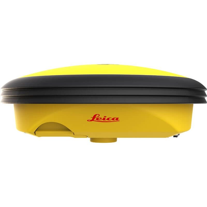
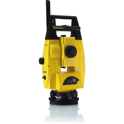
Leica iCON GPS 30 RTK Rover
Compact RTK GNSS Rover for Construction Layout and Surveying
The Leica iCON GPS 30 RTK Rover is a reliable and efficient GNSS positioning solution developed for construction layout, surveying, mapping, and infrastructure applications. Manufactured by Leica Geosystems, the iCON GPS 30 combines advanced RTK positioning performance, rugged field durability, and simplified workflows in a lightweight and easy-to-use rover system.
Designed for construction professionals, contractors, engineers, and surveyors, the Leica iCON GPS 30 provides accurate real-time positioning for daily field operations while integrating seamlessly into Leica iCON construction workflows.
Why Choose Leica iCON GPS 30 RTK Rover
Accurate RTK GNSS Positioning
The Leica iCON GPS 30 delivers reliable centimeter-level positioning accuracy for construction and survey applications.
Positioning Benefits
- Accurate stakeout and layout
- Stable RTK correction handling
- Reliable elevation measurements
- Improved site productivity
Compact and Lightweight Design
The system features a compact smart antenna design that improves portability and simplifies field operation.
Field Advantages
- Easy transportation
- Fast setup time
- Reduced operator fatigue
- Efficient daily operation
Optimized Construction Workflows
The Leica iCON GPS 30 integrates with Leica construction software and machine control systems to improve digital construction productivity.
Key Features of Leica iCON GPS 30 RTK Rover
Multi-Constellation GNSS Technology
The receiver supports multiple satellite constellations for enhanced positioning reliability in complex environments.
Supported Satellite Systems
- GPS
- GLONASS
- Galileo
- BeiDou
- QZSS
- SBAS
Real-Time RTK Positioning
The RTK engine enables highly accurate positioning for construction and surveying tasks.
RTK Capabilities
- Rapid initialization
- Real-time correction support
- Fast signal reacquisition
- Stable positioning performance
Rugged Construction Design
Built for demanding outdoor environments, the iCON GPS 30 offers reliable operation in construction and survey conditions.
Durability Features
- Dust-resistant housing
- Water-resistant design
- Shock-resistant construction
- Outdoor field optimization
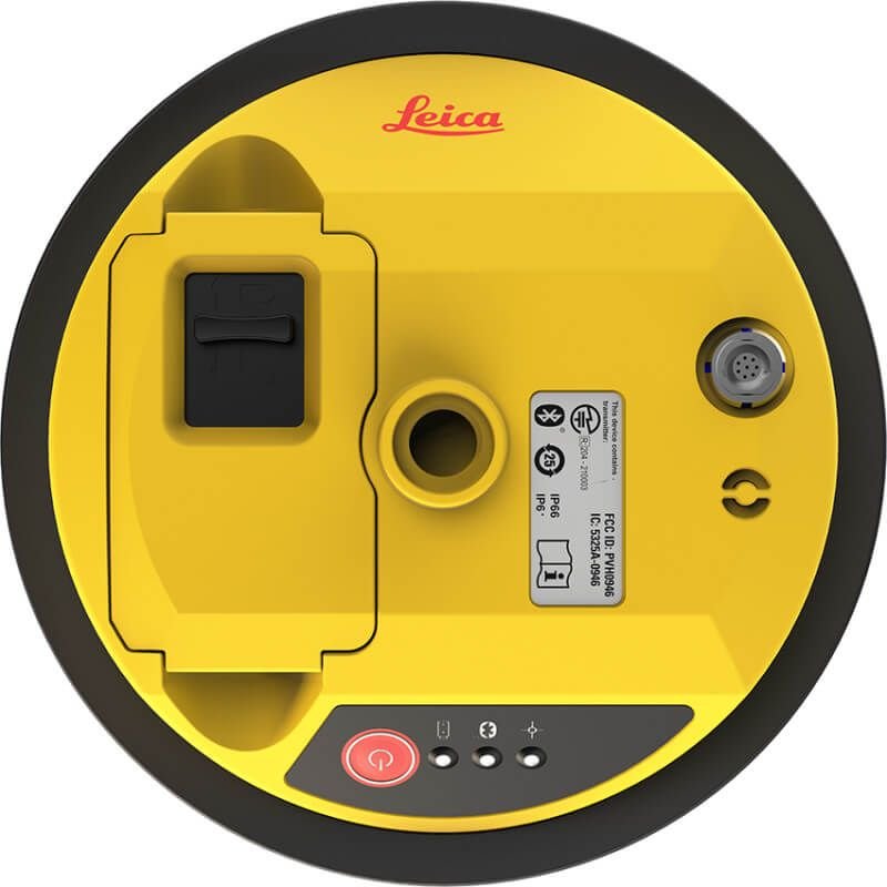
Wireless Connectivity
The system supports multiple communication methods for efficient field connectivity.
Connectivity Options
- Bluetooth
- Wi-Fi
- Cellular communication
- USB connectivity
- NTRIP support
Leica iCON GPS 30 RTK Rover Specifications
General Specifications
| Specification | Details |
|---|---|
| Product Name | Leica iCON GPS 30 RTK Rover |
| Product Type | GNSS RTK Rover |
| Manufacturer | Leica Geosystems |
| GNSS Technology | Multi-Frequency GNSS |
| Primary Applications | Construction Layout, Surveying, Mapping |
| Operating Mode | Rover |
| Positioning Methods | RTK, DGPS, Static |
| Workflow Integration | Leica iCON Platform |
| Form Factor | Compact Smart Antenna |
GNSS Tracking Specifications
Satellite Tracking Performance
| Specification | Details |
|---|---|
| GPS Tracking | Supported |
| GLONASS Tracking | Supported |
| Galileo Tracking | Supported |
| BeiDou Tracking | Supported |
| QZSS Support | Supported |
| SBAS Support | Supported |
| Multi-Frequency Tracking | Supported |
| Multi-Constellation Tracking | Supported |
| Satellite Channel Capacity | Advanced GNSS Engine |
| Signal Acquisition | Fast |
| Signal Stability | High |
| RTK Correction Support | Supported |
| Dynamic Tracking | Supported |
| Signal Reacquisition | Rapid Recovery |
Positioning Accuracy Specifications
RTK Accuracy Performance
| Specification | Details |
|---|---|
| RTK Horizontal Accuracy | Centimeter-Level Precision |
| RTK Vertical Accuracy | High-Precision Elevation |
| Static Survey Accuracy | Survey Grade |
| Initialization Time | Rapid |
| Network RTK Support | Supported |
| Repeatability | Excellent |
| Dynamic Positioning Stability | High |
| Stakeout Accuracy | Optimized |
| Measurement Reliability | Stable |
Connectivity Specifications
Communication Features
| Specification | Details |
|---|---|
| Bluetooth Connectivity | Supported |
| Wi-Fi Connectivity | Supported |
| Cellular Communication | Supported |
| USB Interface | Supported |
| NTRIP Compatibility | Supported |
| Wireless Data Transfer | Supported |
| Remote Configuration | Supported |
| Cloud Synchronization | Supported |
| Real-Time Data Streaming | Supported |
Construction Workflow Specifications
Leica iCON Integration
| Specification | Details |
|---|---|
| Leica iCON Compatibility | Supported |
| BIM Workflow Integration | Supported |
| CAD File Compatibility | Supported |
| Stakeout Workflow | Optimized |
| Utility Layout Support | Supported |
| Road Construction Workflow | Supported |
| Building Construction Applications | Supported |
| Infrastructure Development | Supported |
| Earthmoving Applications | Supported |
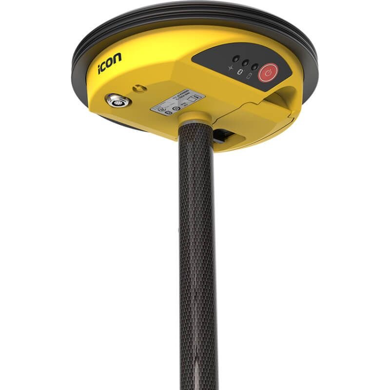
Physical Specifications
Hardware & Durability
| Specification | Details |
|---|---|
| Housing Design | Rugged Industrial Housing |
| Weight | Lightweight Portable Design |
| Pole Mount Compatibility | Supported |
| Tripod Compatibility | Supported |
| Dust Protection | Industrial Grade |
| Water Resistance | Supported |
| Shock Resistance | Supported |
| Vibration Resistance | Supported |
| Compact Form Factor | Optimized |
| Outdoor Field Operation | Supported |
Power Specifications
Battery & Power Management
| Specification | Details |
|---|---|
| Battery Type | Rechargeable Lithium-Ion |
| Battery Runtime | Full-Day Operation |
| External Power Support | Supported |
| Intelligent Power Management | Supported |
| Charging Interface | Industrial Charging System |
| Power Consumption | Optimized |
| Battery Replacement | Quick Swap Support |
Environmental Specifications
Outdoor Performance
| Specification | Details |
|---|---|
| Operating Environment | Construction & Survey Sites |
| Extreme Temperature Support | Supported |
| Humidity Resistance | Supported |
| Rain Operation | Supported |
| Dusty Environment Compatibility | Supported |
| UV Resistance | Supported |
| Harsh Outdoor Conditions | Optimized |
| Industrial Site Compatibility | Supported |
Data Management Specifications
Survey Data Handling
| Specification | Details |
|---|---|
| Real-Time Data Collection | Supported |
| Coordinate System Support | Multiple Coordinate Systems |
| Data Export Formats | Industry Standard Formats |
| Cloud Collaboration | Supported |
| Survey Data Logging | Supported |
| GIS Workflow Compatibility | Supported |
| BIM Integration | Supported |
| CAD Data Support | Supported |
Software Compatibility
Supported Software Platforms
| Software Platform | Compatibility |
|---|---|
| Leica iCON Build | Supported |
| Leica Captivate | Supported |
| CAD Software | Supported |
| BIM Platforms | Supported |
| GIS Software | Supported |
| Construction Management Platforms | Supported |
| Cloud Collaboration Systems | Supported |
Applications of Leica iCON GPS 30 RTK Rover
Construction Layout
The Leica iCON GPS 30 is ideal for construction stakeout and layout operations.
Typical Tasks
- Building layout
- Foundation positioning
- Utility installation
- Structural alignment
Surveying & Mapping
The system supports accurate topographic surveys and geospatial data collection.
Survey Applications
- Terrain mapping
- Elevation surveys
- Boundary measurements
- Site documentation
Infrastructure Development
The Leica iCON GPS 30 is suitable for roads, railways, utilities, and infrastructure projects.
Earthmoving Operations
The rover supports earthmoving workflows and machine guidance applications.
Supported Operations
- Excavation layout
- Grading control
- Site preparation
- Road alignment
Advantages of Leica iCON GPS 30 RTK Rover
Improved Productivity
Fast setup and rapid RTK positioning reduce field downtime.
Reliable GNSS Performance
Advanced satellite tracking improves positioning stability.
Compact Field Design
Lightweight construction enhances portability and operator comfort.
Durable Outdoor Operation
Built for demanding construction and surveying environments.
Efficient Construction Integration
Seamless compatibility with Leica iCON workflows improves project efficiency.
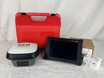
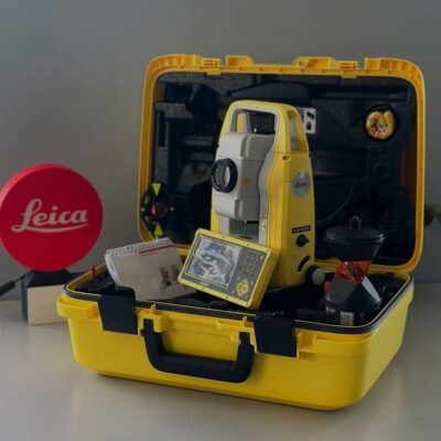
Standard Package Contents
Included Components
- Leica iCON GPS 30 RTK Rover
- Integrated GNSS Smart Antenna
- Rechargeable Battery
- Battery Charger
- Communication Accessories
- Carrying Case
- Pole Mount Hardware
- User Documentation
Optional Accessories
Expansion Options
- Survey Poles
- External Radio Modules
- Additional Batteries
- RTK Subscription Services
- Tripod Systems
- Field Controllers
- Protective Carrying Cases
- Cloud Collaboration Services
Industries Using Leica iCON GPS 30
| Industry | Application |
|---|---|
| Construction | Site Layout |
| Surveying | Topographic Mapping |
| Civil Engineering | Infrastructure Projects |
| Utilities | Utility Positioning |
| Transportation | Road Construction |
| Mining | Site Measurement |
| Energy | Facility Layout |
| Agriculture | Precision Positioning |
There are no reviews yet.